Canyon de Chelly – Bare Trail Hike
I have tried to take advantage of living in Chinle to explore the area. The spectacular Canyon de Chelly is only a few miles from the hospital in Chinle so I have explored it more than anywhere else. There is only one trail, the White House Trail, down into the canyon that is open to the public without a ranger guide. The park rangers lead free hikes into the canyon on weekends. They prudently limit the number of people they guide in, determined from a first come, first served signup sheet at the visitor’s center. My friend Chris and I signed up for a hike on a Friday morning down Bare Trail to the Ledge ruins.
Canyon de Chelly National Monument has a unique governmental model. The land is part of the Navajo Reservation but the land of the monument has been jointly administrated by the tribe and the federal government since 1931. This was not a ‘land grab’ by the government; rather it was a mutually desired arrangement. The Navajo only had a few things they wanted: that all the jobs onsite be filled by Navajos, and that the people living in the Canyon be allowed to remain. The park provides also much needed jobs and tourism brings in more money. All this while allowing private ownership of the land in the Canyon where the Navajo people can live a traditional albeit austere life.
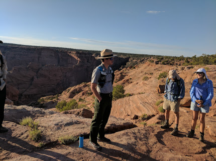
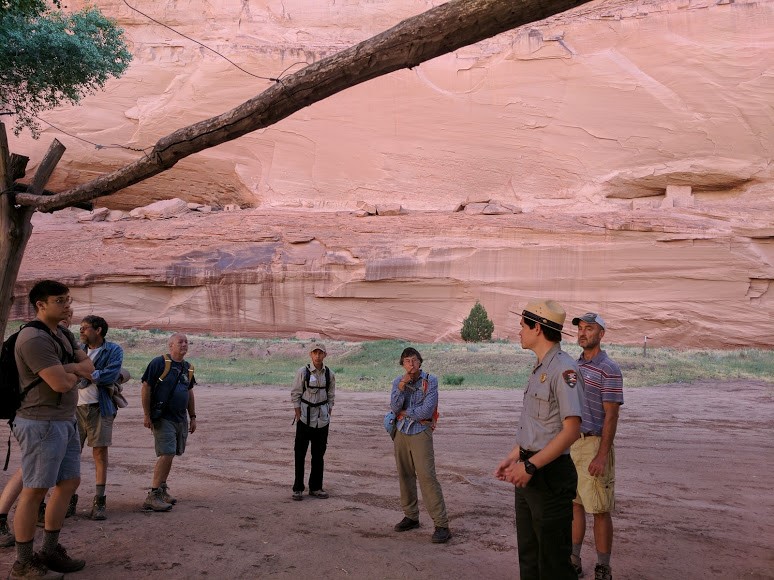
The weather can be warm in June so the hikes begin at 0700 with a plan to be out of the canyon by 1100. That meant that my friend Chris and I were standing by the visitor’s center bright and early on a sunny Friday morning ready to walk down the demanding trail to see the Ledge Ruins. Before we left our guide, Justin did ask if anyone had a fear of heights and reminded us that the hike was considered ‘strenuous’.
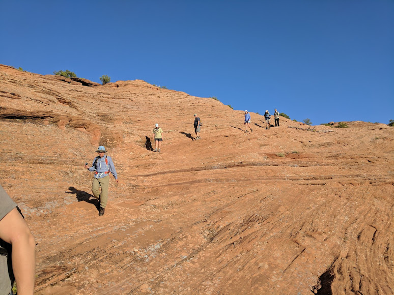
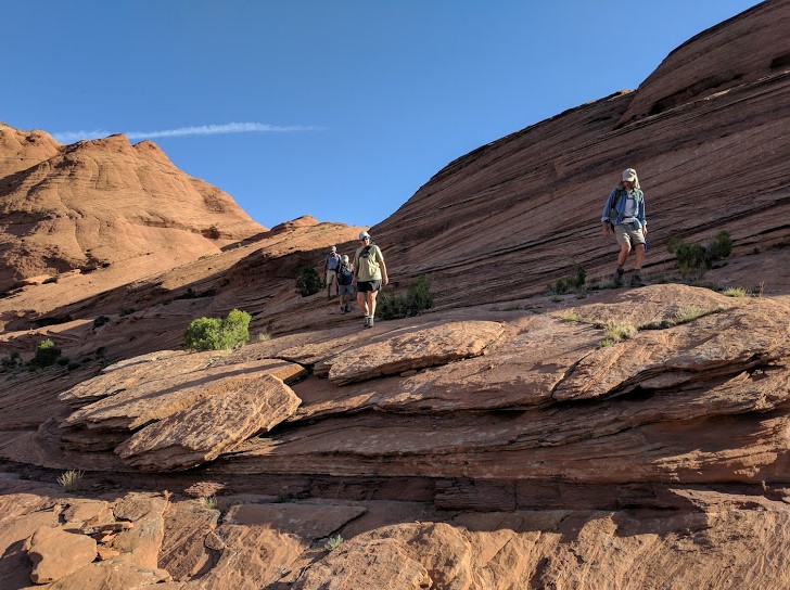
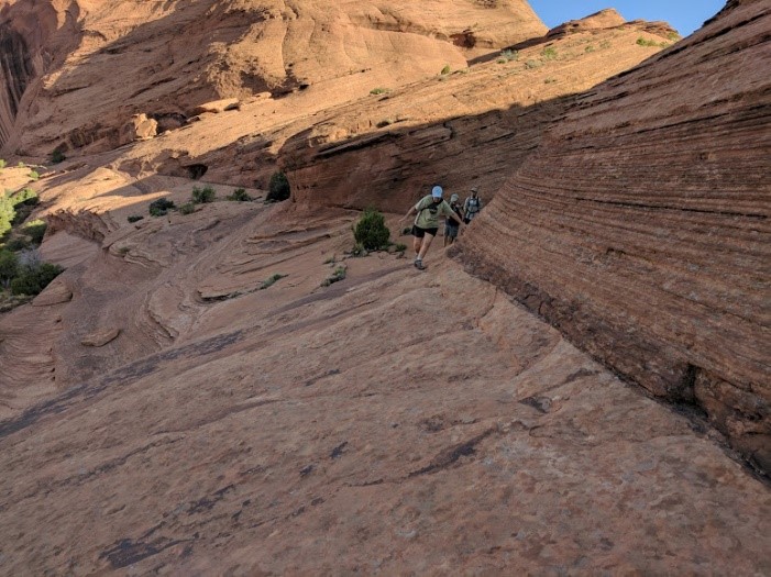
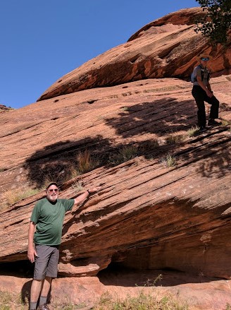
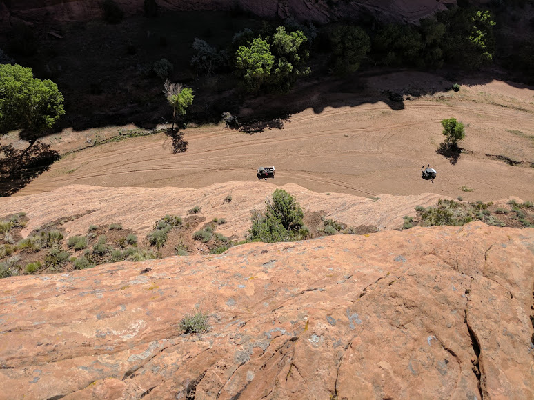
There is no real trail head to speak of down to the Bare Trail, and the dirt and rock track to it really requires a vehicle with a high clearance, like my trusty pickup truck, Red. The Bare Trail is so named because it is just that. This is not a dirt path winding between hills. The ‘trail’ is simply a known way down the steep and bare rock. In some places, the way requires the use of foot and hand holes made by the local people many decades ago. Canyon de Chelly is absolutely shot through with routes like Bare Trail, developed over quite literally millennia of occupation, first by hunter-gathering people, then basket maker people who farmed the bottom of the canyon, then pot making people who lived in pueblos and finally, the Navajo. We suppose these people first followed game trails made by animals. Even the ancient people would transit from the canyon rim back and forth to the fertile floor of the canyon. As invaders and raiders made their inevitable depredations, the people of the canyon learned to use many and often inconspicuous routes up and down the cliffs. During their wars with the Spanish and Americans, the Navajo perfected making and using these trails. Some are only visible from high on the opposite side of the canyon; dotted lines of foot and hand hole leading to one inconspicuous ledge that then leads to another slanting route higher up. Some of the holes were cleverly placed so that if you did not begin the sequence with the correct foot you would find yourself in a difficult position on the cliff requiring an impossible reach across your body. The only solution would be to make a tricky descent and try again. As almost all of these trails were over bare rock, there was no real chance of tracking where others had gone. You have to learn them and that means spending lots of time, even a lifetime, in the canyon. Of course, if you make a blunder on some of these trails you will have spent the rest of your life learning them.
Justin, our Park Ranger guide, did not impart all this information to us at first. We learned it during the course of the hike. After we parked our vehicles and assembled to start the walk down, it quickly become obvious that we really did need a guide to find our way. Justin lead us over a number of broad rock faces only occasionally marked with a cairn of stones or the slight evidence of the passing of others on the rock. The caution about fear of heights was justified; in some places, the path led right along a serious cliff face. It helped to remember that locals had been doing this for a thousand years; sometimes with a load on their back such as an infant.
Since other than our guides, Chris was the only person under 60 in the group, I was a bit concerned about some members of the group being able to make the hike. I need not have worried. They may be older, but the members of our group are still spry.
After about a 1/2 mile of working our way down we could see the bottom. There is a working farm down there. The husband has a job and their children go to school so they live in a house on the rim during the school year. The wife, however, lives there year-round. They grow corn, beans, and squash on their farm. In the summer, they host school groups who come down for camp outs. Such a group was there this morning. We could see a group of teenagers moving around the buildings. When we reached the bottom (at last) we turned our backs to the farm and headed deeper into the canyon.


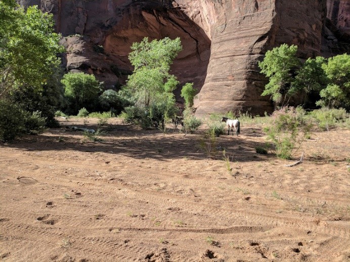
Being embraced by the sheer rock walls is somehow comforting. We walked in the cool shade. The floor of the canyon is mostly flat and it was an easy walk to the ruins. Even with our large group of eleven we startled two mule deer who fled and some mustangs who stayed to watch us pass.
The Ledge Ruins are so named because they are on a narrow ledge. Like most of the sites in Canyon de Chelly, they are not especially impressive. There is nothing left of some of the structures other than outlines of the foundation. It is hard to see how this could have ever been all that big as the ledge on which the buildings were constructed is narrow. Archeologists estimate these particular buildings were constructed sometime around 1000 ACE and abandoned about 300 years later.
We rested in the cool shade and listened to Justin talk about the area. Canyon de Chelly in the shape of a giant Y; Del Muerto Canyon, where the Ledge Ruins exist, splits off to the north. Justin explained that the Del Muerto canyon extends toward Mesa Verde in Colorado, almost 150 miles away. The ruins in Del Muerto leg such as Ledges Ruins are done in the same style as Mesa Verde. The extension of the other leg of the canyon points at Chaco Canyon, New Mexico, about the same distance away. Ruins in that leg show are similar to the style of Chaco Canyon ruins. The entrance of the canyon, the base of the Y, points west to Navajo National Monument, and the ruins in that section bear a resemblance to structures in that area. Clearly Canyon de Chelly was a prehistoric center of sorts for trade and communication in this arid region.
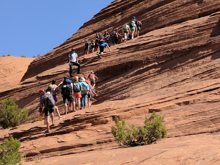
The hike out or rather up turned out to be relatively easy. I personally prefer going up to down. The group of teens, obviously on a trip here from off the reservation, had gone up before us, giving us old folks the opportunity for frequent stops where Justin would talk and show us some of the other trails in the area. Few of them are needed anymore, but some of the ‘easier’ ones are still in use to move livestock or simply when it is easier to walk down than drive the 30 miles down to the mouth of the canyon and then up the dirt tracks.
On the way, out Justin pointed out a very strange set of small ruins that are unlike any other in the canyon. Not only was the style different, the size and shape were also unique – between that of a dwelling and a storage site and oval. It will remain a mystery.

The Bare Trail is very interesting and a bit scary. I am glad I went. I got a chance to see the northern side of the canyon and to clamber over some of the old original trails. It is a long way from the normal safe and secure types of access we have gotten used to. This little four hour trip gave me some insight into what it was like to have lived here a thousand years ago.
