Moab, Canyonlands, & Arches National Parks – May, 2017
Living in Chinle is an opportunity. Being so far out “in the boondocks” means we are (relatively) closer to notable places here in the Four Corners area. I knew that the town of Moab, Utah was near two large national parks and had a stellar reputation for eco/outdoor tourism. I had passed through Moab during my Utah hiking adventure and knew that it was a tidy little town with a nice set of motels, shops, and restaurants. All that made it a good destination for our next adventure. Directions could scarcely have been simpler: turn left at highway 191, the only highway through town, and drive north 200 miles. We headed out after breakfast on a cool, sunny, high desert Saturday.
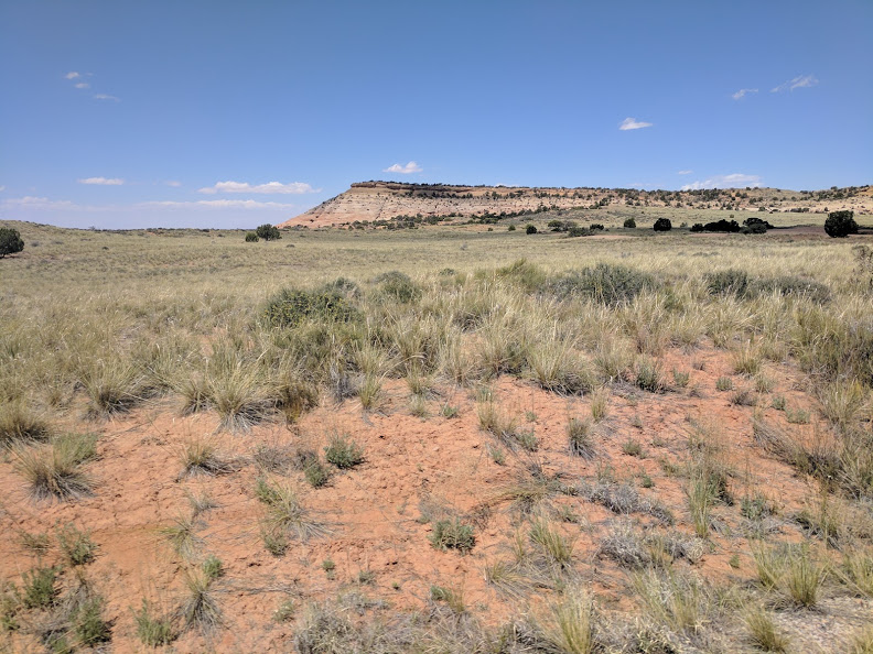
The terrain, as we headed north, was very like that around Chinle – high desert. Low scrubby shrubs sort of cover the ground. Mesas and buttes poke up here and there. The mesas were just what you expect – a flat topped rock formation with straight sides buttressed by piles of rubble coming down at about a 45-degree angle starting about halfway up the sides. The occasional water courses are marked by green, as trees live either on the banks or, more commonly, in the beds of washes which are only wet part of the year. You can see a “looo—nnnn—-g” way in this part of the country. Navajos like to live more spread out than most. Way off to one side of the road you could see clumps of a half dozen or so dwellings. There were small collections of houses and hooghans, trailers and trucks, depending on the affluence of the families. Some groups were typical homes you might find in any other rural area with barns, garages, carports, and often a separate hooghans off to one side. Other, obviously poorer, places had the typical rural poor fixtures of a worn out mobile home with junked cars and other pieces of machinery scattered about. There were even a few solitary hooghans off by themselves, inevitably with a battered old pickup nearby. Photographs fail to capture the scale of the country and the distant structures lose their impact in images.
The ‘towns’ on the reservation tend to be quite small. The ones we passed through certainly were. There might be a gas station and a school. Only bigger towns on the Navajo Reservation have a Bashar’s grocery store and the map dots we went through were far too insignificant for that. Despite the low population density, there are still quite a few people in the area; the Chinle Hospital allegedly serves 35,000. This is in part because the reservation is so big: over 25,000 square miles. That is about the size of West Virginia. It stretches over parts of three states, Arizona, New Mexico, and Utah.
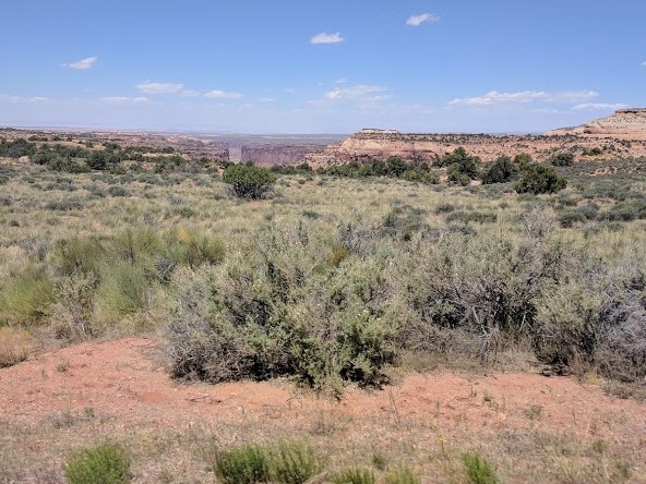
Even so, it was not long after crossing into Utah that the countryside began to change. There was more water for one thing. Towns, although still far apart, were larger and more like the small towns you see in the east and there were fewer distant clusters of buildings. We now saw many more campgrounds and facilities for RVs. As we moved north, the country continued to change so that by the time we reached Moab, things were very different. Distant mesas had become huge red cliffs standing tall, first on one side, then the other, and as we entered town, on both – embracing and sheltering the narrow town of Moab. The Colorado River cuts through the town, on its way to Lake Powell and eventually the Grand Canyon. The town is a center for all sorts and manner of outdoor activities. This is obvious by the large number of outdoor toys in evidence. There are bicycles, kayaks, rafts, and many varieties of all-terrain vehicles, off highway vehicles, and a wide variety of four-wheel drive vehicles traversing the single main road. We intended to visit both National Parks in the area. We had been advised that traffic into Arches NP was heavy in the afternoons and to go there first thing in the morning. So as soon as we had checked into our motel and had a nice healthy lunch at the adjacent Love Muffin Café we headed up to the other park in the area: Canyonlands National Park.
As we drove north we passed by the entrance to Arches NP; sure enough there was a long line of cars waiting to get in. The entrance to Canyonlands NP is almost 30 miles west of the main highway. The park is huge and most of it is not accessible to two-wheel drive cars. We intended to drive in the Island in the Sky section, staying on the paved road.
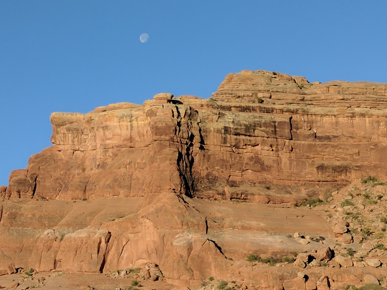
Long before we reached the entrance we came to a stop on a two-lane blacktop in the middle of nothing in particular. Apparently, there was a line to get into Canyonlands, too. After about 10 minutes we moved up to the entrance and were admitted. The problem in many national parks is that there are only one or two entry lanes. People pay to enter with credit cards. This takes time. Of course, we had a Senior Pass and so were able to breeze right in for free. Almost immediately we noticed huge canyons opening off in the distance. Soon we were passing deep, colorful vistas. The erosion was showing its best side, and was perhaps getting ready for the Grand Canyon further downstream. We continued on past many stops where you could see vast expanses even from inside the car. I was more impressed than Ruth who, as I have mentioned, has already seen a lot of rocks.
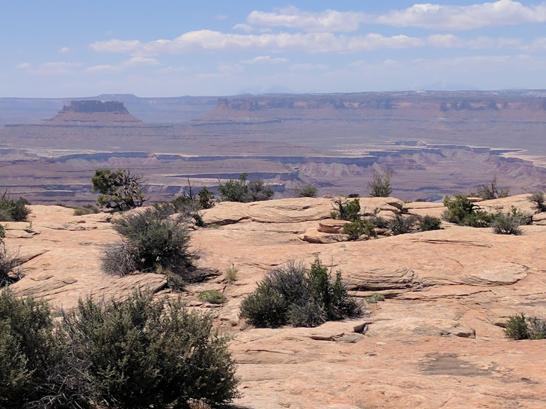
Poor Ruth would wait patiently in the car while I bounced around looking at all that wild countryside. She even drove some while I did the visual equivalent of a dog with his nose out the window. They claim that the far end of the park, called the Mazes, is one of the nation’s ‘most remote regions’. That is easy to believe. Like the Painted Desert and Petrified National Forests Parks, Canyonlands National Park is truly a wild place, full of wonders.
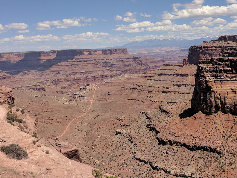
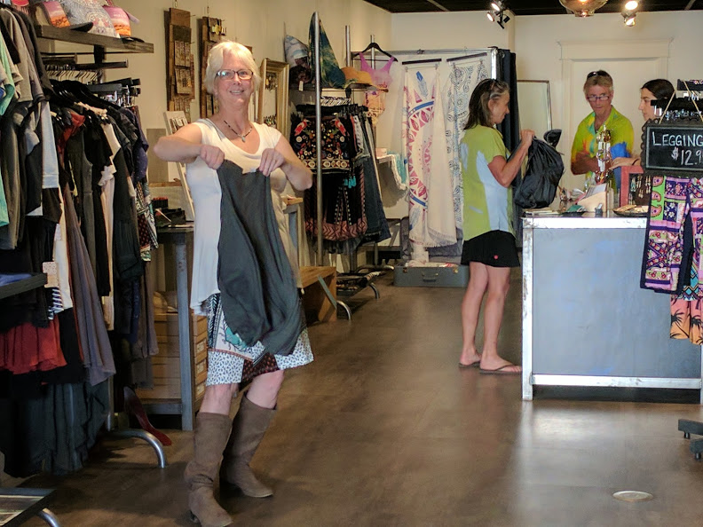
We drove the 34-mile-long road from the Grand View Point out of the park and back to civilization. Ruth said that she preferred “shopping, eating, and drinking” to driving around looking at rocks. Moab is most definitely civilized. We had a spent a very pleasant afternoon, dropping into various shops and neat little watering holes. The only cloud on our horizon was that Ruth had left her purse in Love Muffin after our lunch. They had closed before we could get back and so we would have to wait to rescue Ruth’s purse (and cell phone) in the morning. Fortunately it looked like they had a pretty good breakfast menu.

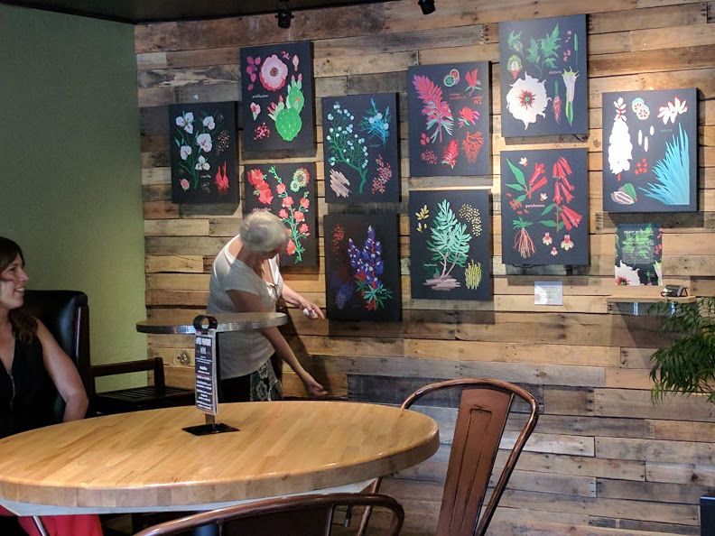
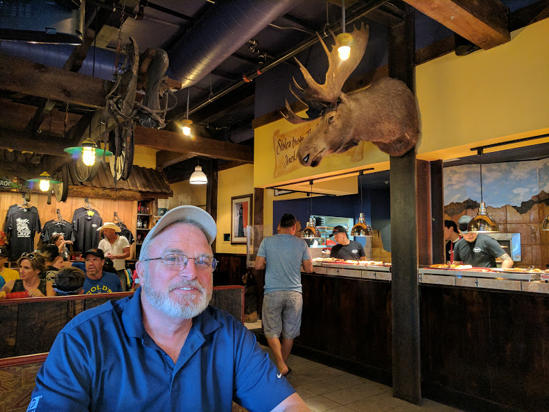
We had a drink and shared a bowl of pho, at a neat little place called 98 Central. We perused the art exhibit there while chatting with the artist. Indigo Alley had a lot of bargains that Ruth could not resist. Finally, we ended our evening at Zax’s where a moose watched as we ate and enjoyed some of the local brews. Yes, there are microbreweries in Utah – good ones.
We were up bright and early the next morning. We wanted to get breakfast, rescue Ruth’s purse, and get to Arches National Park before too many people arrived. Love Muffin Café delivered on the first two items and we were soon off to the park where we breezed right in.
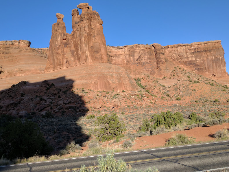
I was especially glad traffic was very light that Sunday morning because the scenery was a major distraction. Unlike most buttes and mesas, the rocks in Arches National Park are often vertical right up from the ground. Unlike Monument Valley, there is vegetation on the ground and considerable variety in the rock formations. Further, you are closer to the formations in Arches; weird and wonderful formations are all around you. Unlike other places in the region the rocks often do not have the rock detritus around them. Lacking these buttresses, they seem to spring directly from the ground.
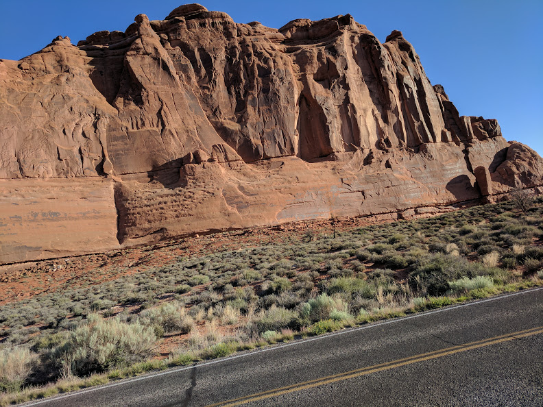
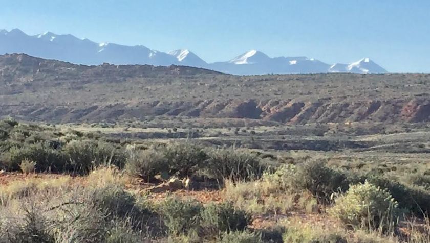
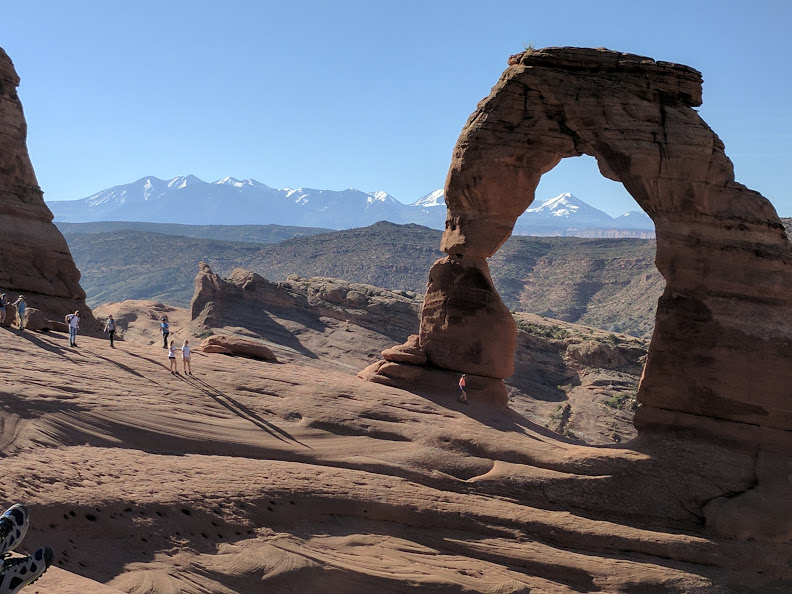
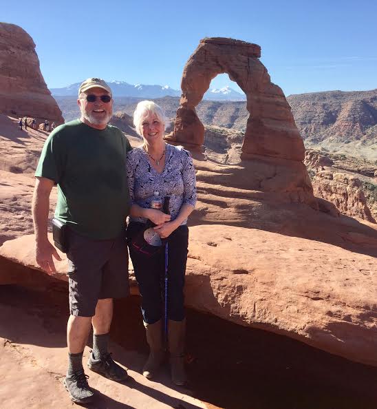
The road into the park curved around though a wide variety of formations from petrified dunes to outrageously balanced rocks atop natural obelisks. Off in the distant east were the snow-covered La Sal Mountains. The morning was cool and bright, just right for a casual drive along the two-lane blacktop. There were many pull outs to admire the scenery and a lot of that scenery to admire. One section of the park, the Devil’s Garden, was closed due to road construction. We instead went directly, well, actually with several stops to admire the formations, to the Delicate Arch This is a famous formation, one of the iconic images of the park. The arch requires a mile and a half walk to get to it. To my surprise, Ruth agreed to undertake the hike.
Even though it was well before 0800 the parking lot at the head of the trail was filling up. Before we even began the hike, Ruth began to manifest what she needed. Though the day was cool, there was a bright sun. Ruth decided she needed a hat and there, on the wooden fence by the trail, were several ‘lost hats’ placed for those who needed them. Ruth selected a cute one. The hike went by the Wolfe Ranch where, early in the 20th Century, a family lived and ranched way out here in splendid isolation. We moved on past the wretched hut that still stood near the meager water course. I was amazed to see two couples pushing a baby carriage up the trail. A hiker coming down assured them in no uncertain terms that it would not be possible to get a stroller up over the rocks. After about a quarter of a mile we came to a large steep rock face. The trail led right up that face. It was a hard pull for Ruth and at the top, she paused for a break. The bright sun made it easy to overheat. A passing hiker offered Ruth a cold bottle of water – a second manifestation. Upward and onward we went. This is not a handicapped-accessible trail. I was secretly pleased that there was a complete lack of guard rails or any of the other ‘softeners’ we put around our oh-so-safe world these days. This trail was unabashedly difficult and frankly dangerous in some places. If you were careless or foolish you could get hurt. A bit higher up Ruth was working hard to manage the rough trail. Unasked, a young Hispanic boy in a Superman T-shirt offered Ruth the use of a trekking pole to help her keep her balance. The third manifestation of something Ruth needed.
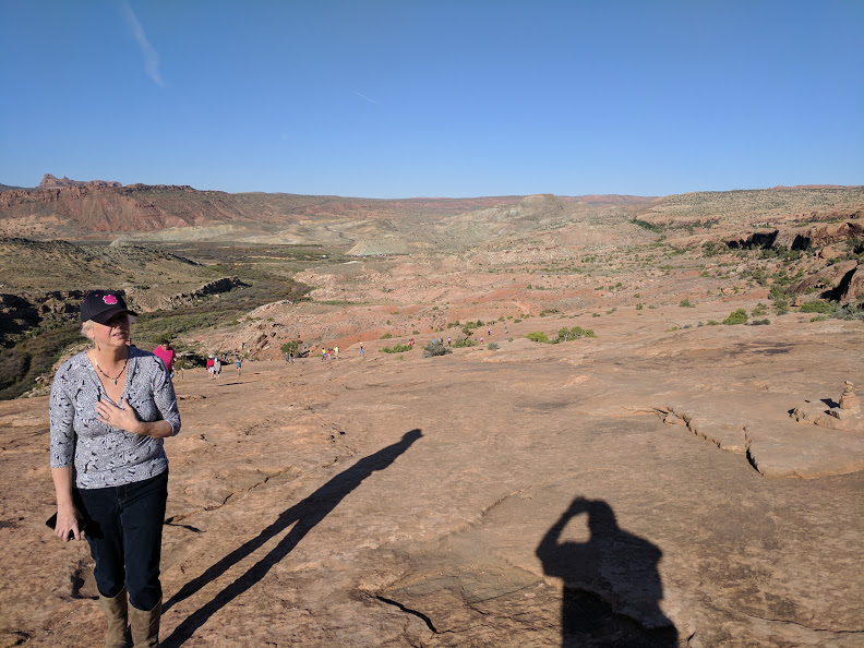

Finally, the trail led around a huge rock shoulder – with a 30 foot drop to one side – and there was the arch. It is not especially delicate; in fact, it is quite large with a 65’ opening and only seems delicate compared to the rocks around it. We enjoyed the magnificent views, the arch perfectly framed the distant La Sal Mountains, and exulted at making up to the top. I can easily imagine how brutal that climb over the rocks would be when the desert temperatures soar. As it was we had pleasant temperatures with intensely blue skies, cut by the white contrails of cross-continental jets, high above.
On our leisurely return downhill we chatted with other returning hikers. Ruth happened to mention that she was looking forward to an Advil when she got to the truck. A lady immediately offered one to Ruth right then – the fourth manifestation of what Ruth needed when she needed it. Ruth was so grateful that humanity and manifestations occurred as needed.
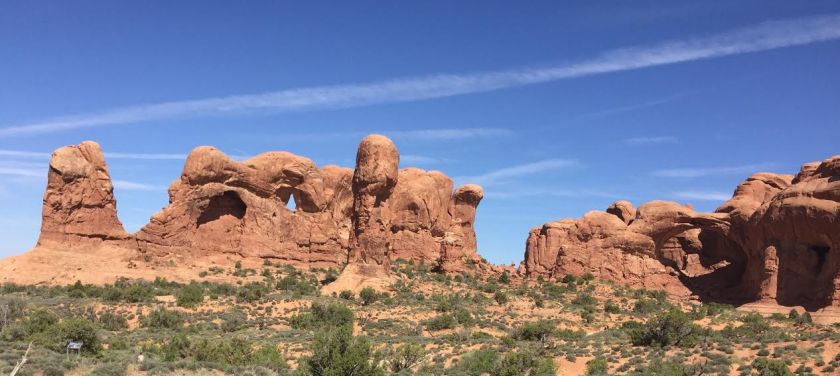
We cruised back, stopping at sites such as the Double Arches and taking in other formations such as Balanced Rock, Gossip Rocks, and the Parade of Elephants.

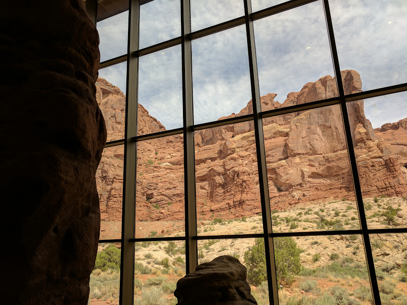
It was time to end our trip in this place of wonders; besides it was lunchtime. We stopped at the Visitor’s Center on the way out. This was a first-class combination of what to do in the park along with an excellent museum describing the specifics of the rocks in the formation, when they were created, and how they came to have such extraordinary shapes. As we left the park, sure enough, there was a long line of cars waiting to come in.
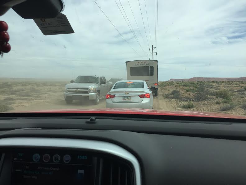
We stopped on the way out at Moab for some more casual shopping and a fine lunch. Then it was off for the 200-mile drive back. Ten miles from home we encountered some weekend roadwork that shut down the highway. We took what I call a ‘reservation detour’. I was glad I had a truck. We followed a set of dirt ruts a half mile west before paralleling the road on another track that ran beneath a powerline for a mile or so before making our way past a few homesteads and eventually back to the road and home.
Our visit to Moab was our best trip yet. The ride up and back was interesting and not too long. The town was clean, neat, and full of interesting places to enjoy ourselves with a 1960’s-ish feel. Canyonlands offered terrific views of wild desolation. Arches National Park was simply spectacular and unlike anything either of us had seen before. I would like to come back someday.
