Backpacking Uintas Wilderness

Back country Backpacking in Utah –   April 2015

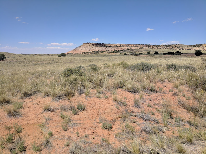
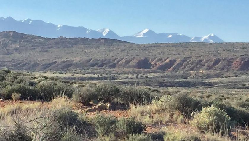
Since I have the resources, time and money, and am still healthy I resolved to have periodic adventures.  Some of these are small things, little more than vacations.  Others are more significant such as sailing from Panama to Florida or hiking the Appalachian Trail.  I have been getting together with my old friend David Romanausky for the past few years to go on backpacking expeditions.  This year was our most ambitious yet.  Since David lives in the Portland area and I am near Houston Texas, just getting together is a challenge.  I had planned to be in Park City, Utah to celebrate a group birthday/reunion with a group of friends, so David took that as a point to work from.  He found some challenging trails in the High Uintas Wilderness Area.  High and wilderness – that pretty well describes the area about a hundred miles east of Salt Lake City.  A few meager roads go into the area but it is almost uninhabited.  Most of the area is either Indian Reservation or National Forest.  I remembered that my old friend Tor used to go up and camp in National Forests when it got too hot to stay on his boat.  He always said there were fewer people in the Forests than National Parks and way fewer regulations. The maps David emailed me were a bit fuzzy but looked intriguing. The plan was for David to ride the bus from Portland to Duchesne, Utah where I would pick him up and we would drive up to the Rock Creek Trail Head some forty miles north.

Why do I call my trips adventures instead of vacations?  Because an adventure should incorporate elements of discomfort and even danger – consider that the spice of the activity.  This particular trip had elements of both, along with periods of solitude, scenery, simplicity, and intense quiet – things missing in our modern world.  I have been asked why I would put myself though the hard work (and it is physically taxing) and discomfort of going wilderness backpacking.  I call it a ‘simple pleasure.’  Then I was asked if it was the pleasure or myself that was simple.  Part of the reason I go off into the wild is my personality.  I love the concept of having ‘everything you need and nothing you don’t’.  The farther back we got into the wilderness the more I found my mind becoming clearer as things simplified.  You remember where you put things.  You know what is and is not important.  Thoughts of things that might have been and concerns about things I should have said or done drop away.  Life is about simple things – eating, packing, and where we want to end up that day.  Life becomes where you are going to place your steps on the rocky trail and looking up now and again to where the trail is going.  Most of the time you can only see a short distance ahead.  I would estimate that the highest point I see on the uphill trail ahead is no more than ten feet higher than I where I am standing.  So up you go, fifty to a hundred feet forward and perhaps six to ten feet up; repeat as necessary.  About every hour David would have us rest and take off our packs for ten minutes or so.  There was not much conversation while walking and most of what there was was with yourself. Once in a while you look around at the scenery which was very nice – if you like wild mountainous terrain.

Some elements were the same for all the days of both trips:

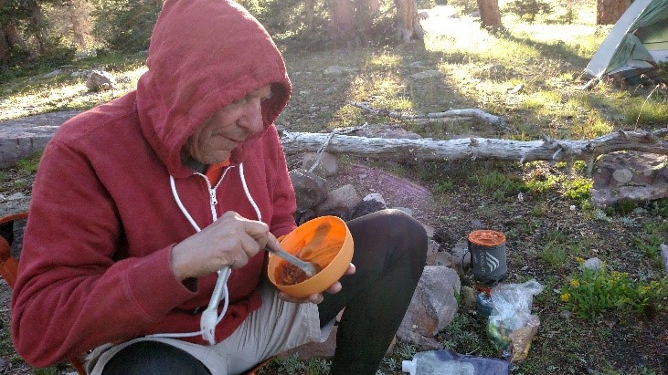
Food – We had to carry what we would eat for five days. I knew that oatmeal and instant coffee, mixed with creamer and cocoa would do for breakfast.  The easiest things to buy were snacks/lunch/trail food like jerky, dried fruit, and trail mixes for while we were hiking and for consumption as our lunch.  We both brought way too many of those.  I purchased a variety of the freeze-dried dinners you find in outdoor stores.  Dave, being a more experienced hiker used quart freezer bags with things like instant rice or noodles with dried meat and spices.  This was cheaper and allowed for bigger portions.  For both of these, all you have to do is pour boiling water in the pouch and wait a few minutes and you have a hot meal.  One thing we did not care about was the carbohydrates, sugar, sodium or fat content of what we were eating.  We wanted it all; we needed it all.  When you are burning the furnace hot enough it does not matter much what you put in it, and we were burning over six thousand calories a day.  We liked some of the meals better than others. Dave liked the Chili Mac package I brought; I preferred the chicken and rice dinner.  David brought along a combined salt and pepper shaker which really helped the flavor of our dinners.

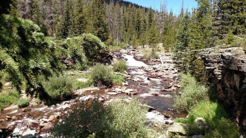
Drinking – We each carried between two and three liters of water with us.  As we had been advised, water was not a problem in the Wilderness; there were mountain streams and lakes all around us.  Although we were high in the mountains David insisted that we use our iodine pills in all our water.  I suspected that we were too far from civilization to risk having a debilitating bout of diarrhea.   Although I suspected that he was being overcautious I took his advice.  Turns out that Giardia can be brought into those remote brooks by rodents as well as people.  We also had a filter pump which we used when we took water from the lakes to strain particulate matter as well as harmful bacteria.  It worked; we used a lot of water with nary an intestinal twinge.  I really enjoyed adding some flavoring to the water, stuff like EmergenC or Tang.  As to alcohol, I had absolutely no interest in a drink of that kind on the trail.

1 Typical brook
Typical brook where we got water along the trail      


2 Dave Reorganizing
David reorganizing his gear

Shelter – We carried, tent, sleeping bag, and pad with us.  They were marvels of lightweight protection. Sleeping is an important part of backpacking.  Often you will spend from ten to twelve hours a day in your tent.  Not only do you need your rest but frankly there is not a lot to do in camp once you finish eating and cleaning up.  Often it is too cold, or there are too many mosquitoes, or it is raining, so you wind up spending a lot of time in your little cocoon.   Believe me it is very nice to enjoy the tenuous protection of a tent when it is raining or there is a chill wind blowing.  Modern pads keep you comfortably off the ground.  Sleeping bags can to keep you toasty warm – within limits.  On the other side of the equation, a backpack tent is also small and confining.  Your little cocoon is not much bigger than a coffin.   You are starting from flat on the ground and the tents are far from easy to get in and out of.  When you go into your tent you had better have everything you might need in the night close to hand.  Trust me, you do not want to have to get up in the middle of the night to relieve yourself – way, way too much trouble. So, you lie there in your tent, with not much room.  Often you are so tired this is not a problem – I know I slept a lot on the trip.  Other times you are in there with just your thoughts.  A backpack tent is a good place to do some thinking; you have few distractions although the line between dreams and consciousness can be very thin.

Clothing – We mostly wore shorts to hike, even when it was chilly.  Once we got into camp we would often put on long johns for sleeping.  We did a lot of layering so we could shed items as the day warmed up.  We often wore the same thing day after day.  Between that and the lack of bathing I guess we were pretty ripe by the time we got off the mountain.  We did not seem to notice ourselves.  We were probably scent blind to ourselves after a day or so, but honestly it was not a problem to us and since there was no one else around it just didn’t seem to matter.

The process of elimination – Yes, I learned to do what bears do naturally.  There were signs that warned us from camping or eliminating waste within 200 feet of trails or water.  No problem.  Privacy was also not an issue – there was no one else around.  You just took your little trowel out into the bushes and did your business.

The Trip Out

But before I could hike I had to do some planning.  First, I had to review my equipment and plan.  I had a new tent to use, courtesy of my brother-in-law, Fred, and some other new bits of gear I got after our trip last year.  I checked the weather both recently and historically and found that we could expect highs in the mid 80’s and lows in the upper 50’s.  There was a 20% chance of rain on Tuesday, the day we were to depart.  The rule of thumb is to reduce temperature about 3-5 degrees for each thousand feet. Duchesne is about 6,000 feet above sea level and we would not be too much above 10,000 feet – so a difference of about four thousand feet.  Four times four degrees is 16 so we could have lows in the 40’s.  Dave’s bag was rated for that.  Mine was rated for 32.  Just to be on the safe side I decided to bring along my bag liner which gets me an extra ten degrees of warmth; turned out to be a good decision.  The other aspect of planning was my driving route.  Dave just had to buy a bus ticket, I had to develop an itinerary.  I estimated my route so that I could be in Duchesne to meet Dave by 0945 on Tuesday.  That meant being within a couple of hours of there the night before and that meant spending the night in Green River, Utah.  About halfway between home and there was the city of Clovis, New Mexico.  I followed recommendations to reserve my motel room online to secure the best rates – usually in the $60-70 range.  I chose ‘the road less travelled’ as is my preferred route to get to those cities.  I like small town America and avoided long stretches of Interstate travel.

I was underway promptly at 0900 on Sunday, having attended the Saturday church service so I could leave early.  As expected, between my satellite radio, book tapes, and the back roads of Texas I had a very pleasant ride.  I even discovered the unexpected pleasure of fried chicken strips dipped in gravy when I stopped for lunch.  It is fortunate this combination is not available where I live because it is so tasty it has got to be bad for you.  West Texas is where you can find the Staked Plains, terrain so open and unvarying that the Spanish explorers resorted to driving stakes into the ground to mark their way.  Now it is marked by oil derricks and wind turbines.

The road through Clovis was under construction and without my phone’s trusty navigation system I would have missed my motel.  My room was just what I wanted: simple, quiet, clean, and cheap.  I ate a Cobb Salad at a local eatery to make up for the chicken and gravy I had for lunch.

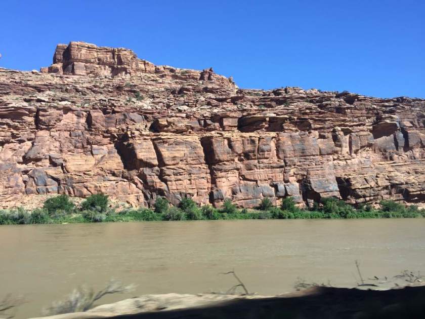
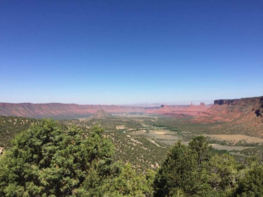
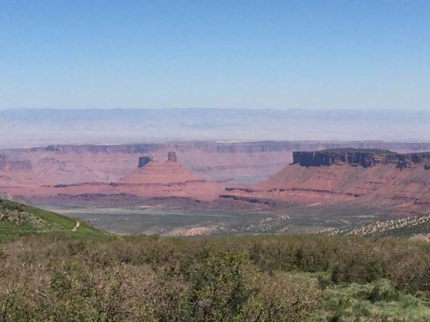
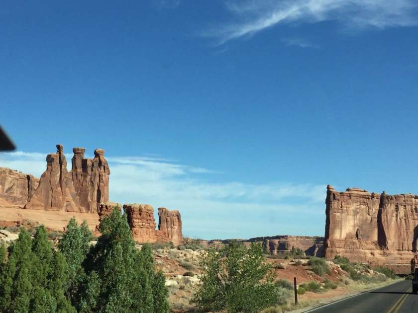
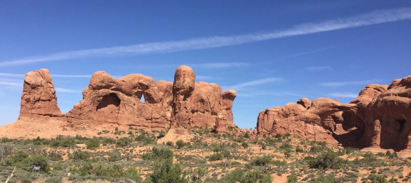
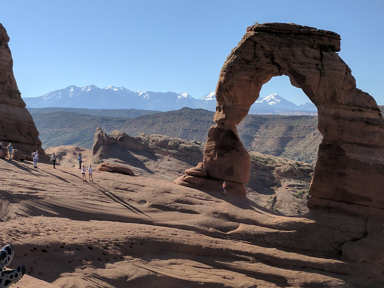
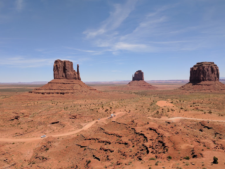
It was easy to leave early and within a few miles I was out into the plains of New Mexico.  I intersected I-40 and whipped through my old home of Albuquerque and then onto the back roads of northwest New Mexico which inexorably let me up through southwest Colorado to Utah.  The rock formations became larger and more bizarrely beautiful as I went further in.  I passed through Moab, near Arches National Park, an altogether nice little tourist town.  It was a marked change from Green River, and hour down the road.  Green River, Utah is a dump.  The motel was clean but old and funky.  I took the word of the nice lady who suggested the best restaurant in town.  I certain hope she was wrong.  In examined the menu and looked at the tired food being served around me and ordered a salad which was – filling.   I guess.

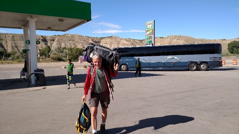
I slipped out of Green River on Tuesday morning, stopping at a classic country café for breakfast on the way to Duchesne.  I arrived there in plenty of time to check out the town.  It did not take long.  Duchesne only has a population of 1600 people and is essentially just one street.  That made it easy to realize that the ‘bus station’ was the Sinclair gas station.  I waited there, chatting with a couple of dozen Frenchmen riding some excellent road Harleys.  They were part of a package tour: fly from Paris to Denver and pick up your Harleys.  Then your group rides around Colorado and Utah, led by a local guide and accompanied by a pickup truck acting as a sag wagon.  Seemed like a pretty nice vacation.

The Greyhound was right on schedule and Dave came out, pack over his shoulder and his other luggage in hand.  We loaded up Silver and headed over to the Ranger station.  Ranger Sheila was not there so we just picked up a map and chatted too briefly with the lady who was on duty.  We figured we were ready to go so headed on the little two-lane road out of town.  We were on our way.

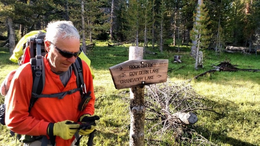
Of course, we got a little lost…hey, this is David and Tom.  We pulled into the campsite at the head of the trail and spoke with the camp host, a lady who lives there rent free in exchange for answering questions from campers.  It took a while before we realized that we had missed the turnoff for Rock Creek – we were at the trail we planned to do the second week.  Back we went to the charming bread and breakfast inn where we bought sandwiches – the last prepared food we would have for a week.

The First Hike

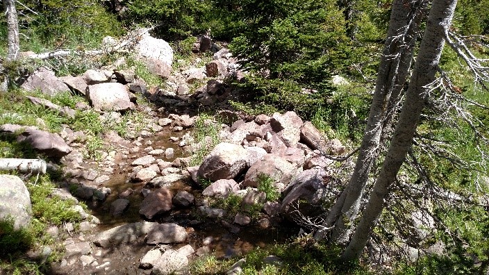
The Rock Creek trailhead is at the end of a very long two-lane road.  We read that the parking area is at the base of a dam.  We were so far back up in the hills by then, we had long since lost cell reception, that we were expecting to see some little earthen structure.  What we got was a substantial concrete structure a quarter mile long and at least 80 feet high.  Off to one side was the empty parking lot.  There was a latrine and water faucet there; pretty basic, but the last we would see until Saturday afternoon.

3 Dave arriving
 David arriving in the ‘bus station’ in Duchesne    


4 happy campers
Happy campers heading out

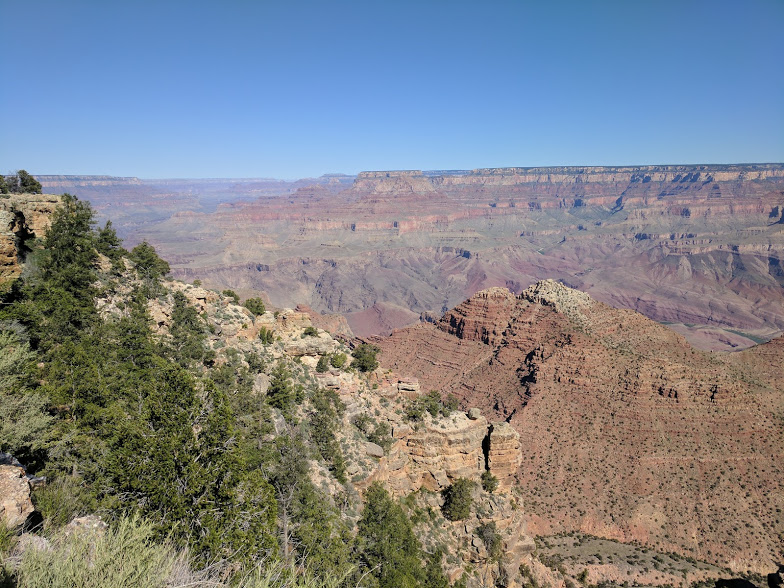
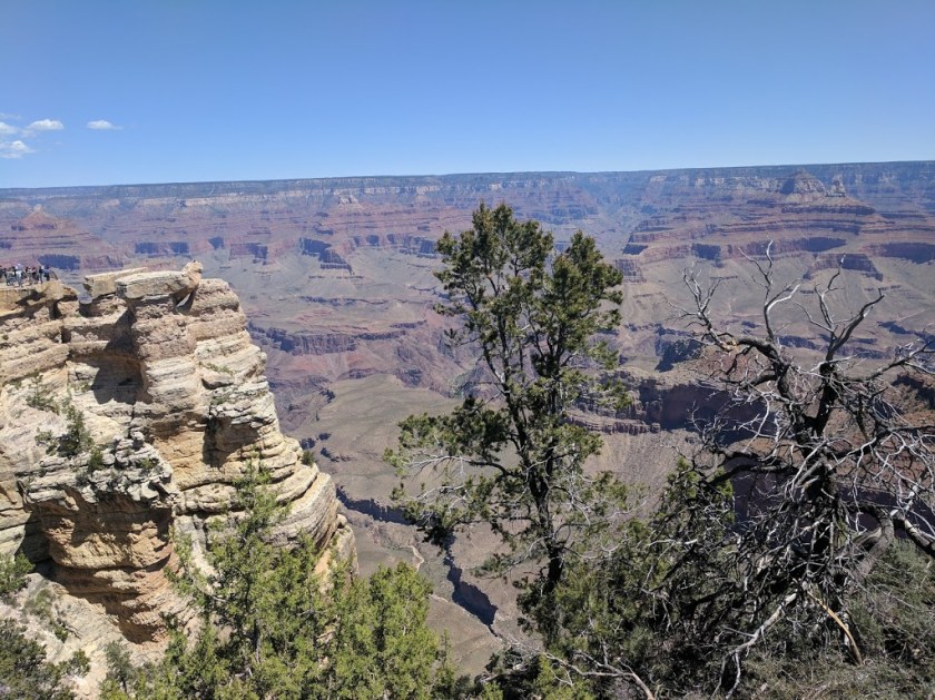
Our plan was pretty simple: we would follow the Rock Creek loop clockwise, a distance David figured at ~30 miles. We would be going over Rocky Sea Pass.  I did not notice the altitude – 11,300 feet, which meant we would be climbing about 2600 feet.  That is a half mile up.  Nor did I pay attention to the small warning next to the pass – hazardous to horses and pack stock.  [Cue ominous music]

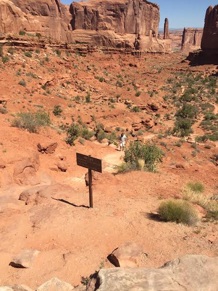
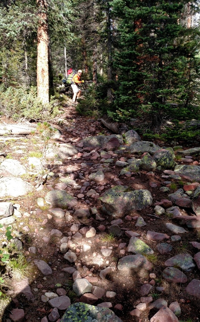
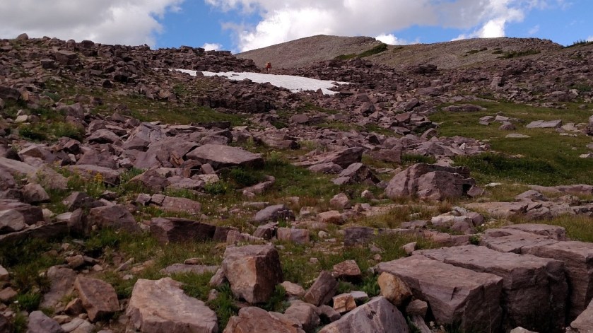
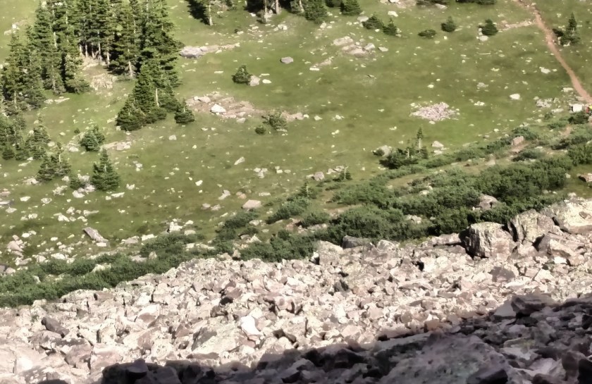
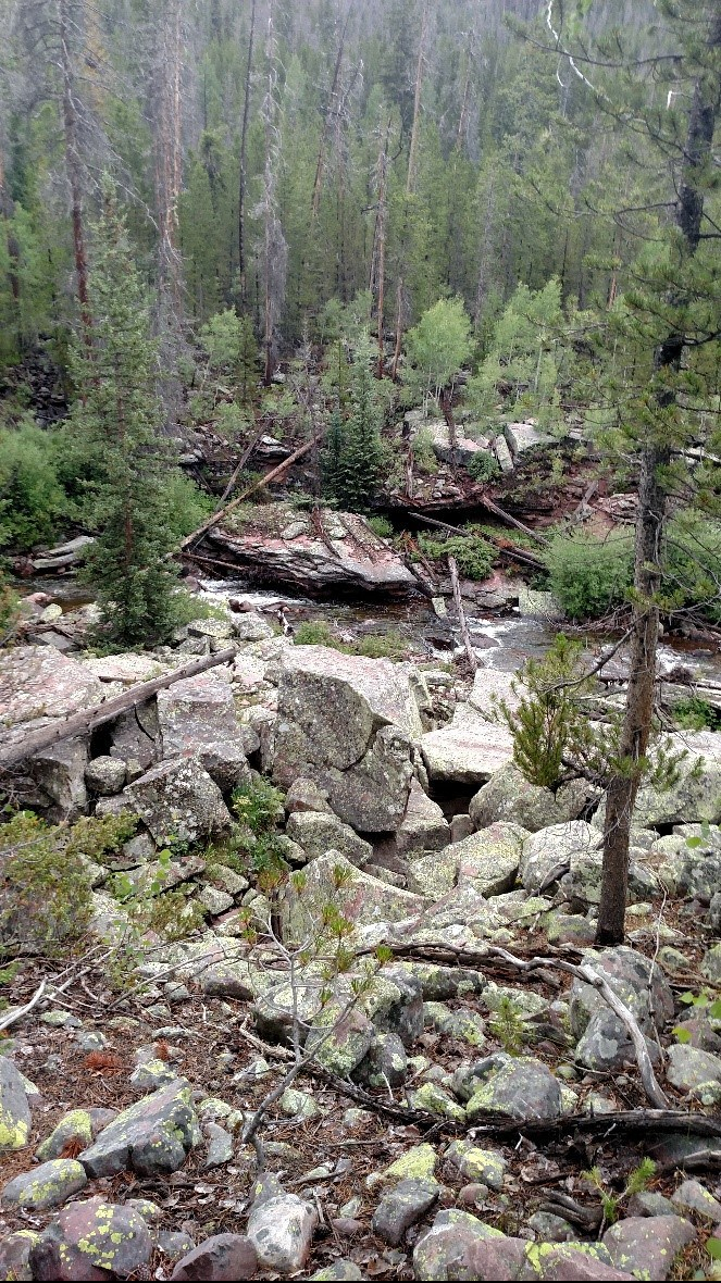
Hiking is more than walking.  Everyone walks, but hiking is different, and usually considered more difficult than mere walking.  It really depends upon the amount of weight you are carrying and above all the trail that you are hiking upon.  My workups at home in preparation for the hike consisted of walking with my pack a little over three miles on a level asphalt path near my home.  I could do that in just over an hour with no real problem.  But that was a sea level; until you acclimate to the altitude even moderate exertion leaves you gasping.  When you add a grade, either uphill or downhill your pace slows down dramatically.  Rocks in the path are even worse.  Rocks on the trail range in size from pebbles to boulders, but most are from fist to head-sized. Some are loose, ready to roll underfoot undermining your balance.  Others are deeply embedded in the earth providing solid trip hazards.  I have no idea how many times a day I stubbed my toe – dozens at least.  Walking on a trail with lots of rocks keeps you from getting a nice energy-saving rhythmic stride; it is like trying to walk on railroad ties, except the ties are all different sizes and the intervals are never the same.  Going uphill on a rocky trail at altitude can slow your pace down to less than one mile an hour.

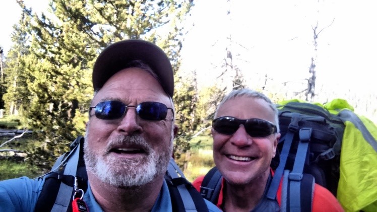
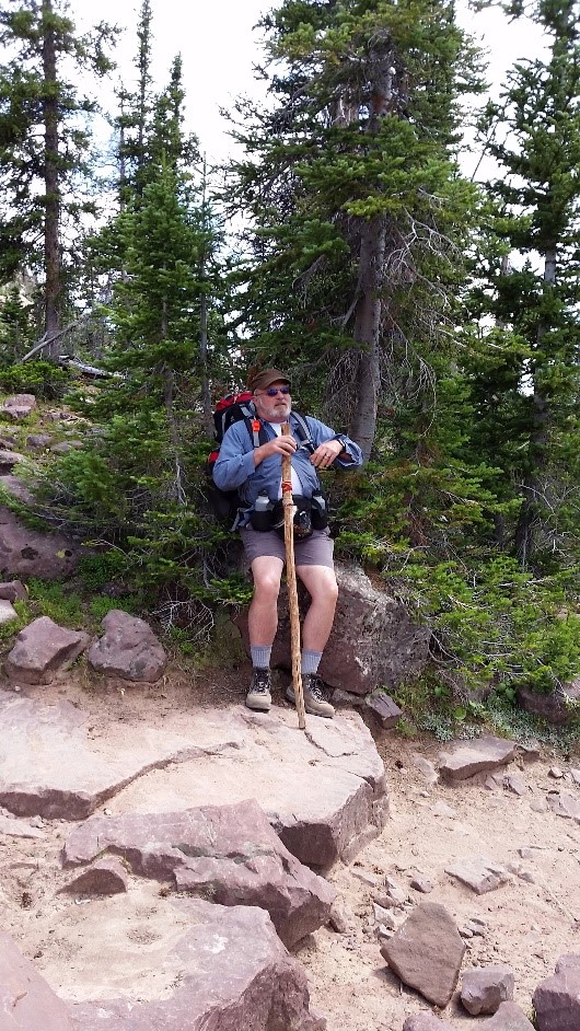
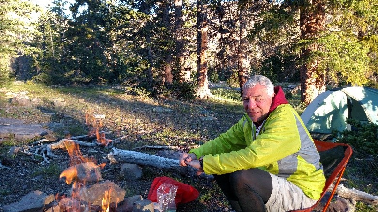
As we headed out from the car I noted that the trail was uphill as expected, and it was very rocky.  Still we were fresh and full of energy and the weather was perfect – low 80’s, low humidity, and pretty white puffy clouds.  Early on we saw a couple of Rangers, a young man and woman who were out repairing the trail.  They would be out for eight days.  Since they were going around the trail in a widdershinds direction and we were doing the loop clockwise we said goodbye, commenting that we would see them in a couple of days.  We made good time for the first couple of hours until after we reached the split where the loop began and started our clockwise cycle of the trail.  Then it got steeper.  Then it started to rain.  Dang.  So much for the rain prediction of 20%.  We put on our pack covers; I had a nylon windbreaker with a hood.  To save weight Dave had not brought along his rain gear so I loaned him my hat and pulled up my hood, looking, I imagine, like a disgruntled lawn gnome.  One thing that can slow you down even more on an uphill rocky trail at altitude is a wet uphill rocky trail.  We struggled uphill for another hour or two before the rain let up and Dave began look for a campsite.  People tend to walk at different paces.  I tend to be more of an ambler.  David, on the other hand is more like the Terminator.  During this trip, he would walk at his normal pace which is much quicker than mine, and periodically wait looking back down the trail for me to make an appearance.  Once assured that I had not collapsed in a quivering heap, he would move ahead.  This gave him time to check the route for good campsites. Dave has an absolutely uncanny ability to find good places to stop, usually by spotting fire rings – circles of stones piled up so campers could have a fire.  If there is ever a competition for finding fire rings in the wilderness, I want Dave on my team.

5 GPS
David checking his GPS.  Too bad we left the map 


6 1st camp

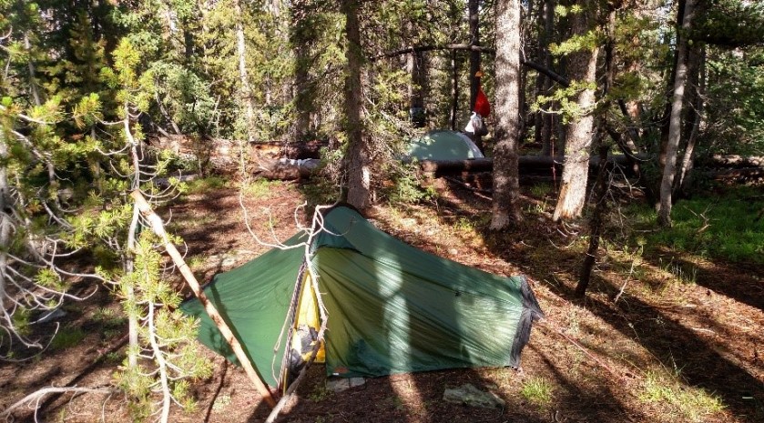
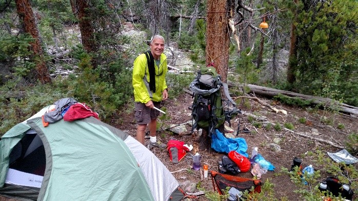
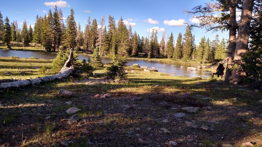
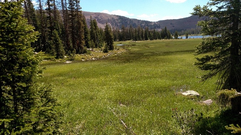
Our first camp – the trail is between the tents

The spot he picked consisted of two level places on either side of the trail.  It was by far the best we could do in difficult terrain.  We did not want to be wandering down the trail looking for a place and then have to set up in rain and gathering dark.  We set up our tents in some haste as we were uncertain how long the rain would hold off.  For a wonder, even though it was the first time we had set up camp on this trip, everything went like clockwork.  In no time, we were sitting on our stools heating water for dinner in our Jetboil cookers.  I tried some noodles mixed with jerky.  It was terrible, but I did eat all I could as I knew I needed the calories.  I was aware that often on the first night out you have little appetite and so was not concerned.  It was still an hour or more before the sun went behind the high cliffs but we had finished our meal and the air had started to cool down.  Then it started to drizzle again so we both crawled into our little tents for the night.

Listening to soft rain pattering on your tent while you are warm and dry is a profound soporific.  I was asleep in minutes only regretting I could not remain awake to enjoy the pleasant sensation.  That first night I either was running a small fever or I had gotten too much sun for I varied between chills and fever and I had some tremulous dreams.

As we did on all our trips we rolled out as soon as it was light. We would heat water for coffee, then have our oatmeal and pack for the day.  Things become very focused when you are on the trail.  We saw no one else that second day.

7 breakfast
Dave at breakfast – taking on fuel 


8 uphill
Typical uphill.  Repeat over and over all day long

While stopped for lunch four hours later beside a rushing stream.  I sat down on a log after eating my snacks and sausage and wound up being unceremoniously dumped on the ground as the log rolled.  No problem, just embarrassing.  But as I lay there looking up I saw serious storm clouds billowing over the nearby overhanging cliff.

We barely had time to get our gear on and packs covered before the storm was on us.  With no other real option we continued to hike.  The drizzle turned to rain.  I noticed some of the drops were cold and heavy.  Then I saw the ice pellets on the ground – we were caught in a mix of rain, frozen rain, and hail.  Yuck.  Adding considerably to my anxiety was the frequent rolling thunder.  Lightning in the mountains is no joke.  Most of it seemed to be cloud to cloud but still, we were up high in the mountains walking past lots of nice tall dead pine trees which are natural lightning rods.  David and I were separated by at least 50 yards. I explained to David that we did not want to give old Thor just one target.  It would rain, sleet, drizzle, stop, and repeat – not good conditions to hike or even be outside.  What was worse was that we could not even stop, not in lightning-prone terrain like we were on.  It made for hard slogging.  We noticed that oddly, under some trees there were dry patches where the low Christmas-like trees provided some shelter and we could stop out of the rain to catch our breath. Around 1430 I was under one of these when I saw Dave coming back down the trail without his pack.  He had found a nice flat spot where low trees provided some shelter.  Sure enough, David had found an excellent place.  It even had a fire ring.  David and I pulled out our stools and settled in under the natural shelter.  The wind had kicked up and it was chilly.  We broke out our “emergency” Mylar space blankets.   As soon as I put it over my bare lower legs it was as though it was not preserving but actually providing heat.  A bit of wrapping and I was warm and dry.  I leaned back against my pack, comfortable and very tired and went instantly to sleep.

I woke up thirty minutes later to a changed world.  The sun was out with fluffy white clouds drifting through a blue sky.  I could hear distant thunder troubling some other mountain far away.  We decided that this was such a nice place we would call it a day and camp here, relaxing and resting.  Even with an afternoon of rest we were both down for sleep well before sunset, sleeping soundly until we awoke to the sound of gunfire at 1240.  The moon was not up and it was very dark.  I heard the sound of people calling out; it sounded like the word “Noah” but it was not in a tone of voice that sounded as though it was protesting.  You do not want to be zipped in a confining little tent when there are bears or strange men are around your tent; I unzipped myself and stuck my head out of my tent.  I shined my light in the direction of the trail, some ten yards away.

“Wow, you scared me,” came a voice from the darkness.  “We are out looking for our friend.  He took a shortcut and now he is lost.”

I spoke with them for a bit and confirmed that they had been firing shots in the air in an effort to locate their lost friend. They moved off down the trail periodically calling out and firing shots.  An hour later I heard them returning back up the trail.  It was an interesting night. David wondered about the wisdom of walking down those trails on a cold and very dark night, hoping to find someone.  I wondered what it would be like to be out there in the wilderness alone and presumably without much equipment.  The next morning, just before he broke camp we clearly heard three quick shots – the usual signal that searchers had found their man.

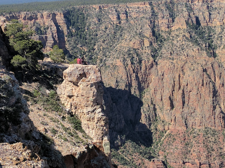
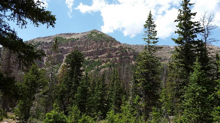
The third day was the most physically difficult.  We did about ten miles, almost all of it uphill to Rocky Sea Pass at the highest point in our adventure, 11,300 feet, about 2500 feet above where we started.  Once I got above the tree line it became easier to see how far there was to go – how very far, far we had to go.  We wanted to do the final push over the top as quickly as we could for fear of being caught up in a thunderstorm up high with no cover.  We need not have worried; the skies were clear.  To my delight I saw the trail actually led us through a little snow field.  Of course, the snow made for treacherous footing on a steep side slope but I still liked it.

9 snowfield
The tiny figure at the top of the snowfield is David    


10 tired tom
The very tired hiker slogging up the trail on the right is Tom

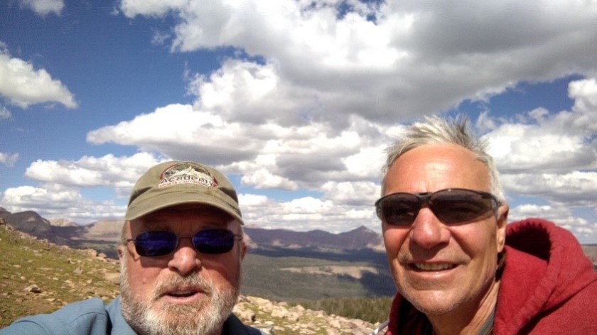
David and I took some pictures in the pass and took advantage of scanty cell phone coverage to send some texts.  Then we crossed over and checked out the other side of the pass.  About 800 feet below us was a lovely basin – green with lakes and copses of trees here and there.  All we had to do was follow the trail through a field of boulder-sized scree.  David headed on down while I limped after.  I had a bit of a scare with a rock shifted below my feet almost pinning my left ankle.    This would be a very bad place to twist an ankle, many miles from the trailhead and on an exposed pass with evening coming on.  Adding to my problems my boots were just a bit too loose and my big toenail was just a bit too long.  Soon my feet began to hurt with each downhill step, and there were a LOT of downhill steps.  I could see David far below moving smoothly over the rocks.  My progress was anything but smooth.  I think the best description was ‘painfully slow’.  David got down in half an hour; it was almost thirty minutes after that before was able to painfully hobble up to him.  We shared out the mosquito repellant (they liked the basin as much as we did) and I put on my camp shoes, a pair of Crocs, to hike the short distance to camp.

11 Rocky Sea
Atop Rocky Sea Pass with Rock Creek basin in the background


12 basin
The right-hand side of Rock Creek basin.  We would camp by the closest lake.


13 Dave waiting.jpg
Halfway down.  Dave is waiting 800 feet below on the trail

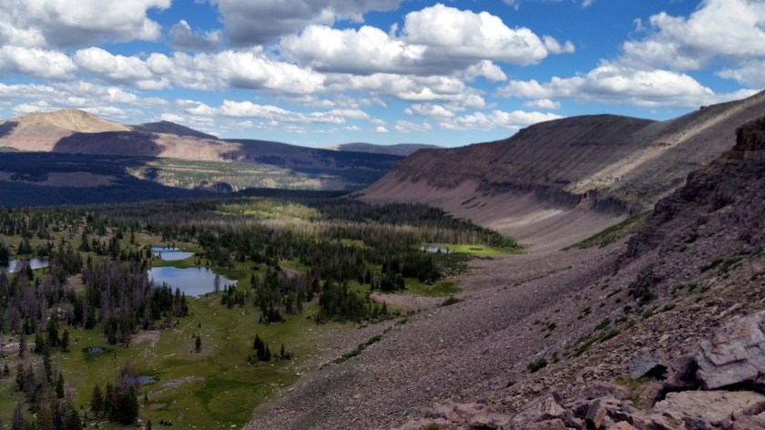
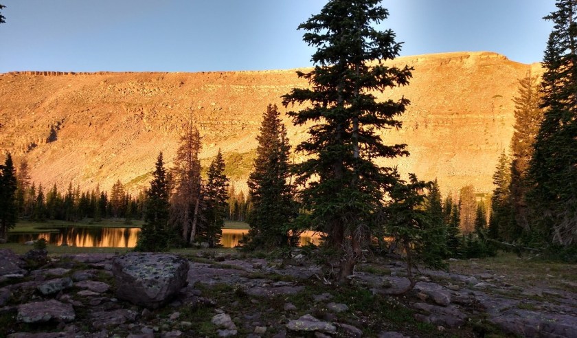
We had many choices for superb campsites and no competition – there was not another soul in sight. All we saw were a couple of mule deer that came up to drink from the little lake by our camp. The basin was surrounded on three sides by impressive cliffs.  David, looking up at the steep climb up to Rocky Sea Pass on this side opined that if we had come around the loop the other way we would have turned around and gone back out the way we came in.  The wind was gusty, sounding exactly like cars on a distant highway as it swept through the trees, only we were many miles from the nearest road.  As we were pretty high we were concerned about how cold it would get.  Fortunately, although it did get cool the wind went down with sun and it was comfortable.  I was what my mother used to call ‘bone tired’ and slept soundly.

14 sunrise cliffs
 Sunrise on the cliffs down in the basin.  The sky was incredibly blue


15 pond
Camp by the pond where deer came to drink.  My pack is on the tree on the right

We awoke to a spectacular morning.  We sat around the fire with our coffee and oatmeal watching the surrounding cliffs light up with the morning sun.  I was optimistic we could get most of the way back in one day.  Hey, it was downhill, right?  Well, it was not downhill for long; mostly it was more or less level.  We walked alongside a mountain brook that turned into a stream, fording it several times.  Crossing these little creeks was about the only thing I did better than Dave.  On one of the more ambitious crossings I was thinking about taking off my boots and wading over in my camp shoes.  Dave thought he could make it, hopping from rock to rock as we had done several times before.  Alas, a rock just under the surface treacherously rolled underfoot and Dave took a tumble into the stream.  I crossed right behind, electing to get a boot wet to get over to Dave.  He was alright, but uncharacteristically pissed off.  It was one of the few times I have ever heard him swear.  At the next big stream we took off our boots and forded it in safety.  I was glad for the cool water on my feet.

16 enjoying view
Enjoying both the view and having the pack off     


17-stream-fording.jpg
Rock Creek – Typical stream we had to ford

We walked for about eight hours or so and, as David had predicted, were nowhere near the end.  For several miles, we passed through an area that had apparently been burned over a few years back.  There were lots of old downed trees and young trees.  The smell of pines was intense.  I was beginning to get a little concerned about finding a good place to camp for the night.  No worries, David once again came through with a near perfect flat spot about twelve feet above a rushing stream with a little waterfall just upstream providing a pleasant background noise.  We sat by the fire and enjoyed the evening.  Unfortunately, the flat spot I chose to set up my tent in was hard as asphalt.  For the first time on the trip I did not sleep well.  Oh, well.

18 waterfall camp
The waterfall camp.  It made a delightful water noise    


19 paused
The pause that refreshes

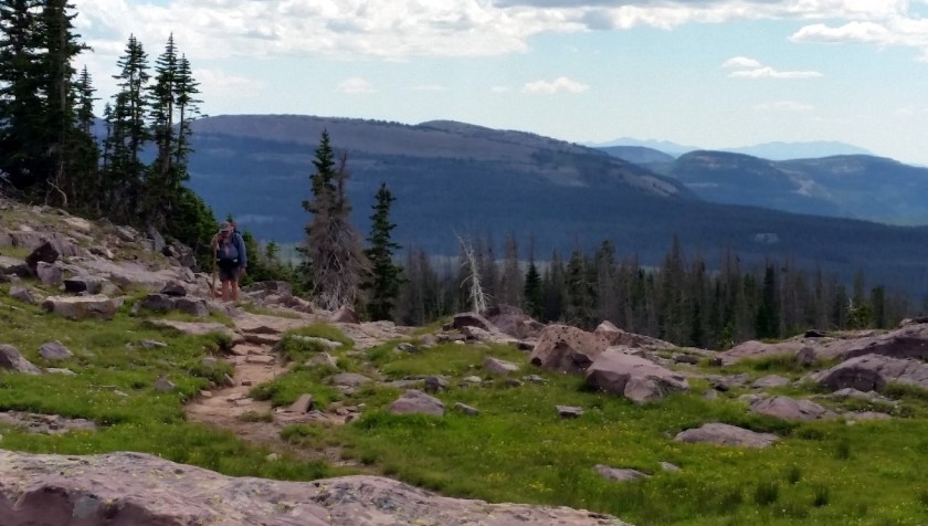
The next day the trail finally began to trend down.  We passed the two park rangers we had left on Tuesday; they were busy doing trail maintenance.  Mid-morning, we began to encounter cattle.  Free range grazing is permitted in National Forests although we both wondered how the hell you get your cows and their calves back.  When we came to the split where we had started our loop we stopped for lunch.  A cowboy, the genuine article right down to his moustache, came by on horseback leading a pack mule with empty packs.  Apparently, he was going out to carry something out.  What, I could not imagine.  We saw not a spec of trash in the wilderness on either of our hikes.

David moved out ahead of me as usual and soon I heard him call “I can see the dam.”  Damn that sounded good.  It meant we were almost back.  Of course, it took over an hour to get back to the car from there – that was one long reservoir. On the way, we passed over a dozen people on day hikes or going fishing, mostly nice Mormon families. When I got to the car park, Dave was waiting with the car open.  The first hike was over; we were ready for some civilization.

Between Hikes

We were looking for a campground with running water and maybe a place to buy a meal.  It was a Pioneer Days, a state holiday in Utah and the campgrounds were all full, so we bounced around a bit before a very helpful young man at a campground called Duchesse and made reservations for us at the best hotel in town – the Motel 6.  I bought two ice creams from the guy and gave one to David as a small  thank you for his great patience.

The motel was almost empty so the clerk gave us a couple of nice rooms on the first floor near the door.  We reacquainted ourselves with hot water, flush toilets, and beds that were up off the ground.  I hit the motel’s hot tub and took a nap.  David and I got together that evening and went out to eat.  There is not much to choose from in Duchesse.  There was a classic small town seedy bar but I did not want bar food.  Instead we ate at Cowen’s Café, a typical small-town restaurant with a typical laminated menu with typical not very good café food.  Still it filled our bellies. We went straight back to the hotel.  I am not sure what David did but I watched a bit of TV and went to bed early.

The motel had a good free breakfast, especially for a Sunday.  After eating we adjourned to our rooms and spent the morning cleaning clothes and repacking our gear.  For example, we packed rain gear along for the second hike. You learn a lot from five days of hiking and we put that experience to good use.  Lunch wound up being at the Sinclair station which had a Subway AND a pizza outlet, and dinner was back at Cowen’s Café.  We did not do much else, or at least I didn’t, but that was just want I wanted.

The Second Hike

After breakfast Monday morning, we headed once again to the Ranger Station.  Ranger Sheila was there this time and she a very experienced and friendly old gentleman named Cordell gave us some fine detailed local recommendations.  We took their advice and headed to our new destination – Granddaddy Basin.  It had an altitude of around 10,000 feet but only required a climb of a thousand feet or so – there was a six-mile road that gained two thousand feet up to the trailhead.  Perfect.

We again drove north and this time west into the high Uintas Wilderness.  As we got close to the turn off to the road that led to the trail we passed by a place called the DeFa Dude Ranch.  There were some funky log cabins and a few trailers and RV’s in a field.  One of the log cabins had a sign that read ‘Saloon and Office’.  The other said ‘Restaurant’.  Since it was close to lunch we wandered in to the restaurant and got ourselves a big old greasy burger – quite tasty, too.  We noticed that we could rent a cabin for only $40; that looked like it might be a good place to recover after our hike.

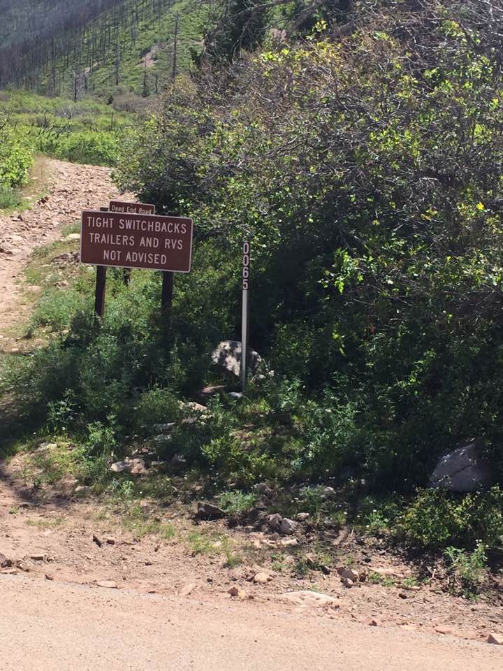
We quickly found the dirt road that led up to the trail head.  It was what I call a Peruvian road: steep, poorly maintained, and with lots of steep drop offs to the side and no hint of a guardrail.  There were lots of big sharp rocks in and on the road to avoid, both to protect my tires and my oil pan. My Focus is not optimized for ‘roads’ like this one.  It took us half an hour to get to the Grandview Trail head but that six miles was all uphill; it would have taken us a long hard day to have walked it.  At the trailhead, we chatted with a young woman who had walked in with her dog to go fishing.  She had a couple of lovely trout she was taking home for dinner.  That seemed like a good sign.  We were well rested and so when we started up the trail toward the basin shortly after 1300 we made good time.  Although there certainly were some long uphill stretches we had reached the highest point within three hours.  About half an hour after that David found an absolutely lovely spot complete with fire ring.  It was just in time because a cold front had that been predicted to come through in the middle of the afternoon had arrived right on schedule and a cold wind had begun to blow.  We pitched our tents in what each thought would be a protected area.  With the wind gusting so strongly there was no thought of a fire.  The cold wind became so uncomfortably chilly that soon after we had eaten we retired to our tents as much for warmth as rest.


20 frosty Dave
David resting by the fire on a frosty morning  


21 Grand daddy basin
One of many lovely views in Granddaddy Basin

In the morning, I waited until David had the fire going before I stuck my head out of my tent.  The wind had died and as long as you stayed in the sun it was not too cold, however there was frost on our tents and backpack covers.  Frost in late July!  Well, that is part of why you go up into the mountains in the summer.  We did five or six easy miles winding past a few campers fishing in the mountain lakes of the basin.  Just after lunch we encountered two Boy Scouts who had been sent out to try to locate one of their leaders who had gone missing.  David, who has led High Adventure Boy Scouts, went ahead and met up with the rest of the hapless troop who were at one point had lost three of their four adult leaders.  The scouts were not lost – the leaders were the ones who had somehow separated from the group.  David was dumbfounded at their stupidity.

We had done a nice hike through lovely mountain terrain with little gain or loss in altitude and David decided to look for a spot to enjoy the rest of the afternoon.  He quickly found a gorgeous spot on a peninsula reaching out into one of the local lakes.  We had a very pleasant afternoon wandering about, watching the chipmunks, and having a good dinner.   Although the weather was fine and I was not all that tired, I still did not make it all the way to sunset before turning in.

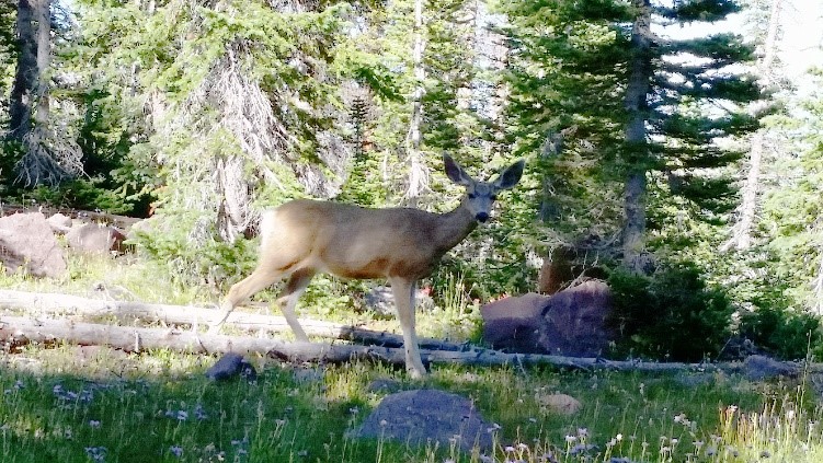
Since the weather had been predicted to slowly warm I was surprised to find frost on our gear then next morning.  In fact, there was ice in our water bottles.  A nice fire with hot coffee and oatmeal set things to rights.  In the morning, we would usually see birds; they were often jays of some species.  They were bold and quite insistent that Dave feed them.  We decided to have another easy day, completing the circuit of Granddaddy Basin.  It only took six hours or so for us to wander back to our first campsite.  David did not want to push it and come in to some place just at dark.  The weather was fine and we relaxed in the late afternoon sun.  I caught a bit of movement out of the corner of my eye and turned to see a mule deer watching us from close by.  She seemed fascinated by us, David especially, and she came back three times, eventually standing in the open not 30 feet from us.  I called her Socks because of the lighter color of her lower legs.  We noticed half a dozen groups of campers including some with horses coming down the trail passing us without noticing our cozy little camp 50 yards off the trail.  Clearly Granddaddy Basin was a relatively popular camping spot.  I intended to get up and check out the stars that night but the moon was almost full and it completely washed out the stars.  Oh, well.

22 socks the deer
Socks the deer checking out Dave  


23 where we were
A look back at where we had been

Our last day was the easiest yet.  We tended to be a bit leisurely about getting underway in the morning.  By the time we get up, drink our coffee, eat breakfast, and get everything packed up and ready to go it usually takes an hour and sometimes a bit more.  This particular morning, we saw some fellow our own age striding rapidly up the trail at 0700.  Twenty minutes later two men followed him, these without packs but carrying bags and all but jogging.  Strange the things you see on the trail.  On the way, we ran into the two men we had seen jogging up the trail.  They were carrying trash out and now were headed back to one of the other scout troops that was camping in the basin.  Yes, they had gone out and back before we even got out but then as I pointed out to David they were 40 years younger than we were.  We were making good time but still it was almost lunch before we got to the trailhead.  The trail back always seems longer on the way back.  Here I must admit that I unfortunately kept my string of getting lost at least once on one of my adventures.  Literally on the last turn into the car park I stepped over a tree and wound up going past the lot and entering it from the wrong end.

The road down was just as slow and tense as the ride up had been and I was glad to see the paved road that led back to DeFa’s.

Postlude –           

We had lunch in DeFa’s Mason, the same guy who took our order and made lunch the last time made us another burger.  Then we each rented a little cabin.  David headed for the single head and shower to clean up while I chatted with a nice couple, Timmy and Suzie Lee who lived in Park City and were staying a DeFa’s because they had been camping and still had too much food and drink left.  We sat behind their cabin helping them eat and drink and having a nice casual chat.  I even took opportunity to drink a beer in the saloon.  When it was dinnertime we all wandered over to the restaurant.  Dave ordered pork chops from the very restricted menu.

“Um… I don’t know how to make that,” confessed Mason, the sole employee.  “My mom will be back tomorrow and she can make them then.”

We ordered burgers.

I stayed up talking and drinking with Timmy and Suzi until after dark.  The saloon was inexplicably closed but my new friends gave me some Bailey’s to sip while we waited for the enormous blue moon to come up over the surrounding cliffs.  It was quite a sight.  I think I may have lasted until almost 2100 before retiring to my austere little cabin where I slept comfortably in an actual bed.

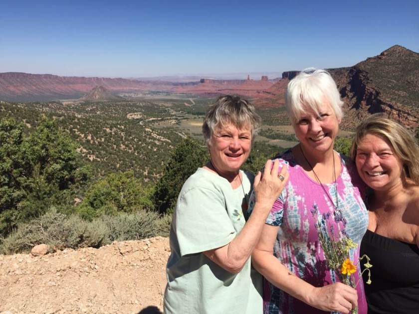
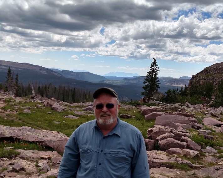
In the morning, we packed up and went over to see if Mason could rustle us up some breakfast.  His mom was there and she outdid herself.  Dave had ham and eggs and his ham steak was as big as his head.  Then it was off to our rendezvous with the birthday bash people in Park City.  We rolled down state road 35, waiting at one point for a herd of sheep to get off the road.  We drove up and over the pass (9350 feet) and down toward Park City and civilization.  I could not help but pity the bicyclists we encountered, grinding their way past us up mile after mile toward that pass we had so recently and easily crested.  We arrived just in time to join our friends for lunch.  I checked into my hotel in Park City and David and I hung out until most of the group met for dinner at a local restaurant that evening.  We had a great time eating, talking, and socializing until dark.  Then Jet’s daughter Christine and her husband walked with David to where he expected to meet his bus.  I followed in the car with his gear.  We stood there, literally on the side of the road, next to a cutout for the bus.  Right on time at 2100 the Greyhound pulled in.  David gave the man his ticket and the driver put his belongings in the luggage compartment.  Then he was gone, riding back twenty hours to Portland and Kathy.

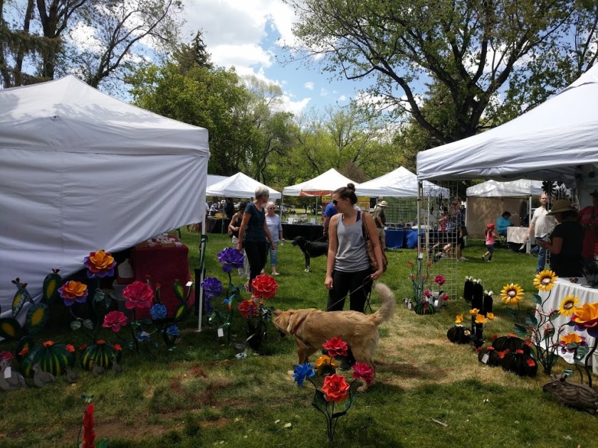
The rest of my trip was anticlimactic.  I wandered through a lovely little art festival in the morning, attended a great party at Christine’s home that afternoon.  Sunday morning, I was off, once again driving roads less traveled to a night at the quarters in Kirtland Air Force Base in Albuquerque and then home on Monday.  The drive was pleasant and uneventful but long.  One item of note happened as I crossed southern New Mexico near Canon AFB.  A MQ-1 Predator drone coming in for a landing flew right in front of me.  It was the first one I had seen in flight; they are surprisingly big – about the size of a Cessna.

I was glad to be home. I had been gone fifteen days.  The last day of my return trip was 845 miles accomplished in a total of 11 hours and 45 minutes of driving.  Total mileage the return trip was over 1750 miles.  Silver, my trusty Focus had not a bit of trouble and averaged 34.8 mpg for the trip, which is quite good since I did hurry her along at times.

Obviously, I could not have had this adventure without David.  He is highly competent, good natured, positive, and endlessly patient.  He is also the only friend I have who is crazy enough to do this kind of thing with me.  Oh, and I lost somewhere between 8-10 pounds on the trail – fat burned hiking, and well worth it.


Sailing to the Bahamas

Sailing from Florida to The Bahamas – December 2015

I like having my small adventures.  Since I have no regular work obligations I have the option to ‘up and go’ for weeks at a time.  Not that I do that on a frequent basis; for one thing, although I am financially comfortable, I am in no way able to support a life of nothing but travel and leisure.  More than that, I like being home.  Part of the charm of leaving to go on adventures is the pleasure of coming back to an established routine that is both relaxed and include-s useful work.

When my old friend Tor Pinney indicated he was looking for two people to help him sail Silver Heels, his Pearson 442 forty-two foot ketch to The Bahamas on the first leg of what would probably be an extended voyage to various southern islands for at least six months, and probably many more, I applied for the job.  I had sailed with Tor once before, helping him bring Silver Heels, up from Panama to Green Cove Springs, Florida.  This time we would be going from the sailboat yard in Green Cove Springs, Florida, where Tor had been repairing and upgrading Silver Heels to Spanish Wells in The Bahamas.  Once the relatively difficult 400 mile open ocean passage was completed Tor would continue south single handed, day sailing and making relatively easy passages among the thousands of islands that stretch from The Bahamas to the South American continent.  The temporary crew would make arrangements to fly back home from one of the many little local airports back home.

He chose an experienced sailor from Boston, Greg Allen, and myself to help him crew Silver Heels on the open ocean passage to The Bahamas.  The trip would allow me to visit family and friends on the way over from Texas to Jacksonville and back.  Pressing business at home required me to stay in The Woodlands through the evening of Thursday, 3 December.  So it was that I left bright an early on Friday the 4th to start my adventure.  My first leg was stopped at my friend Pam and Craig’s new home on Perdido Bay right on the Florida/Alabama line.  It was a long pull there, eight and a half hours, but my trusty Ford Focus, Silver, was up to the ride.  I arrived just before sunset which was a very good thing because they have a fantastic view of sunsets over the bay.  Their home is not just on the bay, it is located at the junction of a bayou so they have splendid views in both directions.  My cousin Edie who helped Pam and Craig find this home joined us for wine and sunset appreciation followed by some delicious Pam-prepared pizza.  The setting was splendid and companionship wonderful.

1 Perdido Bay
Sunset over Perdido Bay from Craig & Pam’s porch at their Florida house


2 Craig's bayou
Looking back down the bayou on the other side of the house


The following morning Pam, Craig, and I went to Joe Patti’s seafood for breakfast.   Joe Patti’s is a Pensacola institution for over 80 years.  It is a unique seafood place with fresh seafood and gourmet items; they will even prepare your fish for you.  However, this morning all we had was beignets and coffee.  I was on the road to Jacksonville by 8.  The familiar ride ended at my sister Dianne’s home on the west side of Jacksonville.

That evening I took my sisters, Carol, Dianne, and Dianne’s husband Lamar out to dinner at one of my late parents’ favorite restaurants.  We had a typical north Florida meal of fried seafood which was quite good.  I am grateful that I get along so well with my sisters – we had a lovely outing.

Tor asked me to be at the boat at 0800 on Sunday.  I was so eager to get there that Lamar dropped me off half an hour early, catching Tor still getting ready for the day.  I stowed my sea bag in minutes.  Greg Allen was the third crew member; a very experienced sailor from Boston.  This gave Captain Tor a couple of ‘burly sailors’ to help him for the 400 mile transit down to the Bahamas.

Sunday – The first leg up the St. Johns

The St. John’s River is over 300 miles long but there is only a drop of about 30 feet in all that length.  This means there is little current and the river is strongly influenced by tidal flow even 50 miles from the mouth of the river.  On that Sunday, we had to wait for the tide to turn, around 1100, before we headed north.  We spent the time productively, preparing for the trip.

It was a nice day to be on the river: sunny, cool, with a slight breeze.  We motored steadily north.  Our goal that day was The Landings, a shopping/entertainment center about halfway to the river’s mouth.  They have a long dock which allows free mooring.  More importantly, it is past the Acosta railroad bridge.  This low bridge would be under repair and would not be able to be opened for five days starting on Monday, 7 December, blocking the way north for boats of any size.  This gave Tor a hard ‘not later than’ date to depart, whether he was not really fully ready to depart or not.

Tor knows something about being ready for sea.  He is immensely experienced in these matters – in fact he actually wrote a book on the subject.  A series of unfortunate events had hindered his normally comprehensive preparations.  Silver Heels was struck by lightning in a summer thunderstorm.  Lightning has famously weird effects on electronics.  Some things that should have been fried were fine.  Other random bits no longer worked.  Worse, some pieces of gear that seemed alright later went on the fritz.  One of the most troubling was the self-steering.  Tor discovered with only a month or so to go that it was not working.  He immediately sent it back for repairs exhorting the manufacturer to get it back to him in working order before December.  That was only one of a host of things that hindered and harassed poor Tor in the weeks leading up to the scheduled departure.  Even working 12-14 hours a day, seven days a week, Tor did not have everything done to his satisfaction.  All the critical things were done and done correctly; however, all sorts of things can suddenly become critical when you are at sea.  Tor gave serious thought to spending Monday night at a little marina just inside the mouth of the St. John’s to allow him another day to rest and prepare, but the weather window was looking promising so he decided to stay with his original plan to exit the river and head out to sea as originally planned.

That afternoon we continued working, cleaning, and settling in at our berth in The Landings.  That night I took Tor and Greg out to dinner.  This was in part because of a known failing on my part – I am a poor cook at the best of times and even worse underway.  I believe it is important that each member of the crew does his fair share of the work and cooking underway is definitely work.  I figured I was ‘paying it forward’ a bit for my failings in the galley.  We retired early, knowing that tomorrow would be a big day.

3 at the Landings
Silver Heels moored at The Landings   


4 Ready for sea
Ready (more or less) to head out into the Atlantic


Monday – Out to Sea

We started the next day by completing a few final preparations such as deflating the dingy and stowing it securely on deck.  The tide would begin to ebb at The Landings around 1000, and we headed under the Main Street Bridge shortly after that.  Tor rechecked the weather.  The small craft advisory had been lifted.  We could expect favorable winds at 20 knots, gradually diminishing to 15 over the next 48 hours.  We motored steadily north, then followed the river east toward the Atlantic.  The St. John’s narrowed and deepened as we moved toward the mouth, staying clear of huge sea-going barges that were none too happy to share the channel with private craft.  Greg was kind enough to pass up a delicious sandwich for lunch.  Tor let me drive most of the way up the river, which delighted me.  An hour from the entrance Tor hoisted the main with a deep reef – it would be blowing out there.  He was also kind enough to offer me a sea sickness pill.   We would need them.

I was glad to get a look at Mayport Naval station with several haze gray warships.  Although I was busy as we navigated out between the jetties, I was able to observe a sleek warship coming out.  I am embarrassed to admit that I did not recognize the low silhouette or an Arleigh Burke destroyer.  It was not until I got a beam view that I recognized DDG 99, USS Farragut.   Oh, well, it has been a long time since I was on active duty.

The wind was a steady 20 knots- nothing for a stout old girl like Silver Heels, especially with just a staysail and deep reefed main.  However, there was still a good swell running from the previous two days.  I have estimated that when seated in the cockpit my eyes are between six and seven feet above the waterline, and I was looking up at a lot of those waves.  Again, no real problem for a craft like Silver Heels.  But these were nasty waves.  The combination of a cross-current and relatively shallow water led to a vicious lumpy sea.  There was no real rhythm to the seas, they came from different angles with varying periods and they tended to be steep.  The motion was violent and irregular.  Later on, my watch I observed that even seated securely in the cockpit pressed up against a sturdy object I had to hold on to something or I would be thrown around.  Moving around below was almost comical.  We were shaken like dice in a Yahtzee cup. The others had problems, too, but I was very definitely the worst.  My progress was marked by a series of crashes followed by curses.  I was able to go below and get an hour’s sleep as we tumbled along toward the Bahamas on a course of 140.

We were lucky to be in Silver Heels, a fine boat.  Built in the early 1980’s by Pearson Yachts, she is a well-thought-out design.  At 42 feet, she is big enough to manage rough weather but small enough for an experienced yachtsman like Tor to sail alone.  She is no lightweight and has a long fin keel which keeps her tracking well.  The ketch rig gives Tor great flexibility in his choice of sails and the sturdy 54 horsepower diesel can push her along both comfortably and economically.  There are two settee berths for crew with big double bed in the owner’s cabin, located next to the cockpit.  There is an old tradition for sailors to anthropomorphize their boats.  Silver Heels is a very reliable lady; comfortable and absolutely trustworthy as long as you treat her right.  Tor has been updating and upgrading her since he bought her nine years ago and in many ways, she is actually better and stronger now than when she was new.  Although it was rough that first day we did not worry about our vessel.  There is an old saying: ships don’t break – men break.

We were on three hour watches.  I took the 6-9 PM watch.  Tor was already down sleeping by then as he had the next watch. The evening was gray and the wind was cutting.   Greg, blessings upon him, handed me up a bowl of hot Raman noodles with some ham mixed in.  I asked him to join me but he said he was not feeling well enough to eat and so retired.  That would be only one of two hot meals we had over the next four days.  We mostly ate peanuts, fruit, and sandwiches.  As the evening turned to night the wind became cutting.  I had to go below and put on a fourth layer.  My shirt was in my sea bag which was stowed in the foc’s’le.  Do you remember those old pinball games where the big silver ball would bounce wildly from one side to the other?  Me going forward to get my long-sleeved shirt was kind of like that.  Unfortunately, on the way back a particularly vicious wave caused me to bump against a deeply sleeping Tor, waking him up.  I still feel bad about that.

I was particularly mad at myself for waking up Tor because he was so tired.  Make no mistake – Tor is genuinely tough, both mentally and physically.  But he had been working very hard the past few weeks and did not sleep well the night before we left.  The reason is very simple.  Tor does not just own a sailboat he lives on her – and has for over eight years.  That means virtually everything he owns is kept in a very small space.  Think about it: that includes all his cookware, clothing, tools, books, pictures, spare parts, bedding, stores, food, beverages – everything.  To quote the song, he has ‘everything he needs and nothing that he don’t’.  This means everything must go in a specific place or things won’t fit.  Further, you need to clean up and put away everything as soon as you are finished with it.  Tor is keenly aware of everything that goes on aboard Silver Heels.  Two large men coming aboard, combined with weeks of hard work preparing for an extended cruise along with the normal anxiety before setting him robbed him of the sleep he needed before heading out to sea.  It took him two good nights of rest after we got underway before he felt like he was back up to 85%.

Hanging on in the cockpit of a pitching and rolling sailboat a night with a strong and cold wind trying to cut through your clothes is not exactly what most people think of as a Bahamian sailing vacation.  But times like that are all part of cruising.  You have to expect and prepare for nights like that if you are going to get to the good places.

Tuesday – Crossing the Gulf Stream

My next watch was the 0300-0600.  The seas, although still rough were now more regular and the wind had moderated somewhat.  Silver Heels had a counter current under her keel and with the steady wind off the beam we were making 7-8 knots.  My only regret on this watch was that this time of year it was still too early to enjoy watching the sun come up at sea.  I guess I could have stayed up and watched the dawn but decided I would rather nap.

A couple of hours later I joined the others in the cockpit to enjoy the rapidly improving weather.  I embarrassed myself by being sick, fortunately over the lee rail.  Even after 100,000 miles traveled at sea I still can get seasick.  This is more of an annoyance and embarrassment to me than a debilitating affliction, and it did not affect my watch standing.  We continued on out southeasterly course all that day as the sun broke through the clouds.  Making open-ocean crossings involve a fair amount of boredom.  Even Tor admits he no longer looks forward to them.  They are merely necessary in order to get down to the islands.

5 Tuesday AM
Tom on Tuesday morning after a rough night.             
6 Greg
Greg taking full advantage of the better weather

By mid afternoon it was actually rather pleasant.  That night I could feel distinctly warmer gusts of wind, as though it were blowing out of some sort of reverse refrigerator.  The wind was picking up the heat from the Gulf Stream.  Although we continued to move well though the water our speed over the bottom dropped as we crossed that great warm ocean current.

7 Tom
Tom has the conn       


8 Tor
Tor in his native habitat.  And as usual, working hard

Wednesday – Motoring the last leg

As the day progressed the wind, as predicted began to drop and veer to the south.   We shook out the reef but our progress inexorably slowed.   Winds became ‘light and variable’; Tor called them light and irritable.  Eventually we begin motoring in order to hold our course.

One of the most impressive recent additions to Silver Heels is AIS.  This wonderful electronic system provides tracking data between ships; it automatically shares information between ships.  With AIS you can look on the screen of the navigation computer and see every ship within range with type of ship and speed.  No more guessing at dim navigational lights.  Better yet, big merchant ships know where you are and that you are a sailboat.  That morning I got a chance to really take advantage of it.  I could see a vessel ahead of us on the horizon.  Thanks to AIS I was able to discover it was a cargo ship.  Then I saw there were two contacts, but AIS let me know they were really one; an ocean-going tug and tow.  We called her on the radio and she made a minor course change that kept up miles apart.  Easy – but at night and in bad weather that sort of notification can make a real difference.  That afternoon Tor cooked some delicious chicken which I gobbled up while standing watch in the cockpit.

It was becoming clear that at our present rate we would be off Spanish Wells sometime after dark on Thursday.  That meant we would have to spend the night hours waiting for dawn to come in.  It is certainly possible to navigate in under darkness but it is definitely not prudent to do so.  Further, you have to wait until customs and immigration clear you and that is definitely better done in the morning.  Tor determined that a better option was to go to Marshy Harbour, on the island of Abaco.  It was half a day closer so that we could come in there in the morning.  There was a regional airport there so the two crew members could make arrangements to fly to Nassau.  Greg already had a flight booked out of there, and I should be able to find something that would get me back to Jacksonville.  That is the great freedom when you are your own master.  When circumstances change you can go where you want to go when you want to get there – weather permitting.   And with light tropic breezes our diesel gave us the freedom to go when we wanted.

Greg and I wanted Tor to be well rested for the approach the following day so we offered to add an hour to our watches so that Tor would not have to get up and stand his scheduled watch at 0300.  Instead, Tor had each of us stand an extra hour.  That way he would not have to get up until 0600.  The sunset that night was beautiful.

9 Sunset
Looking to the west on Wednesday evening, a lovely tropical sunset over calm seas.
10 Red sky in morning
Dawn on Thursday.  A spectacular and ominous red sky in the morning

Thursday – a Very Odd day

Thursday, December 10 was one of the most unusual days I can remember.  It started for me with the 0200-0600 watch.  We were coming up on the western shore of the island of Abaco in The Bahamas.  The island is surrounded by reefs, and reefs at night frighten me.  When I took the watch, there were navigational lights off to starboard and even though we were on course and well offshore I was as nervous as a cat in a kennel.  It became clear we would be at the way point early even after I slowed us down to 4 knots.  There are worse things than being early – like being late.  Then the self-steering began to start oscillating up to 30 degrees back and forth, in part because we were going so slowly and had a bit of a current pushing us.  I remained a worry wart even after Tor got up around 5:30 and confirmed everything was okay.

The morning came up bright red; one of the most spectacular sunrises I have ever seen.  I was glad we would be going to a sheltered port as I remembered that old bit of sailor lore – ‘red sky in the morning, sailor take warning.’

As the light came in I realized that what I had taken for a stone breakwater was in face a brush-covered low island with the unpleasant name of Great Guano Cay.  The pass we needed was next to another island, Scotland Cay; the pass was a few hundred yards wide and led into the sound. An inter-island coaster was coming in and we followed her through the pass and across the sound toward Marsh Harbour, a wrinkle in a low-lying island off to the west.  I got to drive Silver Heels most of the way over and in, following Tor’s directions.  Coming in, Tor had to decide just where to moor.  He had no way to determine which of these marinas would take visiting yachts or how much they charged; some of these places charged exorbitant fees.  He called on the radio without response.  After a few minutes, he decided to pull up to a fueling dock a resort marina.  That got the attention of a couple of locals who helped us moor.  The fee for tying up there was not too bad so Tor decided we had arrived.

11 Tor at the helm
Tor – seriously contemplating his next move               
12 Marshy Harbor
Tom – safely ashore at Marshy Harbour

The resort was called The Conch Inn.  The place was just opening up as we arrived; fortunately, the staff were very kind and helpful.   The requisite calls were made to the authorities while Tor discussed the costs of staying there overnight, which turned out to be relatively reasonable.  Greg and I turned to and started cleaning up Silver Heels, buoyed by the information that since we were staying overnight at the pier we could access Wi-Fi.  In the event, that turned out to be more difficult than expected.  Immigration arrived first and we handed over our paperwork to the nice immigration lady.  Poor Tor had a number of fees and such to pay.  It costs a yachtsman $300 to enter The Bahamas – a fee which enables you to stay in the country for up to six months.  Not too bad a deal if you are staying for a while but it makes just popping over for a weekend relatively expensive.  Of course, to some of the people who own yachts, $300 is pocket change.  One annoying development happened when customs came on board.  Tor plays strictly by the rules; he always declares everything.  It so happened he had a rifle with 300 rounds of ammunition.  Well, the rules have changed and you can only have 250 rounds with you now.  Tor turned over the extra 50 rounds.  It was a small annoyance; even so, Tor feels that it is better to play by the rules than to risk getting caught later on and facing a severe penalty.

Within a couple of hours Greg and I had completed cleaning the boat.  I began to focus on getting home.  With the internet so spotty on the boat I took my little laptop up to the office and tried there.  Thus began a frustrating two hours of trying to discover what flights go out of Marshy Harbour.  I could see various options but making a connection with a reasonable layover in Nassau was difficult.  Finally, after much frustration I decided to take the Air Bahamas flight leaving the next morning at 0730 and connect with an American Flight that would get me to Jacksonville about 12 hours later.  I start ordering the ticket and just before I get to the crucial point – wham – my laptop runs out of juice!  Ack!  I dash back and get the power cord but despite another hour of trying I was unable to reconnect to the airline websites.  It was after 1500 and I was starting to get worried.  Greg had booked a flight and was gone to make his previously scheduled flight out on Saturday.  I, on the other hand, had nothing, not even a place to stay after Tor left tomorrow.

The ladies at the Conch Inn remained helpful.  When I could not get my computer to reach the link for Air Bahamas she used hers and quickly secured a ticket.  But…. when I tried to use my credit cards to pay for it they were rejected, despite answering security questions.  So the ladies tried calling the airport.  They would not pick up the phone.

“You better take a taxi there and buy a ticket,” they advised me.

“Can I just show up and go space available?” I asked, thinking of costly cab rides there and back.

“No, sah, that flight is almost always full.”

I did not hesitate.  “Can you please call me a cab?”

I had promised Tor to do the laundry at a local laundromat, but getting a ticket out was a priority.  I went out to the street to wait for a cab.    And almost got hit by a car driving on the wrong side of the road.  Oh, yeah, former British colony, of course they drive on the left side.

I stood there in a small parking lot by the side of the road in a foreign country waiting for a cab.  The Bahamas are not rich and I did not expect a gleaming well-marked vehicle.  I was not surprised, then when a Hyundai van built sometime in the late 20th century pulled up.  There was a magnetic sign that identified it as a taxi.  The side door lacked an outside handle so I sat right up front with a large affable black woman who identified herself as Shane.  By this point I was stressed.  Shane was a perfect antidote reassuring me that ‘everything will come out alright’.  Why just this morning her cab had broken down and I was her first fare since it had been repaired.

The fare was $15; I gave her a twenty and scurried into the airport.  The terminal was a moderately sized concrete block building with a counter on one side.  Various airline placards were posted at intervals behind the counter, but only the Air Bahamas station had anyone there: two bored locals.  There was a short line, but the wait was long.  The lady on the left was engaged in a long interminable discussion with a customer.  The wait was punctuated by phone calls by one or the other attendant.  I was amazed to see a customer end one call and then take out another phone out of her purse and make another call.  The man in front of me was engaged in a long wrangling debate with the attendant which apparently involved complex negotiations.  It was getting close to 5 by now and I had an image of the two employees deciding it was quitting time and closing down with customers (including me) still in line.

Eventually I was called to the counter.  I explained I was looking for a flight off the island, preferably to the US. She leisurely checked her display and offered the last seat on a flight that left at 1000 tomorrow – to Palm Beach – for $550.  I then asked about a flight to Nassau.  She grudgingly admitted that she had one ticket left to for that flight for $86 leaving just after 0800.  My credit cards worked just fine here.  Whew.  As a last jibe, the attendant told me I must be at the airport by 0600.  Sure lady; I know when I am being messed with.

And Shane was waiting to take me back to the Conch Inn.  She assured me she could pick me up at the Inn at 0615 which would give me plenty of time to get to the airport in time.  Right – if she did not oversleep, and her car started.  But I had no other real option so I hopped out of her cab telling her I was looking forward to seeing her the next morning.  Now all I had to do was a few loads of laundry in a third world laundromat.  Tor took pity on me and told me that he did not want me hauling laundry half a mile.  I then hustled out and found that the resort would do laundry for boats staying there.  I paid Tor what the load would cost to have done, at least partially discharging my obligation to him.

Tor did not want to go out so I ate dinner in the Conch Inn’s restaurant alone.  I mean literally just me and the staff.  After sampling the curry, I knew why.  Although edible the food was both boring and expensive.  Upon returning to Silver Heels I found Tor had rigged the mosquito screens over the open hatches.  It would be a warm night and Tor was wise to keep the pesky little sleep-stealing blood-suckers out of the boat.  I sat outside for a bit chatting with Tor, then retired to read and try to sleep.

Sleep was elusive that night. The cabin was warm. Although Tor had the place more or less back in order I was uneasy.  I was more than uneasy, I was very anxious.  I knew that if I caught that flight out of Marshy Harbor I would be fine; there are lots of flights out of Nassau to the US, something would turn up.  But if I missed that flight out of the little airport in Abaco I was stuck.  That meant Shane had to show up in her balky taxi well before dawn tomorrow.  I am big on backup plans and alternatives and getting on that flight tomorrow morning was what is called a ‘single point of failure’.  It had to work as I had no other options.  I normally sleep well and do not allow troubles to bother my sleep, but that night I lay awake, sometimes reading, sometimes just staring up at the overhead.  I also did some serious praying.   I may have dozed off and on but despite the fact that I had been up since 0200 that morning, sleep eluded me.  I set two alarms and waited to see what the next day would bring.

Friday – Homeward bound

I awoke long before my alarm went off.  My bags were packed and clothes laid out so I was ready to leave in a few minutes.  Although it was only a few minutes after six, I decided to leave so I could be early for my 0615 pickup time.  Tor offered to make me a cup of coffee but I was too nervous about my taxi to wait even that long.  If she was there I could get coffee at the airport.  If she was not, I did not really know what I would do; perhaps start walking to the airport.

I left Tor with the assurance that he was well.  He was where he needed to be – in The Bahamas.  His boat was more or less back together, he had rested, and could go whenever and where ever he desired.  Tor Pinney has enough money for his needs, a fine cruising sailboat, and most importantly, the skill to take her anywhere he wants to go.  In my book that makes him just about the freest man in the world.

I walked off the pier, backpack and duffle bag shouldered, and headed for the parking lot to begin waiting.  As I entered the lot, to my inexpressible joy there Shane was – parked and waiting for me!  I tossed my stuff in the back and we headed for the airport with me smiling from ear to ear.  When we got there, I gave Shane a 100% tip.  She was worth every penny.

From the moment that I saw Shane waiting for me in the parking lot, everything went my way.  Check in at Marshy Harbour airport was smooth and friendly – exactly the opposite from the day before.  They had breakfast and hot coffee in the waiting area; and free Wi-Fi!   I was able to connect with the American Airlines website and scored the last ticket on the flights from Nassau to Charlotte, to Jacksonville.

The smaller prop aircraft that took me to Nassau was completely full, but the views on the trip over the azure seas that surround The Bahamas were spectacular.  Nassau is a big, modern international airport.  I immediately checked in for my flight, four hours early, and then hung out in the international departure lounge where I had a really good curry for lunch.

The rest of the day was pretty much typical airline travel: safe, controlled, efficient, and boring.  I was glad to see Lamar and Dianne when they picked me up in Jacksonville and took me to a restaurant for dinner.

Saturday – Family and friends

Lamar, my sisters, and I all went out to breakfast Saturday morning.  Then my Dianne, Carol, and I visited my parent’s graves on the first anniversary of Mom’s passing.  Dianne and Carol spruced up the floral arrangements as we reminisced.  Mom and Dad did a great job raising us and it was appropriate to remember them.

I had lunch with Jeff Wilder, and old high school buddy who works as a furniture maker and woodworker.  He still lives in Jacksonville, working not a mile from where I grew up.  We reminisced over a nice pizza.

That afternoon I drove to Carol’s home in Ponte Vedra.  We rode bikes to her club which is located right on the beach and had a little workout in the gym, followed by drinks on the beach.  After dinner at her home I drove back to Dianne’s for the night.

Sunday – Children and Grandchildren

The rest of my adventure was more of a vacation – just an easy drive back west, listening to an audio book about ESPN and then catching some of the football games on satellite radio.  I had just had a short chat in New Orleans with my son, Richard as he was working at his restaurant, The Big Cheezy, and was, as usual, busy.  Let it be said that The Big Cheezy has the best grill cheese sandwiches in New Orleans, no, the world.  Of course, they are a lot more than mere grilled cheese.

It was an easy jaunt from New Orleans to Morgan City where my eldest daughter, Vanessa, and her two beautiful daughters, Alexis and Hadley live with steady Eddie Roe.  After sharing a bit of early Christmas with my granddaughters we paid a visit to Eddie’s hunting lodge.  I am used to driving hours and hours to go hunt; Eddie drives for ten minutes.  His father owns a lot of land and has a camp house that is bigger than my home, all finished in golden cypress – the place is amazing.  I was so astounded at this wonderful place out in the middle of the woods that I completely forgot to take any pictures.  Probably just as well – they would not do it justice.

Monday – Home again         

I left with the girls Monday morning, just as it was getting light.  I cruised home, only stopping to get a great breakfast at a Waffle House.  Why don’t I hit Waffle Houses more often when I am on the road?  You cannot beat them for good, simple food at a reasonable price.

By noon I was home again.  I had traveled 975 miles each way, taking about 29 hours to cover that ground.  That might seem like a lot of distance to cover for a five-day sail, but the journey was part of the experience.  I got to travel by planes, cars, boats, and bicycles and got to talk with old friends and family as well as having a memorable time.

My thanks go out to those who allowed me to stay in their homes during my trip there and back again, to Greg for putting up with me with considerable grace, and most of all to Tor.  This trip would have not happened if Tor had not welcomed aboard Silver Heels, his home and escape vehicle, for this trip.  I will always remember two bits of Tor’s advice.  First, reef early – that is anticipate troubles and prepare for them before they happen.  The second bit of Tor’s wisdom is best expressed in the following graphic.

13 do or not do


Sedona – 2016

Tom, Ruth & Oliver’s Excellent Sedona Adventure

I have a Time Share.   I was not foolish enough to buy one – it was an inheritance.  One thing about a Time Share – you have to pay the ‘maintenance fees’ whether you use your points or not.  Ruth indicated a desire to spend some time in Sedona and fortunately our time share has a resort there.  So last year we booked four days there for early May as sort of a delayed birthday gift for Ruth.  We brought along Ruth’s service dog, Oliver, a black standard poodle.

Ruth surprised me by suggesting we go my car, a distance of over 1200 miles.  Hey, I like road trips.  So on Monday morning, bright and early, we were off on the first leg of our adventure.  Okay, driving from The Woodlands, Texas to Santa Rosa, New Mexico is not exactly an adventure.  Ruth’s car, Ginny, eats the miles comfortably.  We listened to audio books as we crossed the great state of Texas and entered New Mexico where the countryside begins to resemble the classic image of the West.

Santa Rosa is about the last place to stop on I-40 going west before you reach my old stomping ground of Albuquerque. Between the two there is a lot of open prairie but not anything in the way of a motel for over a hundred miles.  The sun was still up but after 750 miles we were ready to stop.  While enjoying a dinner in town Ruth suddenly remembered that she had done an energy project there some years before.  Strange how our various wanderings somehow crisscross.

The long day of driving on Monday meant we had time for some diversions on our scheduled arrival day in Sedona.  I convinced Ruth to take a side trip to Meteor Crater, the impact site of a meteor some 50,000 years ago.  There is not much to see at this privately owned natural phenomena: just a gigantic hole in the ground.  Still, it is impressive.

We stopped for lunch in Winslow Arizona which was “such a fine sight to see”.  We had a healthy and delicious meal at a charming café and then walked across the street to the little memorial the locals put up referencing the old Eagles song, ‘Take it Easy.’  Winslow is a neat little town.  Adding to the pleasure of the visit was that it was not summer yet and was a comfortable 80 degrees with low humidity.

1 Standing or a corner
Ruth and Oliver standing on the corner in Winslow, Arizona – such a fine sight to see


2 Meteor Crater
Oliver is checking out the big hole in the ground that is Meteor Crater

We did not linger; Sedona was calling.  The road down from Flagstaff is beautiful, winding, and descending.  Sedona itself is not very large, about 15,000 people with an average of about 25,000 tourists on any given day.  The town is centered on what they call the Y, an intersection of highways 89A and 179.  Sedona has very strict building codes.  Everything has to be brown stucco/Spanish which sounds boring – but it isn’t.  Even the McDonald’s has that look, complete with teal colored arches on the side of the tan wall.  I saw no buildings more than a couple of stories high.  The architecture blends well into the surrounding red rocks and gives the town a relaxed and calm atmosphere.  Sedona is surrounded by fabulous red cliffs which change colors as the sun rises and falls.  Think Monument Valley with a neat little town filled with art galleries, cool shops, and nice restaurants right in the middle.  Sedona has the reputation of being a very ‘spiritual’ place with mysterious Vortexes which are said to supply psychic/mystic powers.  More on those later.

We found our resort without too much trouble; we had GIS and Sedona is not that big.  Check in was easy and in short order we had our key cards and the three of us were ready to move in.  We had a two bedroom lockout suite.  That allows people to either share their rooms or lock the connecting door.  I slid the card into 3014 and found a very nice, large, comfortable room.  There was a nice little kitchenette, a dining area, and a big bedroom and bath.  We started settling in at once.  I went over to our ‘other’ room, 3015, the bedroom that connected to the suite and found to my astonishment that we were in the smaller spare bedroom.  We had a full kitchen, utility room, spacious dining area, living room, porch, and a master bedroom with an enormous whirlpool bath (big enough for two).  All in all we had about 1500 square feet – larger than some homes I have owned.  We were close enough to the pool and resort center and had a good view of the cliffs as well.  All in all, it was a wonderful place to stay.

We reviewed some of the offered tours at the center and got some advice on places to go and things to see – we signed up for a jeep tour the following evening and Ruth got an appointment at a spa.  Then it was off to the grocery store to pack in provisions such as eggs, wine and shredded cheese for Oliver.  Ruth then wanted to rest a bit so I took Oliver out in the car and we went exploring some of the many well marked trails in the many parks and open areas around Sedona.  We took a short hike together for a mile or so and then headed back to home.  Instead of going out we decided to just get a pizza.  There was a place, Pizza Lisa right at the foot of our street.  I got an unusual pie, a Sicilian, which included a white sauce, artichokes, and thinly sliced lemons (!) on a thin crust.  Washed down with some good wine it was delicious.

The next morning, Wednesday, we started early.  I had to.  All of my life I have tended to get up at first daylight.  Arizona does not do daylight savings time so it is not only two hours later than Texas, it is well east of the rest of the people who are on Pacific Time.  That means the sun comes up early; like 0515 early. This was not a big problem as we both tend to go to be early, but still….  The result was that I was bouncing out of bed and making breakfast before 0600.  We headed out shortly thereafter to see the sunrise at the Sedona airport.  Adding to the excitement was the so-called Airport Vortex located near one of the turnout vistas, although there was not a marker as such for the vortex center.  The Airport Vortex is supposed to provide male energy but I didn’t notice anything.  But what a spectacular view!  As I mentioned before, the sun changes the colors on the surrounding landscape making for an ever-changing vista.

3 Sedona sunrise
 Sunrise over Sedona      
4 airport vortex
At the airport vortex after observing a lovely sunrise

We were back in time for me to drop Ruth off at her spa, NAMTI, while Oliver and I found another trail to hike.  Oliver behaved admirably during the entire trip, never once misbehaving.  Often people in restaurants would be surprised when we got up after eating to discover there had been a dog tucked away under the table.  That said, Oliver is not an outdoor dog.  He likes walking, of course, but after about half an hour or so he starts looking to go back home.  He probably would have liked it more it I had dared let him off the leash; it is not as much fun for a dog when he is constrained to the steady pace of a human. We walked the trails everyday but we never got in more than a couple of miles.  Too bad because the trails are well marked and easy to hike, well, at least the ones I got to try.  There were some more challenging ones that I would like to try (sans poodle) next time.

Oliver and I picked up Ruth from her spa treatment and poured her into the car.  We ate a late lunch at the Paleo Café, the only restaurant I have been in that has a cave motif.  There was more than just grilled meat on the menu.  We had a more or less standard (but delicious) sandwich and a ‘paleo bowl’ that mixed chicken and various greens and veggies.  We enjoyed it very much.

After a restorative nap, we took an evening jeep trail ride.  Our driver, Sid, drove us up way back up into the hills over some four-wheel drive trails, regaling us with stories of the area’s history, explaining some of the local landmarks, and providing commentary on plants we saw along the way.  We ended up at a rustic cabin out in the wilderness.  The owner had homesteaded the place back in the 19th century and lived there, herding cattle with his bride.  The family held on to the land deep into the 20th century before selling most of the original holdings.  We cut through a little path through dry thorn brush behind the cabin for about a hundred yards and abruptly we were standing next to the fairway of a new lush golf course.  Ah, progress.

5 Red jeep.jpg
The Red jeep we rode over some “trails”                    
6 with Sid.jpg
Here we are with our driver, Sid

That evening we ate a late (for us) dinner at the Barking Frog, named after a local species of amphibian who, after a rain, has a croak that sounds a bit like a Chihuahua.  Or so I am told.  They had splendid Prickly Pear Margaritas and excellent food which in combination had us heading back to our rooms and straight into bed.

On Thursday, we had thought to drive up to the Grand Canyon which is only a couple of hours north but instead decided to do a local loop.  We drove past Cathedral and Bell Rock and other fine scenery.  We dropped by Montezuma’s Castle, some long-abandoned pueblo ruins which is now a National Monument.  I was very impressed with the location with sheltering cliffs and a cottonwood tree lined river.  It was easy to imagine people living here.  No one knows why they abandoned their homes over six hundred years ago.

7 Secnery.jpg
Some of the scenery outside of Sedona                                        
8 Montezuma's castle
Higher parts of Montezuma’s Castle

We headed back west to drive up a mountainside to the old mining town of Jerome.  A copper mining boom town late in the 19th century it almost became a ghost town before being discovered by artists and folks who appreciated the scenic views.  I heard that the best way to see the little town, which is built literally on the side of a mountain, is to park at the bottom, walk up the three steep flights of stairs, and then work your way down, shopping and checking out the little art galleries on the switchbacks that zigzag through the little village.   We could see a place that had been recommended, Haunted Hamburger, just above us.  It didn’t look too far.  Looks can be deceiving.  It wasn’t very far but it was seriously uphill – three flights full.  However, the walk was well worth it.  We were early enough that not only did we get a table outside in the cool mountain air, we got one right up against the edge.  The waitress filled us in on the ghost which haunts the place, which she had personally experienced, and brought us delicious beverages and great big, juicy hamburgers.  We were only able to eat about half our lunches as we stared out into the clear dry mountain air.  The rock formations in Sedona were clearly visible 25 miles away.  Once again, good food and excellent beverages had us heading for the bed for some serious napping as soon as we got back.  Afterward Mr. Oliver and I were able to get a little hike in while Ruth continued her nap.

9 Haunted Hamburger
Haunted Hamburger restaurant hangs over the edge.         
10 Lunch view
And this is the view we got from our table – we could see 20 miles

The entertainment that evening at the resort was a guitar-strumming singing cowboy accompanied by his wife on the harp.  It sounds corny but they were actually quite good.  Besides, there were free s’mores there.  We decided not to go out for dinner after our heavy lunch; I just went out and scored another excellent pizza from yet another local fine dining establishment.

Friday would be our last full day.  We started with another sunrise visit to the airport vista where we watched hot air balloons floating over the valley.  Our plan this day was to do some shopping and visit a medium/psychic advisor.  Ruth was there early for her reading.  While she did that I walked around visiting some of the many art galleries in the vicinity.  I was especially intrigued by one that featured metal and ceramic sculptures.  Some were (frighteningly) almost affordable.  But then, where would I put some of these wonderful objects of art?

11 Sedona art
A decorated peccary in uptown Sedona     


12 Frog
An example of some of the art we found all over the town

Ruth was delighted with her reading which was very positive.  In that happy state of mind, we relocated to the shops in an area called Tlaquepaque.  There was a lot of art there and not a few bargains.  We had lunch there, another delicious meal.  In the afternoon, we drove to ‘uptown’ Sedona around the Y and spent a pleasant couple of hours drifting along visiting shops and generally enjoying the day.  The weather was, as it was for all of our stay, very pleasant – highs in the mid 80’s and lows in the mid 50’s with low humidity and sunny days.  After our excursion Ruth went back for a nap and Oliver and I walked the Coffee Pot trail for a while.  Not only is there art for sale, there are artists practicing their craft all over town.  We even ran into one on the hiking trail, painting beneath an umbrella.

We decided to have an early Friday appetizer/dinner at Mariposa’s overlooking the red “sand dune” mountains.  Sitting on a covered patio, watching the sun lighting the red cliffs of Sedona from the west enjoying a nice malbec was splendid.  That night we lay in bed comfortably watching a documentary on the life of Walt Disney.  Okay, it wasn’t clubbing in some hot spot, but it was awfully pleasant.

12 Elegant dining
Casually elegant dining in a splendid patio                  
14 Inner butterfly
Ruth letting her inner butterfly out

The next morning was our last; we needed to check out by 1000.  We arose a bit later than usual before having a big breakfast at the Coffee Pot restaurant (founded by old movie star Jane Russell), named not for the beverage but the big rock formation (not Jane’s the mountain’s).  We checked out on time and cruised down to visit my old college friends Janet and Dave Moore who live in Rio Verde on the northwestern corner of greater Phoenix. On the way, we stopped at an In-and-Out Burger, something we have not done since we moved from California.

Janet and Dave were most gracious, welcoming us into their home.  There had been some concern about how our dogs would interact.  No worries there; it was like doggie summer camp.  They got along great.  We sat in their lovely home chatting until it was time to go to a local block party.  Let it be said: Rio Verde knows how to put on a great party.  All sorts of beverages including frozen Margaritas.  I had the unexpected pleasure of meeting and talking with Lieutenant General David Fridovich who was the senior Green Beret in the Army.  What an interesting man, though most guys in his hazardous line of work are.  I have met a fair number of genuinely tough guys and quite a few natural leaders in my profession.  General Fridovich was both.  As is common in the breed he was both polite and articulate.  The party was a great ending to our trip.

Of course, we still had the 1200 miles to drive home.  We left Rio Verde early and drove all the way to Ft. Stockton arriving in the gathering rain and darkness.  The next day we cruised home, passing through Fredericksburg to get Texas peaches, then on the way and were home by 1400.

All in all, it was a wonderful vacation.  Even the long road trip was pleasant.  Sedona was peaceful and relaxing with excellent food and drink and a lot of things to do.  We hope to go back next year.  Maybe on that trip we can make it up to the Grand Canyon.

Canyon de Chelly & the White House Trail

Canyon de Chelly – White House Hike – April 2017

Canyon de Chelly National Monument is located just outside of the small town of Chinle where my wife Ruth would be working at the hospital for three months.  We took advantage of the situation to visit the canyon before Ruth started her job.  I discovered that the ‘ch’ is pronounced like the ‘ch’ in Chevron, so that it pronounced ‘Canyon de Shay’.  It is from a mispronunciation/mistranslation of the Navajo word Tseyi’(pronounced Say-it).  Tseyi’ is the Navajo name for the canyon.  It literally means ‘between the rocks’.

I did not know much about the canyon which turned out to be a good thing as it made the canyon even more impressive.  The Canyon de Chelly is an abrupt slash in the rising flat scrub land around that reaches out east of Chinle.  After a brief stop at the small visitor’s center we headed up the two-lane road that ran a distance south of the canyon.  We could see 30 foot high red cliffs defining a flat narrow canyon.  The road along the southern side of the canyon moved away from the rim for a mile or so and continued to climb.  We stopped at the first real overlook and found the cliffs on either side of the canyon had grown to 100 feet high.  Most impressive.

Ruth sees the Canyon
Our first look. The canyon walls became higher as we went east.                      
1 Floor of the Canyon
People live in the canyon.  Note the blue roofed hooghan near the treeline                                              

A small, shallow watercourse, Chinle Wash, nourished grass and some scattered trees and shrubs gave the canyon a fertile aspect, at least compared to the surrounding countryside.  A few miles further up the road we came to another turnout where we could see the canyon again.  The walls had risen dramatically to well over three hundred feet.  And so it went as we drove up higher and higher until at the last overlook on the south rim we were looking at huge red cliffs of almost 1000 feet high.  They were more than just sheer; in places, the cliffs actually swept back past the vertical, giving the impression of a gigantic red rock wave about to crest; most impressive.  Far below we could see tiny structures and even small corrals and fields.

We completed our tour of both sides of the Canyon on Monday before noon since rough weather was predicted, both by weather reports and by anyone who looked up at the gray, threatening skies.  By dark we were tucked into our little motel enjoying the security of a warm room.  On Tuesday morning, Ruth’s first day of work, we awoke to a delightful blanket of fluffy power snow.   What joy!  I hadn’t seen snow on the ground in years.  This was the perfect kind; not too cold and obviously going to melt before anyone could even think to grab a snow shovel.   After dropping Ruth off at work, Oliver the Wonder Service Dog and I took another tour of the north rim of Canyon de Chelly to get some more views of a snowy canyon.

3 Winter image
A snowy April morning on the north side of the canyon  


3 massacre cave
3 massacre cave

A view of Massacre Cave on the northern rim of the canyon


The views were spectacular.  Massacre Cave was named for a slaughter of Navajo by the Spaniards who trapped a hundred of them on a ledge in 1802 and shot them down.

Interestingly, the snow picked out just how many houses there are on the upper sides of the canyon.  The canyon and all the lands around it are part of the Navajo reservation.  People live all around the canyon and a few even stay in traditional hooghans down on the floor of the canyon.  The homes were mostly those of the rural poor with a lot of trailers and manufactured homes mixed with a few hooghans.

On a bright cool the next Sunday afternoon, I decided to take the only trail down to the floor of the canyon that does not require a Navajo guide.  The White House trail is only a round trip of 2 ½ miles round trip, but it does involve a vertical change of about 600 feet.  This was confirmed not only by my fancy wrist watch/altimeter but also a handy warning sign about the cliffs.

5 long way down
A valid warning as the cliffs were very steep and the drops long               
6 Start of the trail
At the beginning of the trail looking east up canyon.

Unlike other trails I have hiked, this trail was often over hard rock, sort of like walking on pavement.  Of course, with my talent for getting lost I was a bit concerned.  I need not have been; the trail was just about the only way down, short of a steep drop.  There were plenty of places where an unwary step would have pitched you over a very long way.  The first of two tunnels, blasted through the rock in the 1930’s to allow hikers to get down the steady zigzag trail.  Near the bottom was a final narrow passage about fifty yards long, just wide enough for two people to walk past one another.

7 Hard road
This is a real ‘hard road’.  But easy to walk on.        
8 view from tunnel
Emerging from the second tunnel just above the canyon floor

Coming out through the lower tunnel I divulged onto the floor of the canyon, not far from Chinle Wash, the periodic stream that runs through the canyon.  People live down here.  There was a green roofed hooghan behind a fence that proclaimed, ‘no trespassing’ and that photographs were not permitted.  A right turn led down to the river, in full spring spate.  A charming little foot bridge led over the rushing stream and across the floor the canyon down to the white house ruins; a set of typical pueblo structures located up against a looming cliff.

9 kids on the bridge
The bridge over the Chinle wash.  Note kids who had no trouble with the hike


9 White House ruins
The (no longer) White House ruins; some of the biggest in the canyon.

Make no mistake, these were genuine cliffs.  Walking around modern skyscrapers in a big city gives a small taste of what it feels like up against these massive rock walls that tower over your head.  They gave me a strange feeling of security.  These walls would protect the floor both from the weather and enemies.  They also channel the water; this is a relatively verdant spot in an otherwise arid region.  That may be why there are indications that the Canyon de Chelly has been occupied for around twelve thousand years.  This was the center of Navajo life until the US Army, under Kit Carson swept through it in 1863, destroying the crops, houses, and cutting down their peach trees.

There are still about 80 families that live in the canyon, without electricity or running water, preserving the traditional Navajo ways.  They do not care to have their photo taken without permission or to be more specific, without paying them a fee.  These people can use the money.

I checked out the ruins; not much, they mainly provided an excuse to walk down into the canyon.  It was time to make the climb back up the trail to the car.  No problem, just keep walking up the stone path the equivalent height of a 60-story building.  The hike took me about an hour and a half.  One of the things I most appreciate about the climate in Arizona was that even though there were times when I was a bit warm and was sweating, in the dry air it evaporated immediately, doing its cooling work.  This was a pleasant change from my experience in east Texas where I would be dripping sweat.

10 six hundred feet up
Now that is a sheer cliff – over 500 feet straight up!     
11 Selfie near the top
Back up at the top looking down the canyon.   

Canyon de Chelly is a truly remarkable and impressive sight.  It can be experienced in a single day and is well worth coming to see. There are jeep tours and horseback guided tours into the canyon if you want to explore it even further.


Moab Retreat

Moab Retreat – June 2017


Ruth and I really enjoyed Moab, Utah and its nearby National Parks on our previous visit.  We especially liked Arches National Park.  We were delighted to discover we had a friend, Jan, who owned a vacation home there.  When Jan persuaded a mutual friend of ours, Mary Ellen, to leave her meadow in Sevastopol, California and join us in Moab for a weekend– the game was on.  I undertook this trip with the full, if unstated, understanding that this would be mostly about the three women coming together and enjoying one another.  The duties were established early.  I would drive the truck.  Jan, a semi-local, would be the tour director and navigator, Ruth and Mary Ellen would be in charge of ‘oohs’ and ‘ahs’.

Ruth took off work an hour early so we could traverse the 200-mile journey in time to arrive in time for dinner.  The women immediately settled in to a nice long chat, adjourning to the back deck with gin and tonics.  Jan has many talents including gardening.  We sat comfortably outdoors in her splendid fenced-in back yard garden watching the night creep over the sky while the red mountains hugged us all around.  Plans were made: we would depart at a ‘reasonable hour’, and take the La Sal Mountain Loop road.  The La Sal mountains loom up to the east of Moab along the Utah/Colorado border; some of the peaks are well over 12,000 feet.  They are proper mountains with trees and snow above the tree line.

I brought back breakfast for the ladies from the Love Muffin Café.  Properly fueled by coffee and fabulous breakfast burritos we were on the road by 1000.  Only to find a sign shortly after we started up the La Sal Loop that said: Road Closed 15 miles.  Nothing daunted, I turned Red around and we headed back through town to try the loop from the other direction.  I figured that if the road was closed we could at least get some good views before we were stopped.  The road going east out of Moab is wonderful.  It runs along the south bank of the Colorado, on its way down to carve out some more of the Grand Canyon.

1 Jan & Ellen
 Jan and Mary Ellen in the wilderness 


2 Colorado River in Moab
The Colorado river with cliffs; more cliffs were on behind us

We reached the turn off to the La Sal Loop and, sure enough, there was another ‘road closed’ sign.  I figured, ‘what the heck, this is an adventure, let’s go up’.  The road was obviously under construction.  The ‘road closed’ sign was an advantage as there was no traffic; turned out to be a blessing.  The road a dirt mountain road that was a little dicey so no other cars to worry about was definitely a good thing.

4 Road up La Sal
The road was open but hazardous – that was not going to stop us.   
Whata view!
This is at a wide spot in the road on the way up where we stopped for the views

After a while we came to a wide spot in the road that offered a fabulous view.  None of us were sure just how far we could get up the twisty road, so I stopped and we all took advantage of the photo opportunity.  The mountain still loomed above us; even so looking out it seemed as though you could see forever.  Ruth and Mary Ellen did a great job with the ‘oohs and aahs’.  Jan and I helped.

5 La Sal View
Vast View -the Colorado is visible in the far distance         
6 The Girls on La Sal
Mary Ellen, Ruth, & Jan at the overlook – after harvesting some herbs and flowers

After the stop, we continued up the hill until we reached an orange-vested construction worker.  He stopped us.  The road was open but was limited to one lane.  We waited patiently as he talked into his radio.  After a few minutes two cars came by and we another car (a traffic jam!) headed up the hill.  We passed several pieces of major road repair equipment parked along the way up.  No doubt that the road was closed during the week while they worked on it but this was the weekend with no ongoing construction so we had a pleasant cruise up past the crest.  We stopped on the way down to chat with an Irish (from his accent) bicyclist climbing the hill.  We had seen no other cars so there was no problem just stopping in the middle of the road.  The day was perfect, the view sublime, and stress was altogether missing.  What a day for a drive!

6 Tom in La Sal Mountains
I could not resist getting out as well to enjoy the view and sample the fresh air.   
Bundling on the porch
Bundling special smudge sticks on the deck while I sample a cocktail

Eventually we completed the loop and headed home.  We were discussing what to do for lunch as it was well past noon when Jan, demonstrating her expertise as tour guide/navigator, called out, “We can eat at Milt’s!”  Milt’s is an old-style burger place that has been in Moab over 60 years.  We stood in line to get good old-fashioned burgers and fries which we ate on picnic tables under a spreading Cottonwood tree.

After a restorative nap, we hit the town to do some light shopping.  By the time we returned the sun was over the yardarm – it was time for a reviving gin and tonic.  I had taken advantage of the shopping to pick up some essentials not available in Chinle including a bottle of Jackrabbit Gin, a locally brewed gin.  Yes, they not only sell alcohol in Utah, they even make it.  We all agreed the Jackrabbit was very good stuff, indeed.  Juniper berries of course, with an added touch of sage!

We enjoyed the evening as Jan and Ruth made herbal bundles with sage, yarrow, juniper and amazing Moab grown lavender.  The small bundles are used in smudging, producing cleansing smoke used in blessings.  The ladies had a pleasant time working together and chatting on a soft Utah evening.

The sun was low before we headed out for dinner.  After some searching out expert tour guide selected Jeffery’s Steak House, reputedly the best restaurant in town.  Jeffery’s would be the best restaurant in a lot of cities much larger than Moab.  We waited in the quiet comfortable bar/waiting room upstairs for our table.  Jeffery’s has the best Beef Wellington I have ever eaten.  I am not one to take photos of food, but I wish I had in this case.  We finished by sharing a superb Crème Brule for desert.  Truly a memorable meal.

The next day we did a bit better at getting up and out the door for our Arches expedition.  I was compelled to assure the ladies there would be NO HIKING on this trip.  Getting into National Parks early is important.  They do not really open until 0900.  Before then there is little traffic and you can just drive on in.  The rocks formations are never closed.

8 Three Gossips
 Three Gossips Rock on the left across from Courthouse Towers             
9a Distant Delicate Arch
Distant Delicate Arch observed from a more leisurely spot

In addition to avoiding traffic, the horizontal morning light picked out the colors and textures to the already stunning rocks.  We cruised by famous formations like Three Gossip Rocks, Petrified Dunes, Courthouse Towers, Double Arch, and Elephant Rocks with only brief stops to admire them.  At Delicate Arch, we took the cutoff that led to a distant view of the formation.  The walk was short and we got a clear view of the arch, if at a distance.  There was a memorable stop at Balanced Rock where we got out for a photo opportunity.  It is astonishing how so many of these precarious formations continue to defy gravity and remain upright.

10 Tom, MaryEllen, & Ruth at Arches
Ruth, Tom, Mary Ellen, and Delicate Arch in the distance


11 I see the light
Group photo at Balanced Rock with beam of light on Tom

Although the Devil’s Garden section of the park was still closed we did a relaxed but thorough drive through the main parts of the park.  The woman allowed me to fulfill a personal journey: a one mile walk through the section of the park known as Park Avenue.  This trail runs between massive rock formations on both sides.  At one end the footing is flat solid stone, like the world’s biggest sidewalk.  There were a fair number of people taking the walk going both ways as there was a separate place at each end to enter the trail.  About half of the people encountered were foreign.  Near the end the walk it did become a bit more difficult as the trail climbed to the end.  Jan and Mary Ellen were there, admiring the scenery and waiting for me.  I very much appreciated the ladies allowing me to make this amazing hike.

12 Park Avenue
The beginning of Park Avenue – massive rocks on either side and natural pavement below
13Tom coming out of Park
Tom trudging up at the other end of the Park Avenue trail

We got back just in time to have a delightful brunch with fancy Sunday morning breakfast dishes.  By the time we got back to the house it was time to pack, clean up, and prepare for the long drives home – Jan and Mary Ellen to the big city of Salt Lake, Ruth and I down to and then through the Navajo nation to Chile.

It had been an idyllic weekend; three female friends enjoying one another’s company in a beautiful and exotic location with a nice balance of sight seeing, dining, mild adventures, and plenty of time to relax and talk.  We don’t do things like that often enough.

Flagstaff & Grand Canyon

Flagstaff and the Grand Canyon  – May, 2017

There are a lot of natural wonders in Northern Arizona, but chief of among them is the Grand Canyon, one of the seven wonders of the natural world.  The canyon is about a three-and-a-half-hour drive from Chinle.  Since driving the south rim adds a couple more hours, that means a trip to see the Grand Canyon really requires an overnight trip from Chinle.  Since Ruth had a three-day weekend over Memorial Day, I convinced her that we should spend that long weekend exploring Flagstaff and the Grand Canyon.  Ruth was not especially interested in seeing more rocks, no matter how spectacular; Flagstaff, on the other hand offered plenty of inducements.

Saturday morning, we had a nice breakfast and were out of the trailer long before eight.  I picked a back road route that promised some interesting scenery.  ‘Back road’ on the reservation really means ‘back’.  Of course, I got lost.  No worries – there are so few roads in that part of the world that they all pretty much go to the same place.  We intersected I-40 west of the Painted Desert and rode that fine highway to Winslow, Arizona where we stopped for some nice cappuccinos.  We arrived in Flagstaff just in time for lunch.

Flagstaff is a very cool city of about 70,000 people; it has a great reputation as a magnet for outdoor sports- skiing, hiking, biking, climbing – that sort of thing.  Between the Grand Canyon, Sedona, and Oak Creek Canyon here is also a lot of tourism in Flagstaff.  Add to that Northern Arizona State University and you have a customer base that supports over 300 restaurants and bars along with some neat little shops.  We went right to the Historic Flagstaff, a ten-block area rich with interesting places with lots to see and do.

2 Railway attititudes
Tom relaxing at a pub near the tracks
1 Welcome to Flagstaff
   Ruth  at the train station & visitor’s center in downtown Flagstaff                              

There is a really pleasant vibe to Flagstaff, at least there was on this day.  Flagstaff is also a transportation center in a natural east/west pass.  First there were trails in the area, then the railroad came, then roads, primarily Route 66, and finally the interstate.  These things are all still here, most noticeably the trains.  I have never been anywhere that even came close to the volume  of rail traffic through downtown Flagstaff.  We were told that the trains are not allowed to blow their annoying horns when they go through town.  This makes a huge difference as the many trains passing through are hardly noticeable.

We wandered about town checking things out. We saw an open-air yoga class on the green lawn of the county courthouse.  We had lunch at an art gallery/public house, Root, where we had a nice meal washed down with local porter and stout beers.  And after some more strolling around the historic downtown area, including another stop for a refreshing libation and a haircut for Ruth, we checked into our motel.  The place had a pool and a Jacuzzi that I enjoyed on a cool sunny day.

I was up early the next morning, excited about our trip to the Grand Canyon.  Rather than take the more often used and therefore more crowded road that leads northwest to Grand Canyon Village we took the route that led to the eastern route up to the Desert View entrance.  The 50+ mile ride up to the east entrance is both varied and scenic, featuring everything from mountains to flat fertile plains, to the same red rock high desert we have in Chinle.

The road to the entrance passes through the Navajo Reservation – not surprising considering size of the rez.  As we neared the entrance of the park, there were periodic pull out spots that offered views of the distant canyon to the north, cutting through the plain.  There were characteristic shabby vendor booths in all of the view points, though on a Sunday morning there were no vendors yet.

After another twenty miles or so we pulled right through the entrance station.  Like Moab, the early bird avoids the crowds. Our senior pass got in for free, saving us the $30 entrance fee.  A few more miles into the park and the famous Desert View tower came into view.  We were astonished to find the very large parking lot almost empty.  Based on the size of the lot this place gets very crowded later in the day.

3 Desert view tower.jpg
The Desert View Tower is located on the edge of the South Rim         
4 Ruth chillin at the Canyon
Ruth chilling on the lower viewing platform – the breeze made the morning brisk

The tower was a ¼ mile from the parking lot.  After her experience hiking up to Delicate Arch, Ruth was wary.  But it was an easy stroll to the rim, especially since the day was perfect: cool and clear.

The Grand Canyon is overwhelming.  It is difficult to put it into context.  Even professional photographers admit that photographs do not do justice to the enourmous space.  As you would expect, the views were spectacular.  Ruth was not all that impressed with the ‘big hole in the ground.’  I, on the other hand, enthusiastically bounced from point to point trying to contain my awe.  While I scurried about taking in the views Ruth scored some nice stuff at the gift shop in the tower.  To repeat, photographs do not catch details like the sun glinting off the distant Colorado River.  Nor do they let you feel the vast expanses and palpable sense of sheer scale.

5 Desert view east
Desert View looking back east                        
6 Desert view west
The view looking down canyon to the west

After oogling the canyon for a while and reading the many informative placards we continued on our drive along the rim.  Grand Canyon National Park is very well operated.  The rangers balance the need to keep the park wild and yet accommodate about 6 million visitors a year.  We heard many foreign tongues during our visit; it is indeed a international destination.  There were plenty of activities promoted, ranging from primitive backpacking to motorized tours.  We did what is probably the most common thing to do in the park: a leisurely drive along the South Rim on Route 64, known as Desert View Drive, stopping at some of the observation points.  We saw all sorts and manner of vehicles from bicyclists to huge RV’s and plenty of buses of both the touring and shuttle variety.  We even saw a couple who had somehow gotten out to a ledge, sitting casually over a drop of a few hundred feet.

7 crazy couple
Crazy couple perched on a cliff edge  
8 South Rim
The view from the Visitor’s Center on the South Rim

As the day progressed, it got warmer and there were more and more people.  Parking became more and more congested as we approached the main entrance until at the main Visitor’s Center there were no places to park at all.  We simply drove a mile or so from the rim to the Park shopping center where there was still parking, and bought some cheese and crackers.  We had a very pleasant lunch under an umbrella in the sunshine.

Before we departed we were able to park at the main visitor’s center.  The new visitor’s center is an impressive set of structures; very different from the relatively humble structures I remembered on my visit there in 1961.  There is a lot to do at the visitor’s center.  I would have liked to have hiked along the rim trail or perhaps rented a bike to cruise along the adjoining bike trail, but Ruth had reached her full quota of rocks for the day.  It was time to complete our loop and take the beautiful drive back down past all the traffic coming up from Flagstaff.

After a brief rest at the motel, we decided to explore some of the sights of Flagstaff.  We wandered around the historic section, looking at murals and the outdoor art and simply enjoying the day.

9 Fire Pit
An outdoor globe fire pit at a local bar & grill   
10 Mural
We found lots of murals; note the well-placed bird painted on David

We found a small flea market being held in a lush little city park.  The atmosphere was small town Sunday; very relaxing.  Even better, Ruth found some really neat little things to pick up.  From there we visited the Lowell Observatory where Pluto was discovered – the planet, not Mickey’s dog.  Unfortunately, just as we joined the tour in progress a young girl fainted.  That put an end to the tour as an ambulance was summoned to whisk the poor girl away to be subject to a whole spectrum of expensive tests.  I suppose the tests are necessary to ensure our medical professionals are generating sufficient cash flow.

11 Park shopping
Flower art in a flea market/fair in a city park.    


12 Scientists
A couple of female scientists. 

We took the opportunity to wander around beautiful grounds of the Observatory and take in some of the displays of the cosmos.  There were also statues of some of the men and women who had figured in the work there.  Apparently, once you started working at Lowell Observatory you stayed a long time and passed away at a ripe old age.  Judging from the idyllic setting of the Observatory it was easy to understand why.

We dined in one of the four (!) Thai restaurants in Flagstaff.  It had been a busy day and we were tuckered out, so we headed back to the motel.

On Memorial Day, we found a classic local diner for breakfast and had yet another excellent meal.  Then we cruised around the town, checking out the University of Northern Arizona.   By good chance we happened upon signs directing us to the Arboretum.  It was well worth the three mile drive over a dirt road.  Ruth was delighted to have a change in scenery from rocks to pine-covered foothills.

13 May the Forest be with you
Ruth back among trees at the Arboretum.  May the Forest be with you                                       
14 Botanic Blacksmith sculpture
Some of the ‘Botanical Blacksmith’ art scattered around the grounds.

The Arboretum is beautifully tranquil.  It is also very educational…. if you like plants.  There was a wide variety of native species, all carefully labeled.  Interspersed on the grounds were thirty mostly metal works of sculpture.  We made sure to check out the butterfly exhibit.  Our timing was good as we got to see several butterflies just coming out of their chrysalis’ and opening their wings for the first time.

It was time to go home.  We stopped on the way out to pick up some absolutely delicious specialty hot dogs at the Dog Haus and munched on them as we made our way over two-lane blacktop back roads through the empty quarter of northeast Arizona.  It had been a wonderful trip.

15 Dog Hause
We’re in the Dog Haus Now.  And gobbled them down on the way home.


Moab & National Parks

Moab, Canyonlands, & Arches National Parks – May, 2017

Living in Chinle is an opportunity.  Being so far out “in the boondocks” means we are (relatively) closer to notable places here in the Four Corners area.  I knew that the town of Moab, Utah was near two large national parks and had a stellar reputation for eco/outdoor tourism.  I had passed through Moab during my Utah hiking adventure and knew that it was a tidy little town with a nice set of motels, shops, and restaurants.  All that made it a good destination for our next adventure.  Directions could scarcely have been simpler: turn left at highway 191, the only highway through town, and drive north 200 miles.  We headed out after breakfast on a cool, sunny, high desert Saturday.

The terrain, as we headed north, was very like that around Chinle – high desert.  Low scrubby shrubs sort of cover the ground.  Mesas and buttes poke up here and there.  The mesas were just what you expect – a flat topped rock formation with straight sides buttressed by piles of rubble coming down at about a 45-degree angle starting about halfway up the sides.  The occasional water courses are marked by green, as trees live either on the banks or, more commonly, in the beds of washes which are only wet part of the year.  You can see a “looo—nnnn—-g” way in this part of the country.   Navajos like to live more spread out than most.  Way off to one side of the road you could see clumps of a half dozen or so dwellings.  There were small collections of houses and hooghans, trailers and trucks, depending on the affluence of the families.  Some groups were typical homes you might find in any other rural area with barns, garages, carports, and often a separate hooghans off to one side.  Other, obviously poorer, places had the typical rural poor fixtures of a worn out mobile home with junked cars and other pieces of machinery scattered about.  There were even a few solitary hooghans off by themselves, inevitably with a battered old pickup nearby.  Photographs fail to capture the scale of the country and the distant structures lose their impact in images.

The ‘towns’ on the reservation tend to be quite small.  The ones we passed through certainly were.  There might be a gas station and a school.  Only bigger towns on the Navajo Reservation have a Bashar’s grocery store and the map dots we went through were far too insignificant for that.  Despite the low population density, there are still quite a few people in the area; the Chinle Hospital allegedly serves 35,000.  This is in part because the reservation is so big: over 25,000 square miles.  That is about the size of West Virginia.   It stretches over parts of three states, Arizona, New Mexico, and Utah.

Even so, it was not long after crossing into Utah that the countryside began to change.  There was more water for one thing.  Towns, although still far apart, were larger and more like the small towns you see in the east and there were fewer distant clusters of buildings.  We now saw many more campgrounds and facilities for RVs.  As we moved north, the country continued to change so that by the time we reached Moab, things were very different.  Distant mesas had become huge red cliffs standing tall, first on one side, then the other, and as we entered town, on both – embracing and sheltering the narrow town of Moab.  The Colorado River cuts through the town, on its way to Lake Powell and eventually the Grand Canyon.  The town is a center for all sorts and manner of outdoor activities.  This is obvious by the large number of outdoor toys in evidence.  There are bicycles, kayaks, rafts, and many varieties of all-terrain vehicles, off highway vehicles, and a wide variety of four-wheel drive vehicles traversing the single main road.  We intended to visit both National Parks in the area.  We had been advised that traffic into Arches NP was heavy in the afternoons and to go there first thing in the morning.  So as soon as we had checked into our motel and had a nice healthy lunch at the adjacent Love Muffin Café we headed up to the other park in the area: Canyonlands National Park.

As we drove north we passed by the entrance to Arches NP; sure enough there was a long line of cars waiting to get in.  The entrance to Canyonlands NP is almost 30 miles west of the main highway.  The park is huge and most of it is not accessible to two-wheel drive cars.  We intended to drive in the Island in the Sky section, staying on the paved road.

1 nothin special
This is the boring terrain in the region.  Not much to look at.
2 look away
Then, off in the distance you see huge canyons opening up

Long before we reached the entrance we came to a stop on a two-lane blacktop in the middle of nothing in particular.  Apparently, there was a line to get into Canyonlands, too.  After about 10 minutes we moved up to the entrance and were admitted.  The problem in many national parks is that there are only one or two entry lanes.  People pay to enter with credit cards.  This takes time.  Of course, we had a Senior Pass and so were able to breeze right in for free.  Almost immediately we noticed huge canyons opening off in the distance.  Soon we were passing deep, colorful vistas.  The erosion was showing its best side, and was perhaps getting ready for the Grand Canyon further downstream.  We continued on past many stops where you could see vast expanses even from inside the car.  I was more impressed than Ruth who, as I have mentioned, has already seen a lot of rocks.

3 canyon view
Grand View Point – a 270-degree view of some of the canyons in Canyonlands NP  


4 bridge
In places the road passed close by the edge.  See the dirt road leading off to… nowhere.

Poor Ruth would wait patiently in the car while I bounced around looking at all that wild countryside.  She even drove some while I did the visual equivalent of a dog with his nose out the window.  They claim that the far end of the park, called the Mazes, is one of the nation’s ‘most remote regions’.  That is easy to believe.  Like the Painted Desert and Petrified National Forests Parks, Canyonlands National Park is truly a wild place, full of wonders.

We drove the 34-mile-long road from the Grand View Point out of the park and back to civilization.  Ruth said that she preferred “shopping, eating, and drinking” to driving around looking at rocks.  Moab is most definitely civilized.  We had a spent a very pleasant afternoon, dropping into various shops and neat little watering holes. The only cloud on our horizon was that Ruth had left her purse in Love Muffin after our lunch.  They had closed before we could get back and so we would have to wait to rescue Ruth’s purse (and cell phone) in the morning.  Fortunately it looked like they had a pretty good breakfast menu.

5 new outfits
Ruth checking out a cute new outfit
6 shopping
Tom carrying the load in Moab 

We had a drink and shared a bowl of pho, at a neat little place called 98 Central.  We perused the art exhibit there while chatting with the artist.  Indigo Alley had a lot of bargains that Ruth could not resist.  Finally, we ended our evening at Zax’s where a moose watched as we ate and enjoyed some of the local brews.  Yes, there are microbreweries in Utah – good ones.

7 -98 Central pictures
 We had a chance to check out the art while enjoying a snack and glass of wine                        
8 moose at Zaks
Tom enjoying his dinner and a cold microbrew with a moose looking over his shoulder

We were up bright and early the next morning.  We wanted to get breakfast, rescue Ruth’s purse, and get to Arches National Park before too many people arrived.   Love Muffin Café delivered on the first two items and we were soon off to the park where we breezed right in.

I was especially glad traffic was very light that Sunday morning because the scenery was a major distraction.  Unlike most buttes and mesas, the rocks in Arches National Park are often vertical right up from the ground.  Unlike Monument Valley, there is vegetation on the ground and considerable variety in the rock formations.  Further, you are closer to the formations in Arches; weird and wonderful formations are all around you.  Unlike other places in the region the rocks often do not have the rock detritus around them.  Lacking these buttresses, they seem to spring directly from the ground.

9 a sheer cliffs
Smooth rock wall strata show variations in erosion.    
10 moon over cliffs
Moon setting on a perfect Arches morning

The road into the park curved around though a wide variety of formations from petrified dunes to outrageously balanced rocks atop natural obelisks.  Off in the distant east were the snow-covered La Sal Mountains.  The morning was cool and bright, just right for a casual drive along the two-lane blacktop.  There were many pull outs to admire the scenery and a lot of that scenery to admire.   One section of the park, the Devil’s Garden, was closed due to road construction.  We instead went directly, well, actually with several stops to admire the formations, to the Delicate Arch   This is a famous formation, one of the iconic images of the park.  The arch requires a mile and a half walk to get to it.  To my surprise, Ruth agreed to undertake the hike.

11 La Sal and dunes
Sand dunes frozen into sandstone with the La Sal Mountains in the distance                      
12 Elephant Rock
Just some of the strange and wonderful formation.

Even though it was well before 0800 the parking lot at the head of the trail was filling up.  Before we even began the hike, Ruth began to manifest what she needed.  Though the day was cool, there was a bright sun.  Ruth decided she needed a hat and there, on the wooden fence by the trail, were several ‘lost hats’ placed for those who needed them.  Ruth selected a cute one. The hike went by the Wolfe Ranch where, early in the 20th Century, a family lived and ranched way out here in splendid isolation.  We moved on past the wretched hut that still stood near the meager water course.  I was amazed to see two couples pushing a baby carriage up the trail.  A hiker coming down assured them in no uncertain terms that it would not be possible to get a stroller up over the rocks.  After about a quarter of a mile we came to a large steep rock face.  The trail led right up that face.  It was a hard pull for Ruth and at the top, she paused for a break.  The bright sun made it easy to overheat.  A passing hiker offered Ruth a cold bottle of water – a second manifestation.   Upward and onward we went.  This is not a handicapped-accessible trail.  I was secretly pleased that there was a complete lack of guard rails or any of the other ‘softeners’ we put around our oh-so-safe world these days.  This trail was unabashedly difficult and frankly dangerous in some places.  If you were careless or foolish you could get hurt.  A bit higher up Ruth was working hard to manage the rough trail.  Unasked, a young Hispanic boy in a Superman T-shirt offered Ruth the use of a trekking pole to help her keep her balance.  The third manifestation of something Ruth needed.

13 hard climb
Ruth coming up the rock face.  Note hikers coming up in the distance            
14 Ruth makes it to the top
Ruth victorious at the Delicate Arch!

Finally, the trail led around a huge rock shoulder – with a 30 foot drop to one side – and there was the arch.  It is not especially delicate; in fact, it is quite large with a 65’ opening and only seems delicate compared to the rocks around it.  We enjoyed the magnificent views, the arch perfectly framed the distant La Sal Mountains, and exulted at making up to the top.  I can easily imagine how brutal that climb over the rocks would be when the desert temperatures soar.  As it was we had pleasant temperatures with intensely blue skies, cut by the white contrails of cross-continental jets, high above.

15 Delicate arch & mts.
Note the people next to the huge arch.  The arch is huge


16a full arch pic
Tom & Ruth posing by Delicate Arch

On our leisurely return downhill we chatted with other returning hikers.  Ruth happened to mention that she was looking forward to an Advil when she got to the truck.  A lady immediately offered one to Ruth right then – the fourth manifestation of what Ruth needed when she needed it. Ruth was so grateful that humanity and manifestations occurred as needed.

We cruised back, stopping at sites such as the Double Arches and taking in other formations such as Balanced Rock, Gossip Rocks, and the Parade of Elephants.

17 gossip rocks
Gossip Rock – three figures conversing quietly                      
18 Balance Rock
How do these rocks remain standing?

It was time to end our trip in this place of wonders; besides it was lunchtime.  We stopped at the Visitor’s Center on the way out.  This was a first-class combination of what to do in the park along with an excellent museum describing the specifics of the rocks in the formation, when they were created, and how they came to have such extraordinary shapes.  As we left the park, sure enough, there was a long line of cars waiting to come in.

19 Window in the visitor center
The impressive view out of the Visitor’s Center              
20 Rez Detour
Detours on the Rez are REAL detours. I was very impressed with guy towing the trailer.

We stopped on the way out at Moab for some more casual shopping and a fine lunch.  Then it was off for the 200-mile drive back.  Ten miles from home we encountered some weekend roadwork that shut down the highway.  We took what I call a ‘reservation detour’.  I was glad I had a truck.  We followed a set of dirt ruts a half mile west before paralleling the road on another track that ran beneath a powerline for a mile or so before making our way past a few homesteads and eventually back to the road and home.

Our visit to Moab was our best trip yet.  The ride up and back was interesting and not too long.  The town was clean, neat, and full of interesting places to enjoy ourselves with a 1960’s-ish feel.  Canyonlands offered terrific views of wild desolation.  Arches National Park was simply spectacular and unlike anything either of us had seen before.  I would like to come back someday.


Monument Valley

Monument Valley

I have always wanted to visit Monument Valley, but never had the chance.  This is in part because the valley is most definitely out of the way, located on the Arizona/Utah border, not far from Four Corners. Everyone has seen images this area; lots of westerns were made here.  The stark landscape and iconic red butte rock formations standing dramatically above the plains are recognized world-wide.

Chinle is only an hour and a half from Monument Valley, which by northern Arizona standards is right next door.  We were accompanied on our trip by Dr. Madeline Luke, one of Ruth’s medical co-workers, and Oliver, the wonder service dog who sat in Red’s back seat with Ruth.

We drove north to the valley through terrain Ruth refers to as the Indian Ocean.  She was referring to the way the low sun comes up over a flat expanse the same way the sun came up on one of her trips at sea in the Indian Ocean off Diego Garcia.  We immediately recognized the pun implied by the vast level stretches of Native American reservation land in the southwest; flat with mountains which are analogs to the islands poking their heads above the sea.

Monument Valley is somewhat unusual in several ways.  It belongs to the Navajo Nation and is not federal property.  Before the National Park system was established scenic places like Niagara Falls were commercialized with so many garish advertisements that even 19th Century sensibilities were offended. However, the Navajo are very sensitive to exploitation of land.  They are good caretakers of this spectacular landscape.  In a sense, Monument Valley is a negative of the Grand Canyon.  Instead of spectacular rock formations cut from the rocks, here we have buttes rising up from a relatively flat plain.  The softer sandstone is capped by harder rock layers call Shinarump Conglomerate.  The softer sandstone was eroded away from the places without a cap, leaving a wondrous set of rock formations.

1 Ruth, Madeline, & Oliver
Madeline, Oliver, and Ruth in the parking lot at Monument Valley                 
2 At the point
John Wayne Overlook at Monument Valley

The road up to the viewing point is cleverly situated so that a ridge blocks most of the view of the rock formations.  There is a $20 fee for vehicles to enter, which is a welcome income stream (probably more like a trickle) to the Navajo people.  A complex on the top of the ridge blends seamlessly into the terrain.  The buildings house a very nice museum, gift shop, restaurant, and motel complex.  They also provide some spectacular view points.

There is a loop road that goes down among the formations.  The road is unpaved – it is not really a dirt road – there is not enough dirt down there to qualify as a nice soft dirt road.  It is a rock, dust, and rut road.  They deliberately leave it unimproved so that traffic will be light.  There is a sign warning in serious tones about the condition of the road and strongly discouraging cars from driving on it.  But I had a truck; one with a nice high center.  Down we went on the road loop around the formations.

3 John Wayne Point view
Note the strip of road next to Merrick Butte.  That was our route                      
4 Madeline
Madeline at John Wayne Point with The Mittens and Merrick Butte

Traffic on the seventeen-mile-long loop road was light.  The deep ruts and many rocks in the road deterred those without proper vehicles.  Many people elected to come to the valley in comfortable buses, then transferring to one of the tour’s open touring trucks which drove people around the route, providing commentary on the features.  There is a motel on the rim with what look to be magnificent vistas from the rooms which all face the valley.

5 Monument Valley Motel
The motel, museum & restaurant blend nicely into the cliffs 
6 Mittens and Merrick Rock
West & East Mitten Butte and Merrick Butte. Vehicles are on the road in to them

People still live in the valley.  Navajo like to spread out and if you look for them you can see discreet hooghans and farms off in the distance.  Monument Valley is a long way from the somewhat snooty exclusion of anything ‘not natural’ attitude you get in National Parks.  Hey, Navajos are natural in this landscape and they have very low impact on the beautiful views.

7 hogans in distance
A mile or so off the road is a hooghan & corral           
8 The Hand
Hand Rock waving to the distant Totem rocks

There are names for many of the formations.  Some are obvious like Mitten Buttes which have a separate spire on each side so they look like gigantic mittens.  Or Cube Rock which is a gigantic cube, or Hand Rock, or the Totem Poles.  Others are a bit more obscure such as the Three Sisters.  I get the three part but they do not really look like women unless the middle one is both very short and anorexic.  Even from the loop road some of the formations are a goodly distance away, but they are still very impressive.

9 Three Sisters
Three Sisters Rock next to a butte                          
10 Totem Poles up close
The Totems are only really visible from the road

Although it is not practical to get out and hike the trail, it is easy to stop at the many pull outs and leave your truck for a better look at the many unusual and arresting rock formations; and we did so.  I understand that it gets brutally hot here in the summer.  We were fortunate to be there on a lovely spring day.  There is an expression in aviation: CAVU which means clear air, visibility unlimited which fit.  It did seem as though we could see forever.

After leaving Artist’s Point, so named for the many painters who come here to try to capture the light and textures of the valley, we made our way up the loop road and returned to the restaurant.  The clear air makes distances hard to estimate.

11 Red & the rocks
Red, pulled off beside the trail next to a butte                
12We are at Monument
Looking out over the vista at Artist’s Point

We enjoyed a fine lunch with splendid views before departing the amazing sights of Monument Valley.  On the way home, we stopped off at a nearby Goulding Trading Post museum, the former home of a couple who ran a trading post out in the desert near the valley for decades.  The somewhat cheesy buildings had exhibits from the many motion pictures made in this area and the stars, such as John Wayne, who acted in them.  It was low tech, old fashioned, and fun.

We took the long way home, going past the hill-top pueblos of the Hopis.  They still have still live in villages on three mesas – Mesas One, Two, and Three.  We did not go up to the hills, it was time to go home.  We got back, after covering a goodly section of northeastern Arizona.


Desert National Parks

Visiting the Painted Desert & Petrified Forest National Parks

On Wednesday Oliver, the Wonder Service Dog and I took our first road trip from our temporary home in Chinle.  After we dropped Ruth off at her job with the Chinle Comprehensive Health Care Center we headed south headed for Petrified Forest National Park.  The purpose was to check out the park; if interesting enough we would return with Ruth.

There are few roads to take in this part of the world; of course, I got lost anyway.  Hey, the road was good and headed in the right direction, although it was exceedingly desolate.  On the up side, there was no traffic beyond a few free-range cattle and a car every half hour so.  And there were some fabulous rock formations.  I was so far off the grid that my Maps app had no signal.  We have OnStar on Red and they had a good signal but even they were unable to send me directions.  No worries, I kept headed south; all I had to do was intersect I-40 and that is a very long target.  I found it and the Park easily.

My little detour through the empty quarter of Arizona had a very small impact on my arrival at the park entrance.  In one sense Petrified National Forest is not much.  There is a small unimpressive welcome center situated in a typical scrubby high desert plain.  The park is mainly a drive-thru park with pullouts to view the scenery, and oh my there is some magnificent scenery – unexpectedly so.  First you come to the northern ‘Painted Desert’ portion of the park.  Erosion has stripped away layers of earth leaving behind exotic outcroppings tinted in shades; beige, ocher, blue, purple, and pink stretching off to a distant horizon.

1 Service Dog at the Painted Desert
Oliver at the first overlook in the Painted Desert       


2 Desolation
The beautiful desolation of the Painted Desert

After taking in some of the Painted Desert vistas we drove on for six miles over I-40 and into the Petrified Forest portion of the park.  Oliver and I explored the ancient ruins of Puerco Pueblo, stopping to admire the rock pictographs first at Puerco Pueblo some of which were surprisingly good.  I was so impressed I stopped at Newspaper Rock just down the road.  Newspaper Rock was a series of rock faces with over 600 drawings scattered over them.  Some were good, some looked like they were mere doodles.  The overlook was a fair distance from the pictographs and even with the provided telescopes they were uninspiring to me.  I drove on to the next turnout, Blue Mesa.

3 Blue Mesa 2
Blue Mesa – Photos do not do justice to the colors of the rocks. 
4a Petrographs
Look for the crane with the frog in its mouth

Blue mesa is just that – there is a faint but definite ‘blueish’ tint to the rocks.  One side trip at Blue Mesa was especially interesting.  At one pull out an elderly park volunteer, John, a retired doctor, took us over a low hill to an especially fine set of petrified logs.  He was a wealth of information about the region and how and when these plants became rocks. Not only was he interesting, he was also artlessly charming.

5 Dr. John showing petrified wood
Park volunteer Dr. John showing us details of some petrified wood.         
6 Huge Triasic Log
A huge log over 225 million years old

I decided that the park deserved another visit with Ruth this time.  Oliver and I headed down the long road home, taking the ‘short’ way this time.

Saturday was the day of our Big Road Trip.  First, we would visit Petrified Forest, then we would swing by the bustling city (by comparison) of Gallup, New Mexico.  Gallup has a Walmart, the only one within a hundred miles of Chinle.  It also has a place that sells wine another rarity in this desolate region.

After breakfast, Ruth and I headed south, stopping along the way at Hubble Trading Post National Historic Site.  This trading post has been in continuous operation since 1878.  About half of it is dedicated to the sale of various native art and half to groceries and various sundries – sort of a 19th Century Walmart/flea market.  Every step on the old wood floor gave a new and unique squeak.  We had a nice chat with the friendly lady behind the counter before heading down the road.

7 Trading Post
Parked outside Hubble’s Trading Post National Monument


8 Blue Mesa
Another view of the Blue Mesa showing the striations

We breezed into the Petrified Forest National Park and stopped to check out some of the spectacular vistas in the Painted Desert.  It was a beautiful but windy day.  The air was so clear that distances were hard to estimate.  The land was spectacular as far as the eye could see.

Once again, we stopped at Puerco Pueblo.  This pueblo, located near the Puerco River was inhabited for millennia.  Unlike many ancient ruins such as White House in the Canyon de Chelly, this hilltop pueblo was surrounded at one time by a stone wall about a hundred yards on a side with houses within, outlined by their stone foundations.  It has only been slightly restored, just showing a kiva (underground room) and the outlines of some of the buildings and the outer walls.  I was very impressed with the remains of this sturdy little village.  The reason for its location was obvious – the river provided a natural conduit for trade.  Archeologists have found many items in the excavation that came from hundreds of miles away.  It is a natural east/west conduit.  Looking out I could see I-40 in the distance.  Route 66 also came through near here.  And we could see the Sante Fe Railroad with seemingly never-ending lines of mile-long trains.  This place is still on a transportation artery.

9 Ruth and Oliver in Painted Desert
Ruth and her faithful service dog, Oliver 
10 Windy Mesa
Tom hanging on to his hat in front of striated blue rocks

We took time to pose for pictures at some of the turnouts.  You can tell it was a windy day.  John was not there on that day but there were plenty of petrified logs and splendid vistas.

Our next stop was at Agate Bridge, an enormous petrified tree that has had the rock eroded from beneath it.  Just over a hundred years ago they put a concrete support under it to prevent it from breaking up. That would be a definite no-no today.  From Agate Bridge, drove on to the Jasper Forest.  There were plenty of rock logs here!  Ruth decided that she had seen plenty of rock logs, telling me that she was ‘just not that into rocks’.

Agate Bridge
The Agate bridge is over 100 feet long               
11 puzzeledOliver & the stone log
Oliver was very curious about these strange logs that looked wooden but were rock

Oliver briefly explored the hundreds of log segments.  He was profoundly puzzled how a rock could look like so much like a log.  I was fascinated by the beautiful colors inside some of the log cross sections.  Some of the bits were fully petrified and resembled rocks that were log-like.  Others were apparently partially petrified and initially appeared to be organic wood – until you picked them up and felt their weight.  After Oliver and I walked around for a bit we departed the Park and headed out for Gallup.

13 Petrified log section
This log’s section shows the rainbow effect 


14 Crystal Forest
A small section of the forest of petrified logs scattered all over the ground

Gallup was a full hour east of the park.  The first order of business was to visit Walmart.  I do not often go to Walmart; I have lots of choices where I live.  People around here travel a long way to get essential items in this part of the world.  This particular store offered everything we needed; little things like socks, tweezers, brushes, and some food items we cannot get in our little grocery store in Chinle.

This is the only Walmart-type store in over a hundred miles.  It is a big one, with a big parking lot.  And on this Saturday afternoon, that parking lot was chock full.  So was the store. It is the most crowed Walmart I have ever seen or probably will see and almost all of the people were Native American.  Rural America, stocking up on stuff on Saturday.  Despite the crowds, we got the things we needed, except for one – wine.  We scored that at a nearby package store followed by a wash for Red who was just filthy.

Finally, we took advantage to eat at a different restaurant besides one of the ones in Chinle.  While living in the motel we have to eat out every night and our choices in Chinle are limited to three restaurants, and that includes a Denny’s.  We figured that Jerry’s Café would not be too busy at 4:00 PM on a Saturday.  Wrong, the place was packed.  We found out why when we ate the food – it was wonderful.  Fortunately, we found a parking place right in front of the place and a table opened up for us just as we walked in.  We credit Father Sean’s blessing.

After that all we had to do was motor the hundred miles back home to Chinle.  It was a most enjoyable road trip.