Sandy Hill Hike

Canyon de Chelly – Sandy Hills Hike

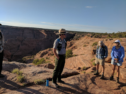
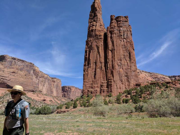
My final hike in Canyon de Chelly was into Spring Canyon with Ranger Justin. I signed up for the scheduled hike into the canyon down the Sandy Hill trail and on to Spring Canyon on Friday morning.  A co-worker/friend was finishing her time at the hospital on Friday.  Ruth assigned me the job of picking up the farewell cake for one of her co-workers at 1130 on Friday to be brought back to hospital for the goodbye party.  The hike was scheduled to be done by 1100.  What could go wrong?

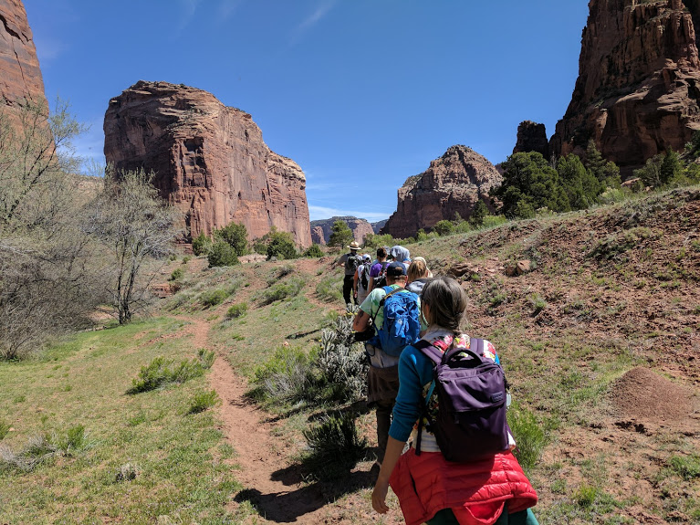
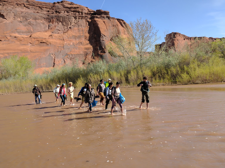
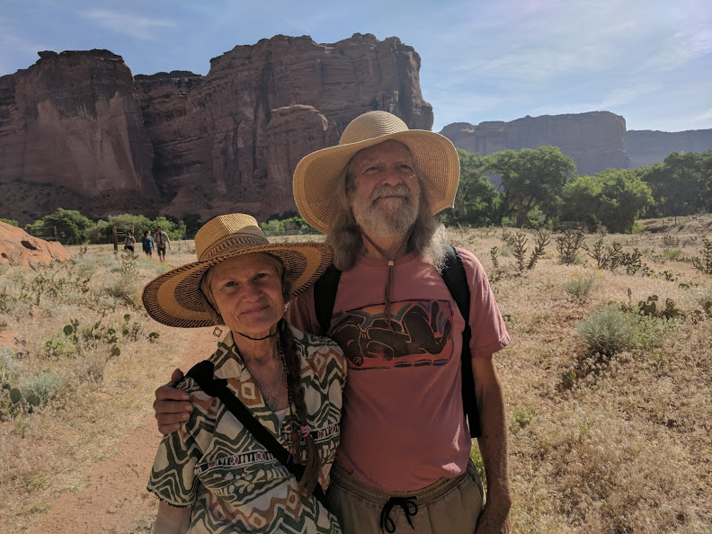
There were only five of us on the walk down to Spring Canyon, departing from the Sliding House Ruins lookout – a college professor and his recently-graduated daughter and a couple of itinerant musicians, Carl and Maryilyn.  This couple, about my own age, had both been practicing musicians their entire lives.   They turned a 24-foot Snap-on-Tools panel truck into a custom RV and set about traveling wherever the weather took them, playing gigs as the opportunity presented itself.  I later had opportunity to listen to some of their music.  You would think two life-long professional musicians would be pretty good – they are better than that- they are spectacular.  You can hear them at https://www.facebook.com/carlandmarilynmusic/

1 Sandy Hill Trail
A distant view of the trail on the cliff face.


2 CarlMarilyn
Carl & Marilyn posing on the trail

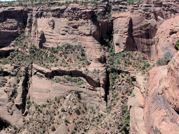
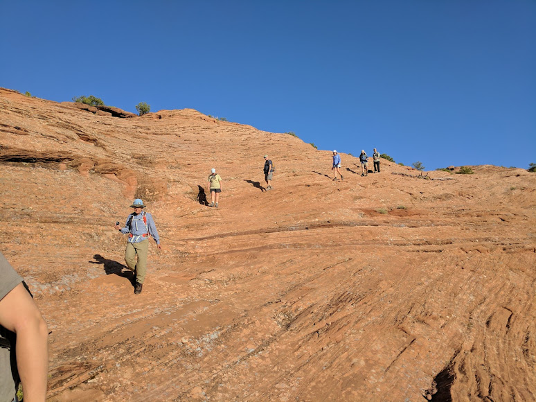
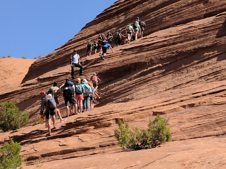
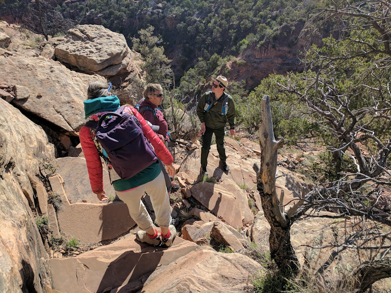
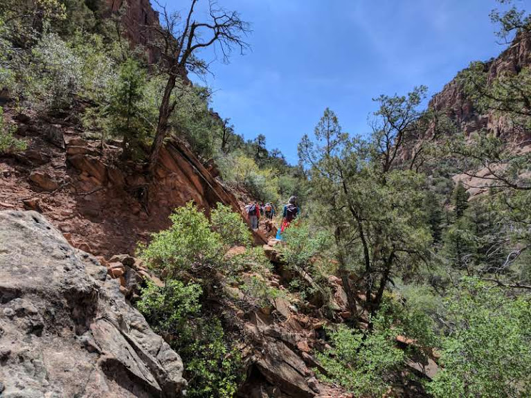
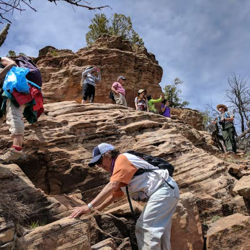
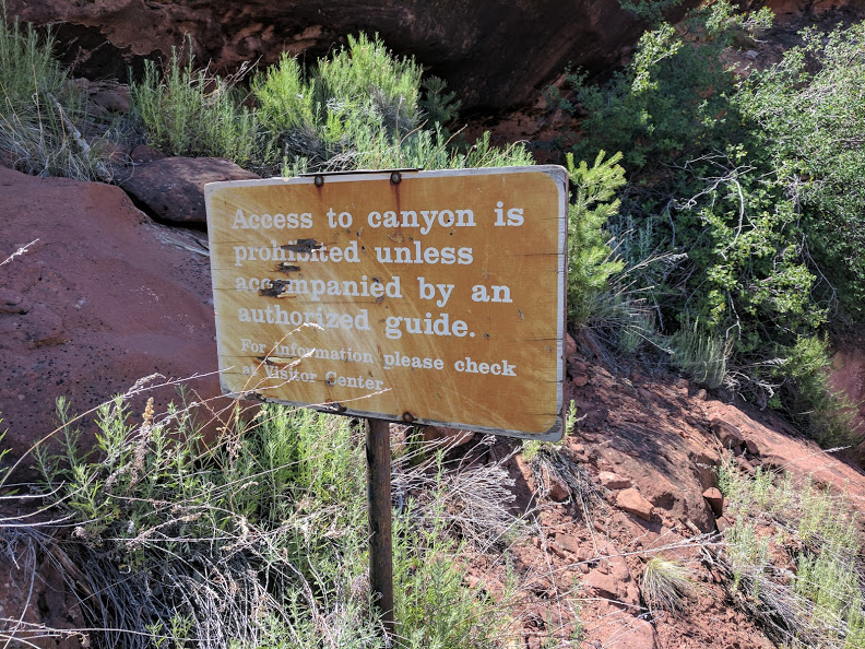
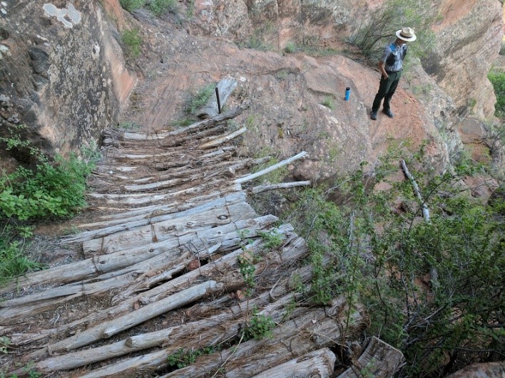
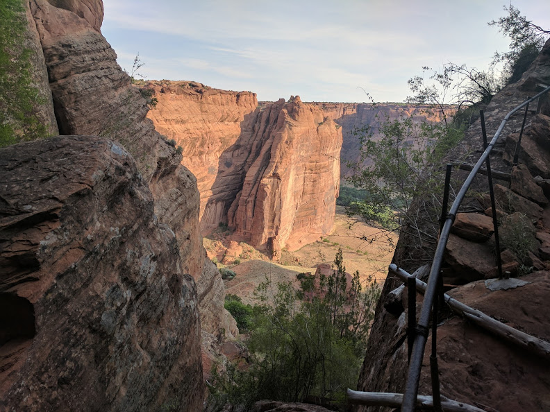
There is only one trail down into the Canyon that does not require a guide, and that trail is well-maintained.  The others are not.  In fact, they are sometimes rather alarming.  There are ‘sort of’ handrails and little log bridges over some dips in the trail.  Nor is the trail itself all that clear; this is one of the reasons why a guide is required.  Another benefit of a guide is the chance to learn more about the geology, biology, archelogy and history of this complex and beautiful set of canyons.

3 Need a guide
A Park Ranger guide is required to enter the canyon here               
4 looking up in Spring Canyon
Sheer walls at the bottom of the Sliding Ruins overlook

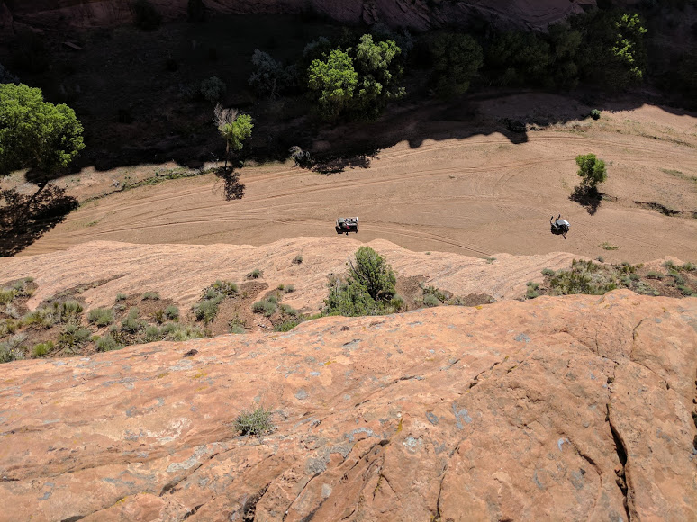
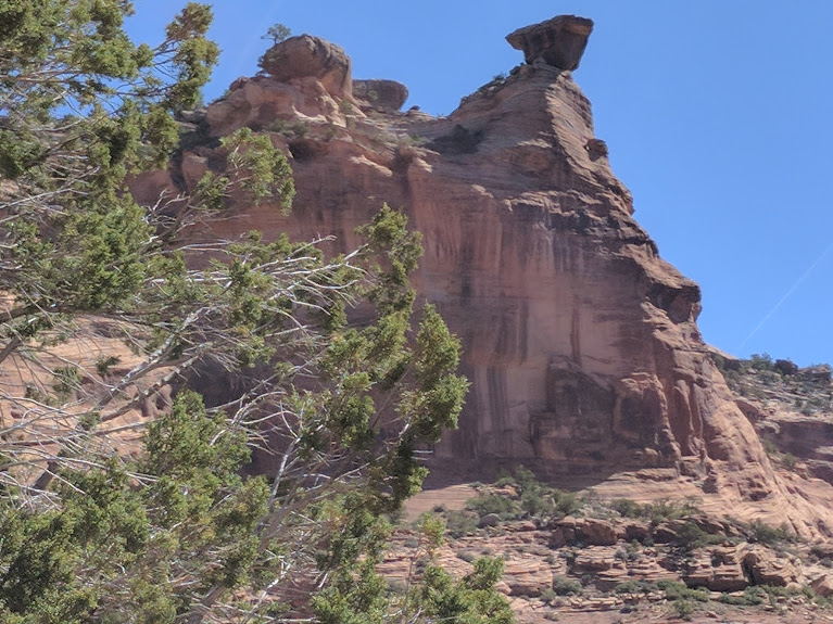
We descended onto the floor of the main canyon and walked alongside the now dry Chinle wash.  Spring Canyon, a significant side canyon opened up to the south.  On the north side of the wash, portions of Sliding House ruins still cling to the north wall.  These ruins were once the largest structures in the entire canyon.  Now they are sliding down into ruin.  Only a good look with binoculars can reveal what was once a complex of about 80 rooms.   Within the Spring Canyon branch is another much smaller set of ruins.  Perhaps because of the spring in this branch of the canyon the area shows signs greater signs of occupation than some.  It also may be due to the sheer beauty of the site.

5 steps down
A wooden set of ‘steps’ on the trail Justin is leading                      
6 view into canyon
View down into the canyon with local railings

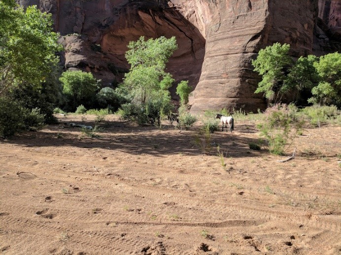
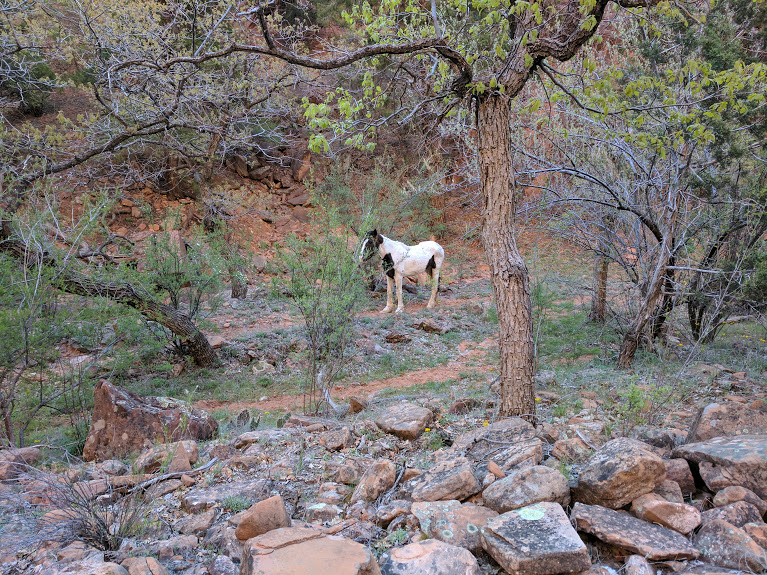
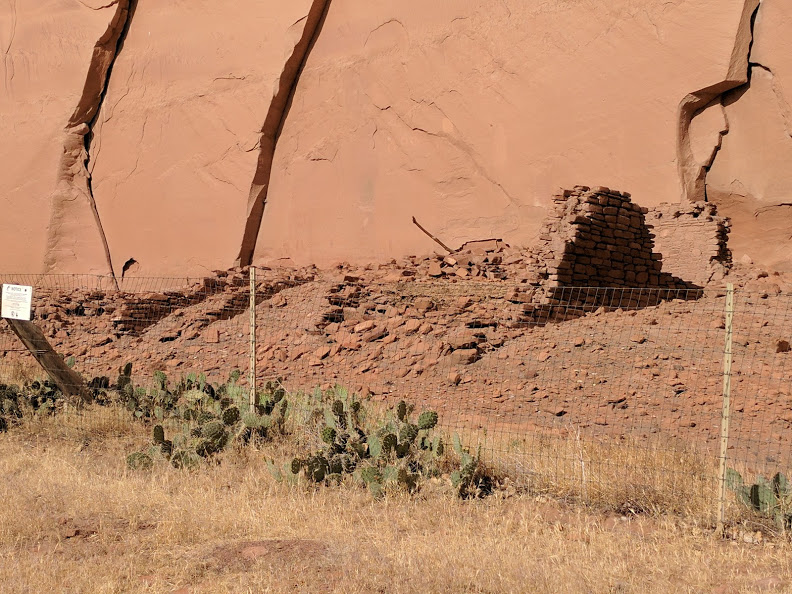
We did not go close to Sliding House but instead cut over to the Spring Canyon site which is now just a few walls of sun baked mud bricks with only a few walls left standing.  One of the recurring things that have struck me in my trips into the canyon is how transitory our civilizations are.  People have lived more or less continuously in this canyon for over four millennia; you can feel it, yet little remains.  Not only people live in the the canyon.  We had stopped to look at the tracks in the sand track at the edge of the wash.  There were horses, deer, raccoons; the expected animals.  Then Marilyn’s keen eyes picked out a clear track of a very large cat.  Puma as well as bear live in the canyon.  The rangers have received reports of one being seen not far from where we found the print in the sand.  The canyon may be inhabited but it is still wild.

7 Spring Canyon ruin
All that remains of the ancient pueblo                                
6 Spring Canyon Wall
Staring up at the massive vertical wall – this always fascinated me

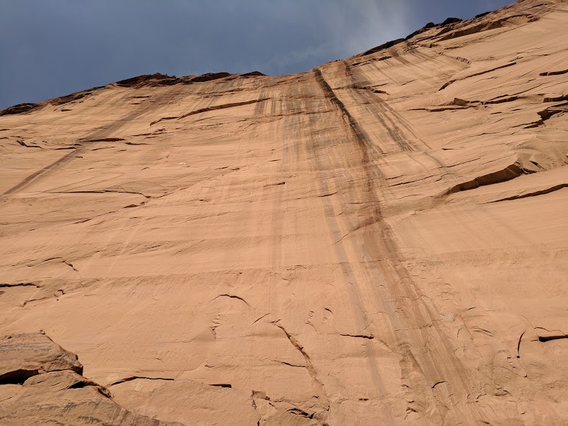
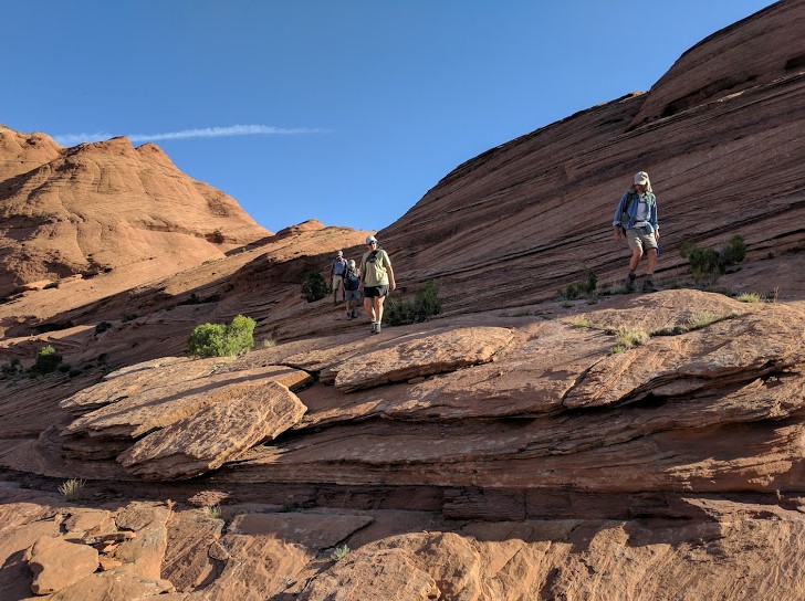
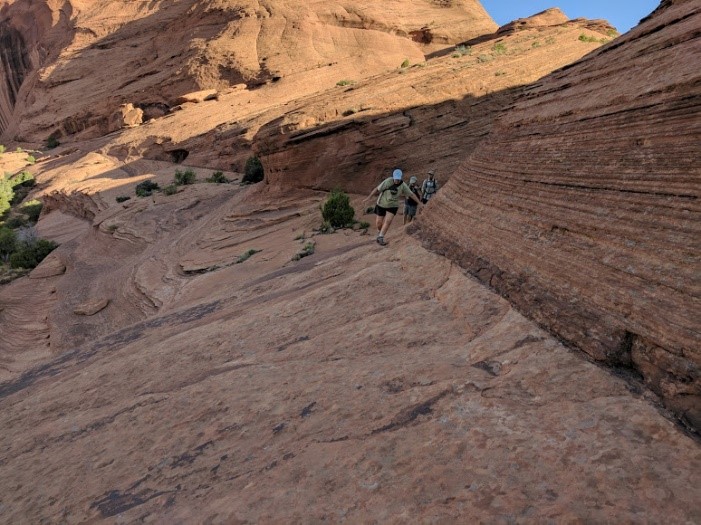
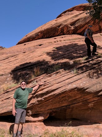
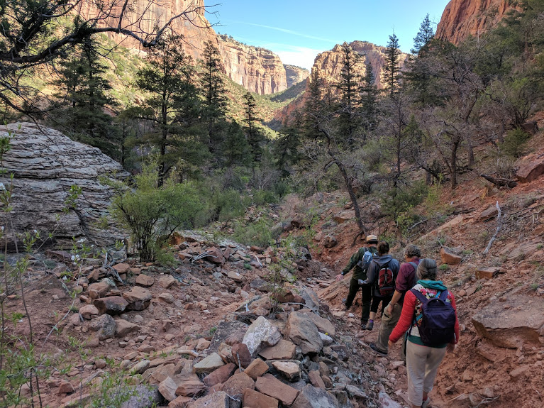
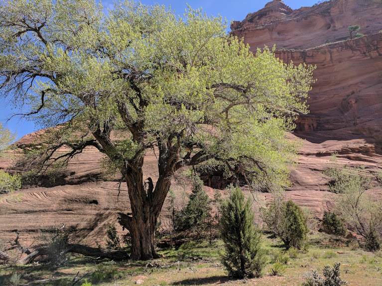
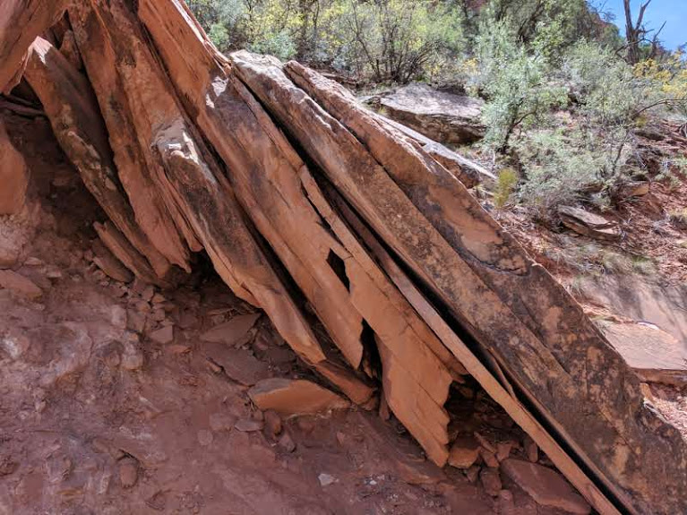
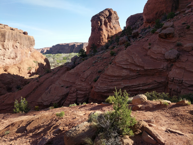
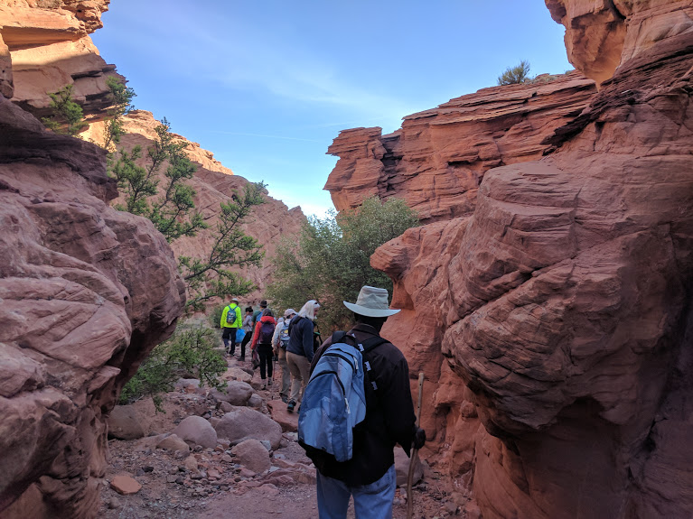
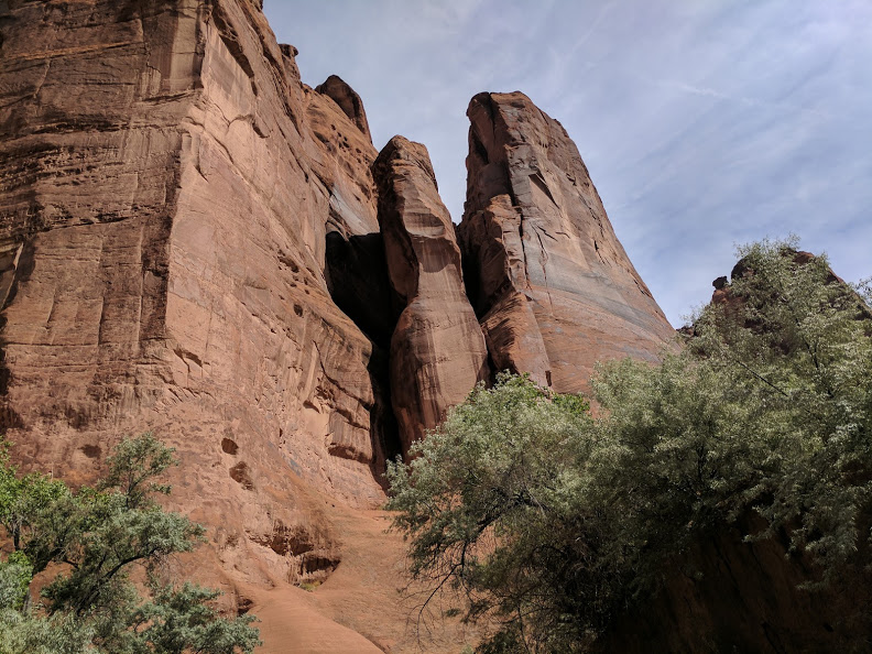
We crossed over a barbed wire fence on a metal stile and walked further into Spring Canyon. The sheer walls reach over you, past the vertical in some places, and are so smoothly huge they are positively disorienting.   You can walk right up to a sheer wall in Canyon de Chelly and put your hand on a stone face that goes straight up for hundreds of feet.  It is unlike the feel of a building; you can just feel the incredible mass and solidity that is lacking in any man-made structure.

Spring Canyon pictographs
Some of the ancient rock art near the ruins   
8 Dam Picto lizard
More recent carving on the dam made by the CCC – with lizard

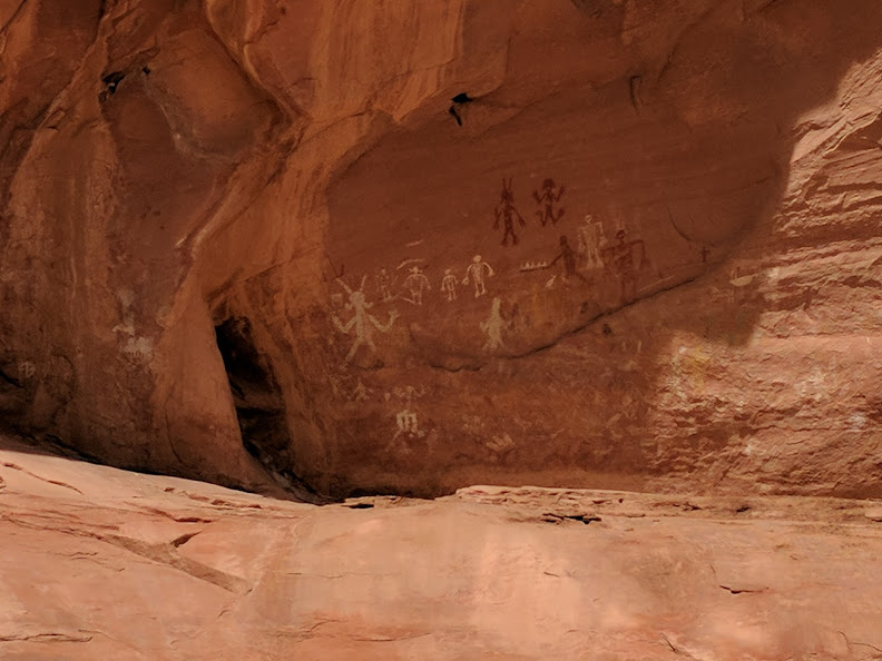
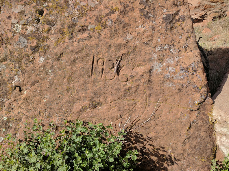
There are not only a lot of ruins in the Spring Canyon area but there are also many pictographs.  This rock art is a reminder of people who lived here over a thousand years ago.  Now all that is left are a pile of sun-dried bricks protected by a fence, a sign, and the forbearance of the Navajo.  The water from the spring at the end of this branch of the canyon was partially dammed by the old Civil Conservation Corp in 1936 as the inscription on a rock indicated.  The granite and concrete dam had fallen into ruin as well.  The timescale within the canyon is huge – millions of years.  Human habitation there stretches back millennia.  The remains of a small dam are hardly noticeable.

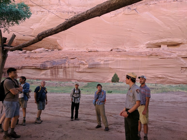
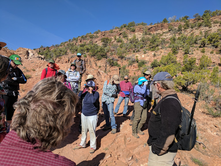
There were not many of us on the hike and Justin had plenty of time to tell stories.  So many stories that we were 30 minutes late getting out of the canyon.  Yikes, I had to go get that cake.  I was lucky enough to pick up the cake and get it to the hospital just in time for the farewell party.  Whew.

This was my last walk into the canyon.  I was lucky enough to walk down five trails into the canyon, four of them guided.  There are hundreds of trails in the canyon; some of which I am physically unable to use.  There are tales of even Navajos, who as a rule are unaffected by heights, freezing on some of the rock faces.  It takes a lifetime to really know this canyon and all of its secrets.

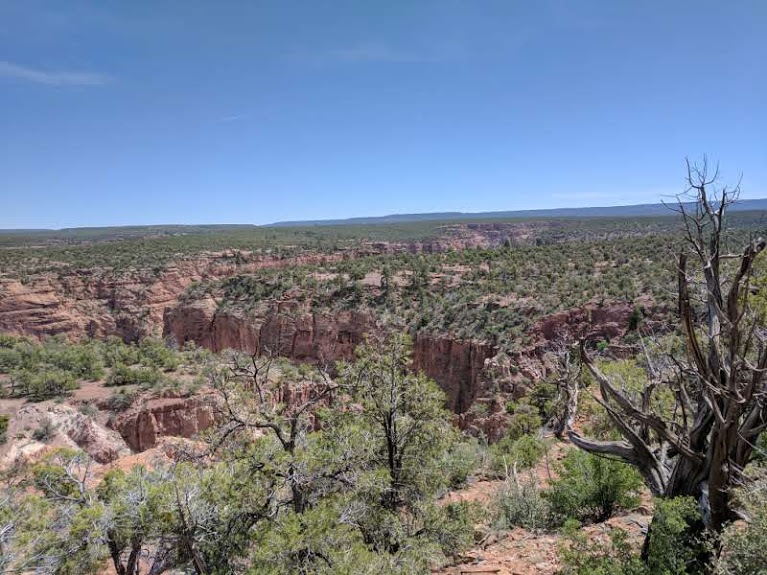
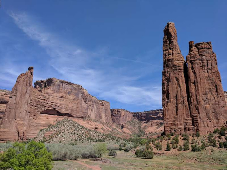
Canyon de Chelly was an unexpected pleasure.  I recommend a visit to anyone willing to make the hundred mile long detour up from I-40.  It is both awesome and accessible; vast but not overwhelming, and stunningly beautiful.  Erosion made the Grand Canyon but God made Canyon de Chelly.


Bare Trail Hike

Canyon de Chelly – Bare Trail Hike

I have tried to take advantage of living in Chinle to explore the area.  The spectacular Canyon de Chelly is only a few miles from the hospital in Chinle so I have explored it more than anywhere else.  There is only one trail, the White House Trail, down into the canyon that is open to the public without a ranger guide. The park rangers lead free hikes into the canyon on weekends.  They prudently limit the number of people they guide in, determined from a first come, first served signup sheet at the visitor’s center.  My friend Chris and I signed up for a hike on a Friday morning down Bare Trail to the Ledge ruins.

Canyon de Chelly National Monument has a unique governmental model.  The land is part of the Navajo Reservation but the land of the monument has been jointly administrated by the tribe and the federal government since 1931.  This was not a ‘land grab’ by the government; rather it was a mutually desired arrangement.  The Navajo only had a few things they wanted: that all the jobs onsite be filled by Navajos, and that the people living in the Canyon be allowed to remain.  The park provides also much needed jobs and tourism brings in more money.  All this while allowing private ownership of the land in the Canyon where the Navajo people can live a traditional albeit austere life.

The weather can be warm in June so the hikes begin at 0700 with a plan to be out of the canyon by 1100.  That meant that my friend Chris and I were standing by the visitor’s center bright and early on a sunny Friday morning ready to walk down the demanding trail to see the Ledge Ruins.  Before we left our guide, Justin did ask if anyone had a fear of heights and reminded us that the hike was considered ‘strenuous’.

1 Justin at Bare Trail
Ranger Justin warning us before we start – note his blue coffee cup
2 Down the Bare 'trail'.jpg
Brave old bilagaanas heading down on the aptly named Bare Trail

There is no real trail head to speak of down to the Bare Trail, and the dirt and rock track to it really requires a vehicle with a high clearance, like my trusty pickup truck, Red.  The Bare Trail is so named because it is just that.  This is not a dirt path winding between hills.  The ‘trail’ is simply a known way down the steep and bare rock.  In some places, the way requires the use of foot and hand holes made by the local people many decades ago.  Canyon de Chelly is absolutely shot through with routes like Bare Trail, developed over quite literally millennia of occupation, first by hunter-gathering people, then basket maker people who farmed the bottom of the canyon, then pot making people who lived in pueblos and finally, the Navajo.  We suppose these people first followed game trails made by animals.  Even the ancient people would transit from the canyon rim back and forth to the fertile floor of the canyon.  As invaders and raiders made their inevitable depredations, the people of the canyon learned to use many and often inconspicuous routes up and down the cliffs.  During their wars with the Spanish and Americans, the Navajo perfected making and using these trails.  Some are only visible from high on the opposite side of the canyon; dotted lines of foot and hand hole leading to one inconspicuous ledge that then leads to another slanting route higher up.  Some of the holes were cleverly placed so that if you did not begin the sequence with the correct foot you would find yourself in a difficult position on the cliff requiring an impossible reach across your body.  The only solution would be to make a tricky descent and try again.   As almost all of these trails were over bare rock, there was no real chance of tracking where others had gone.  You have to learn them and that means spending lots of time, even a lifetime, in the canyon.  Of course, if you make a blunder on some of these trails you will have spent the rest of your life learning them.

Justin, our Park Ranger guide, did not impart all this information to us at first.  We learned it during the course of the hike.  After we parked our vehicles and assembled to start the walk down, it quickly become obvious that we really did need a guide to find our way.  Justin lead us over a number of broad rock faces only occasionally marked with a cairn of stones or the slight evidence of the passing of others on the rock.   The caution about fear of heights was justified; in some places, the path led right along a serious cliff face.  It helped to remember that locals had been doing this for a thousand years; sometimes with a load on their back such as an infant.

3 Last steps are toughest
See the trail?  All I could see were the ledges                 
4 tippy toe
Tippy-toeing along the edge of the trail

Since other than our guides, Chris was the only person under 60 in the group, I was a bit concerned about some members of the group being able to make the hike.  I need not have worried.  They may be older, but the members of our group are still spry.

After about a 1/2 mile of working our way down we could see the bottom.  There is a working farm down there.  The husband has a job and their children go to school so they live in a house on the rim during the school year.  The wife, however, lives there year-round.  They grow corn, beans, and squash on their farm.  In the summer, they host school groups who come down for camp outs.  Such a group was there this morning.  We could see a group of teenagers moving around the buildings.  When we reached the bottom (at last) we turned our backs to the farm and headed deeper into the canyon.

5 Farm on the floor
 First view of the farmstead – the farm house is on the right       
6 Cliffs from the bottom
The cool canyon floor – Chinle wash is dry this time of year

Being embraced by the sheer rock walls is somehow comforting.  We walked in the cool shade.  The floor of the canyon is mostly flat and it was an easy walk to the ruins.  Even with our large group of eleven we startled two mule deer who fled and some mustangs who stayed to watch us pass.

The Ledge Ruins are so named because they are on a narrow ledge.  Like most of the sites in Canyon de Chelly, they are not especially impressive.  There is nothing left of some of the structures other than outlines of the foundation.  It is hard to see how this could have ever been all that big as the ledge on which the buildings were constructed is narrow.  Archeologists estimate these particular buildings were constructed sometime around 1000 ACE and abandoned about 300 years later.

7 horses
The canyon floor is populated by animals; we had just flushed to mule deer                      
8 Justin at ledge
Our group of nine listening to Justin at Ledge Ruins- visible in the background

We rested in the cool shade and listened to Justin talk about the area.  Canyon de Chelly in the shape of a giant Y; Del Muerto Canyon, where the Ledge Ruins exist, splits off to the north.  Justin explained that the Del Muerto canyon extends toward Mesa Verde in Colorado, almost 150 miles away.  The ruins in Del Muerto leg such as Ledges Ruins are done in the same style as Mesa Verde.  The extension of the other leg of the canyon points at Chaco Canyon, New Mexico, about the same distance away.  Ruins in that leg show are similar to the style of Chaco Canyon ruins.  The entrance of the canyon, the base of the Y, points west to Navajo National Monument, and the ruins in that section bear a resemblance to structures in that area.  Clearly Canyon de Chelly was a prehistoric center of sorts for trade and communication in this arid region.

9 Follow Justin up
To the left is the start of the trail up – Justin is leading some old fat guy
10 hand and foot holds
The group of teenage campers ahead of us on the “trail”. The kids soon pulled away.

The hike out or rather up turned out to be relatively easy.  I personally prefer going up to down.  The group of teens, obviously on a trip here from off the reservation, had gone up before us, giving us old folks the opportunity for frequent stops where Justin would talk and show us some of the other trails in the area.  Few of them are needed anymore, but some of the ‘easier’ ones are still in use to move livestock or simply when it is easier to walk down than drive the 30 miles down to the mouth of the canyon and then up the dirt tracks.

On the way, out Justin pointed out a very strange set of small ruins that are unlike any other in the canyon.  Not only was the style different, the size and shape were also unique – between that of a dwelling and a storage site and oval.  It will remain a mystery.

11 Chris at strange ruins
Chris looking at a small, unusual set of ruins along the ledge
12 don't look down
Great views higher up – if you dare look down.  Those trucks are a long way below us.


The Bare Trail is very interesting and a bit scary.  I am glad I went.  I got a chance to see the northern side of the canyon and to clamber over some of the old original trails.  It is a long way from the normal safe and secure types of access we have gotten used to.  This little four hour trip gave me some insight into what it was like to have lived here a thousand years ago.

Spider Rock Hike

Spider Rock Hike – Canyon de Chelly

I had been on several hikes into Canyon de Chelly, including one ranger-guided one up the lower reaches of the Chinle Wash.  The Park Service offered one last free guided tour to Spider Rock this season.  This one was at the deep end of the canyon to Spider Rock and was listed as ‘strenuous’.  The trip was to leave from the entrance station on a Sunday morning.

Our young guide, Jason, assembled all 16 of his intrepid hikers and we carpooled, or rather ‘truck-pooled’ up to the far eastern end of the canyon.  Jason warned us that the so-called road up to where we would be leaving our vehicles was pretty rough.  It was.  We left the tarmac and drove around trails at the upper end for the canyon for a while.  Jason, despite growing up here, got a little turned around a time or two.  My experience in driving the ‘road’ at Monument Valley stood me in good stead and Red navigated the rocks and ruts with no problem.  Eventually we came to a somewhat wider space and parked our cars.

Before heading down the thousand feet into the canyon Jason spoke a bit about his heritage and the lives of the peoples who live here.   His mother and grandmother are Navajo, his father and grandfather Hispanic.  He was born and raised on the rim of the canyon.  He had strong memories of his grandmother herding sheep up the trail we would be taking.  Jason gave us a brief history of what is known about the five-thousand-year history of the inhabitants of the canyon from hunter-gathers, the basket-makers who began agriculture here, to the pueblo dwellers, and finally in the early 1700’s the Navajo people who live here now.

Soon we were off over a series of steep, rocky ledges.  This was definitely off the beaten track.  In fact, without our guide I would not have recognized it as a trail at all.  The view over the plateau with various arms of the canyon visible in the distance was breathtaking.

1 Getting started
See the trail?  Neither do I.  Glad for our (required)  guide.     
2 canyon land
The arms of this branch of the greater canyon stretching over the plateau

A bit farther down the ‘trail’ we intersected another trail coming from father to the south that was used by sheep and mustangs.  From this point on the trail was better marked.  There was even a nice warning sign telling us a guide was required on this trail.  Down we went.  The trail did not have any switchbacks, it just headed down relentlessly into the depths of the canyon.  There was evidence of horses; I was glad to be on my two feet as the trail was narrow with some interesting drop-offs.  The going (downhill) was not too bad.  The surrounding cliffs soon put us in shade, but it also shielded us from the brisk and chilly wind on the top.

3 Into the canyons
Moving down into the canyon                             
4a Wild horse
An open-range colt, along the trail in the canyon

As we walked down there was conversation.  Most of us were older retirees out for adventure.  There were also a group of nurses who go on outings like this from their pediatric ICU facility in Phoenix, and a Swiss photographer who left New York to see America.  She was staying in the canyon area for artistic inspiration.  There were sights enough along the way to make the hike down both pleasant and interesting.  We encountered a young mustang half way down, probably from a ranch up on the rim.  He followed us down the trail for a while, staying some distance back.  I was astonished at how much vegetation there was near the bottom of the canyon.  A hard rock layer in the floor of the canyon, the Supai Layer, keeps the water table close to the surface and in this part of the country where there is water, there is life.

We walked along between spectacular cliffs until we reached a flat floor of the canyon.  In places, a shallow watercourse was positively choked with trees.  These invasive species of trees, planted decades ago to control run off, are slowly being removed and replaced with native trees including peach trees.   Jason told us that for some reason people all over the world know about the peach trees of Canyon de Chelly, perhaps because no one expects fruit trees to grow in the high desert.  There were some huge old cottonwoods which had been there for a very long time.  We saw some petrographs including a splendid horse carved in the rock, but it had been made in the 1930’s by a Bureau of Indian Guide and so was not old enough to qualify as ancient.

5 Filing along
 The hikers filing along on the canyon floor              
6 Big tree at the bottom
An enormous cottonwood looming over the brush on the floor of the canyon.

Jason led us a couple of miles through the canyon to our destination: the famous Spider Rock.  We sat on the grass in the shade of the trees and listened to Jason tell of the Navajo legends of Spider Woman, who taugh the first Navajo women how to weave.  Spider Rock and nearby Face Rock were the frames she used to weave – a big frame.  She was said to live on top of Spider Rock.  Navajo children were told that if they were bad, Spider woman would come down from her perch at night and carry them up to the top and eat them.  Charming/Grimm.

7 Face Rock and
Face Rock (left spire) and Spider Rock    
8 Jason explains Spider Rock
    Jason at Spider Rock telling us about the Navajo legends

There were any number of interesting an usual things to see from a geologic, archaeologic, or botanical aspect.  While we were exploring the area around the base of the rock a horse tour came by and dismounted for  a bit, enjoying a brief rest.  Showing the typical disdain of mounted people for those afoot, they literally went out of their way not to interact with us.

9 teeter tototer
A teeter totter rock resisting entropy – for a time        
10 Horse tour
A horse tour finding their own grove to rest and have lunch

We ate our lunches down there.  The day was cool and sunny.  Jason then led some of us over to a fine panel of ancient pictographs done by long-departed residents.  The Navajos also did pictographs but they used charcoal for their pictographs and they did not weather well..  One exception are the Navajo ‘star panels’. These are crosses located at the top of rock declivities sometimes sixty feet in the air.  No one is sure how they got them there.  Jason thought that might have afixed a charcoal X to the top of an arrow and shot it up to the horizontal panels above them.

It was time to head back.  At first we had it easy, retracing the flat trail along the canyon floor, before turning up into the side canyon from which we had decended.  That mean the return was an assent; every step of the way.  This was the ‘arduous’ part of the hike.  I had been at this altitude, about 6000 feet, for a couple of weeks and really did not have too much trouble.  Some of the older members of the group (yes, some even older than I)  found the walk to be all they could handle.  We took our time, taking time to chat and examine the rock formations.  Jason talked to us about a 34 mile ultra-marathon run up the canyon and then climbing up this very trail to an aid station, and returning.

11 rock slabs
I found the distinct rock layers here fascinating          
12 Uphill all the way
Some of the younger members on the uphill leg

Even a climb of a thousand feet will come to an end if you just keep moving.  Eventually we arrived at the top where it got really steep and rocky.   Some of us found the final fifty feet or so was best handled on all fours.  At the top we reassembled by our trucks and congratulated ourselves on making it up while Jason made sure we had in fact all made it out of the canyon.

13 Final trail
Jason at the top of the ‘trail’ encouraging us                             
14 Happy Hikers
Happy hikers at the top

The hike down to Spider Rock is only conducted a few times a year.  I was very fortunate to have had the chance to go.  The weather was perfect for a nice walk.  The level of effort required was about right: not exactly a stroll through the park but certainly managable without undue effort.  Jason was a fount of information about the canyon and the people who have lived within its protective walls.  All in all I would say it was just about a perfect way to spend six hours in Canyon the Chelly.


Hiking Tunnel Trail

Canyon de Chelly – Tunnel Trail Hike

We continued to have adventures around Chinle, Arizona while Ruth provided health care to the local people.  Once we were out of our motel room and into our (non-traveling) RV trailer parked near the hospital we could expand some of our exploration of the area.  We had driven the rim roads around Canyon de Chelly.  There is only one path down that you can walk without a paid guide, the White House Trail, which I took the first week.  However, there are other free ranger-guided walks on the weekend.  The only requirements are to sign up and then pick up trash along the walk.  Seemed like a fair trade, so on a crisp Saturday I joined a group of 14 people to follow our guide, Devon, down the Tunnel Canyon path on a trip up to the canyon.

1 Down Tunnel Canyon
The start of the trail down into the canyon                                     
2 Walking down the tunnel
     Looming cliffs on both sides of the narrow, apply named, Tunnel Trail

Devon is a local girl, just out of college and volunteering as a member of the SCA, Student Conservation Association.  A short ride took us to the outlook and, following Devon, we strolled right by the ‘authorized personnel only past this point’ and down the rough rocky trail.  Tunnel Canyon is well named: it is very narrow with high looming walls on both sides.  After about half a mile and a descent of almost 300 feet we came out onto the valley floor.  We climbed over an old-fashioned stile, a set of steps that went over a barbed wire fence.  There we had the chance to take off our shoes and socks as we could be walking up the little stream.  Chinle Wash, the waterway which runs through the canyon is called a ‘wash’ because it does not run all year.  Even when the water is running, as it does in the spring, there is not a great deal of water.  It is perhaps ten to twenty yards and shallow.  And cold.  We waded in water anywhere from an inch to a couple of feet deep.  The bottom was sandy and it was easy to walk.  Of course, there were occasional soft spots.  Devon mentioned these were quicksand and that we should not stay in that patch for very long.

3 Hiking Chinle wash
Walking along  in the Chinle Wash   I was glad for my water sandals.                                    
4 Prow Rock
One of many spectacular cliffs and formations along the way          

I was prepared; I had brought pants whose bottom legs zipped off leaving me with shorts. I had also brought some water sandals.  I put my hiking boots, pant legs, and jacket (as it had turned warm) into my little backpack.  Other members of the group went barefoot which was fine while walking in the soft river bottom, but less so when we got out to cut across a loop of the stream.  Devon led us up the canyon toward our destination – the First Ruins.

There is only one way for wheeled vehicles to move up the canyon – Chinle Wash.  Vehicles, all four-wheel drive, repeatedly passed us on the way in and out.  Some were locals, going up to their property.  Only a few ‘tough cookies’ as Devon called them, live down in the canyon year-round.  There is no power and transportation in and out is dependent on the weather.  It is not really practical to commute to work and you certainly wouldn’t get a school bus ride for your kids.  There are several jeep tours that allow people to see more of the canyon from the bottom.  All the while we were walking we had been looking for and collecting various bits of trash.  After a couple of hours, we had two half-filled bags.  Devon flagged down one of the jeeps and persuaded them to take the trash back out with them.  Mission accomplished.

The First Ruins, so called because they are the first ruins you come to as you move up the valley are actually some of the most recent.  They were abandoned about 1300 A.C. or so. The Navajos have a cultural proscription against entering a building where someone has died so the ruins were left in good condition.  Devon explained that the ancient ones who built the pueblos preferred to live in close proximity to one another either for protection or to preserve flat land for crops.  Further, in past eras the water in the canyon would often run from cliff to cliff and their pueblos needed to be high and dry.  According to Devon, the Dine’, the Navajo word for their people, like to spread out more and live in their characteristic eight-sided hooghans (pronounced Hoe-gan).

6 looking at first ruins
   Ankle deep in  Chinle Wash  looking up at the ruins            
5 First ruins
First Ruins included a kiva and dwelling places            

We checked out the ruins from as close as the fence around it allowed and headed back down the wash.  Devon was full in interesting bits of information.  We learned the difference between pictographs, which are painted on rock faces and petroglyphs which are carved into the rock.  Devon told us that Canyon de Chelly had more such art than any other place in the west.  Most of them are small and in out of the way spots.  She showed us several pictographs drawn in perilous places, high on the cliffs.  The writers seemingly chose the most difficult and dangerous places to do their scribbling.  I am sure they were made by young men.  You can almost hear them say something like, ‘hold my beer and watch this.’  Okay, that may be a broad translation but I think you get my point.  Not all the drawings were like that, though.  Near the end of the hike Devon showed us some drawings that were much more recent.  One group was by the Zuni, in their characteristic style.  Some were old Navajo: two men were depicted on horseback chasing a deer.   The old families claim that this was to honor medicine men who, when they needed a deer hide for their rituals, insisted the hide have no holes.  So, they would mount up and chase a deer to exhaustion, then suffocate it so that the hide would be perfect.

We all exited the watercourse where we had entered three and a half hours before.  We put on hiking foot gear and retraced our path, emerging from the canyon at noon.  Taking a four-mile hike through spectacular scenery with good companions on a lovely spring day is a good way to spend a morning.

Tom’s Travelogues

Since I have stopped working full time I have taken advantage of my relative freedom to go on a series of trips, visits and little ‘adventures.’  I call them adventures because there is an element of discomfort and risk in an adventure.

I wrote up a relatively short bit on each of these not just to share with others but to also help me capture and remember what I did.   I call them articles to a non-existent travel magazine.  The first few trips were in truth more like my vacations, but as I got better at my little excursions they became more challenging.

I hope you enjoy these stories.